Guamal, Meta
Guamal is a town and municipality in the Meta Department, Colombia.
Guamal, Meta | |
|---|---|
Municipality and town | |
 | |
.svg.png) Flag .svg.png) Seal | |
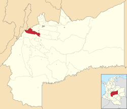 Location of the municipality and town of Guamal, Meta in the Meta Department of Colombia. | |
| Country | |
| Department | Meta Department |
| Area | |
| • Total | 638 km2 (246 sq mi) |
| Elevation | 525 m (1,722 ft) |
| Population (Census 2018[2]) | |
| • Total | 13,857 |
| • Density | 22/km2 (56/sq mi) |
| Time zone | UTC-5 (Colombia Standard Time) |
| Climate | Af |
Climate
Guamal has a tropical rainforest climate (Af) with heavy to very heavy rainfall year round.
| Climate data for Guamal | |||||||||||||
|---|---|---|---|---|---|---|---|---|---|---|---|---|---|
| Month | Jan | Feb | Mar | Apr | May | Jun | Jul | Aug | Sep | Oct | Nov | Dec | Year |
| Average high °C (°F) | 31.0 (87.8) |
31.4 (88.5) |
31.1 (88.0) |
30.0 (86.0) |
29.5 (85.1) |
29.0 (84.2) |
28.9 (84.0) |
29.7 (85.5) |
30.2 (86.4) |
30.1 (86.2) |
30.1 (86.2) |
30.3 (86.5) |
30.1 (86.2) |
| Daily mean °C (°F) | 25.6 (78.1) |
26.0 (78.8) |
26.0 (78.8) |
25.2 (77.4) |
24.9 (76.8) |
24.3 (75.7) |
24.2 (75.6) |
24.6 (76.3) |
25.0 (77.0) |
25.0 (77.0) |
25.1 (77.2) |
25.0 (77.0) |
25.1 (77.1) |
| Average low °C (°F) | 20.2 (68.4) |
20.6 (69.1) |
21.0 (69.8) |
20.4 (68.7) |
20.4 (68.7) |
19.7 (67.5) |
19.6 (67.3) |
19.5 (67.1) |
19.8 (67.6) |
20.0 (68.0) |
20.2 (68.4) |
19.7 (67.5) |
20.1 (68.2) |
| Average rainfall mm (inches) | 69.0 (2.72) |
126.7 (4.99) |
254.0 (10.00) |
484.8 (19.09) |
575.3 (22.65) |
512.6 (20.18) |
395.5 (15.57) |
344.8 (13.57) |
376.8 (14.83) |
440.3 (17.33) |
488.2 (19.22) |
167.6 (6.60) |
4,235.6 (166.75) |
| Average rainy days | 6 | 8 | 12 | 19 | 22 | 22 | 20 | 17 | 16 | 17 | 16 | 10 | 185 |
| Source 1: [3] | |||||||||||||
| Source 2: [4] | |||||||||||||
References
- "Municipalities of Colombia". statoids. Retrieved 10 May 2020.
- "Censo Nacional de Población y Vivienda 2018" (in Spanish). DANE. Retrieved 10 May 2020.
- http://www.ideam.gov.co/documents/21021/553571/Promedios+Climatol%C3%B3gicos++1981+-+2010.xlsx/f28d0b07-1208-4a46-8ccf-bddd70fb4128
- https://en.climate-data.org/south-america/colombia/meta/guamal-49794/?amp=true
This article is issued from Wikipedia. The text is licensed under Creative Commons - Attribution - Sharealike. Additional terms may apply for the media files.