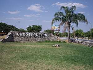
Grootfontein
Grootfontein (English: Large Spring after the nearby hot springs) is a city[3] of 23,793 inhabitants in the Otjozondjupa Region of central Namibia. It is one of the three towns in the Otavi Triangle, situated on the B8 national road that leads from Otavi to the Caprivi Strip.
Grootfontein | |
|---|---|
Town | |
 | |
 Coat of arms | |
| Motto(s): Fons Vitæ | |
 Grootfontein Location in Namibia | |
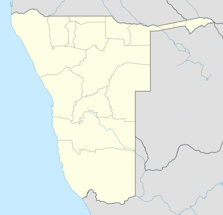
| Coordinates: 19°34′S 18°7′E | |
| Country | |
| Region | Otjozondjupa Region |
| Constituency | Grootfontein constituency |
| Established | 1885 |
| Government | |
| • Mayor | Haimene[1] |
| Population (2011)[2] | |
| • Total | 23,793 |
| Time zone | UTC+2 (SAST) |
| Area code(s) | 067 |
| Climate | BSh |
| Website | http://www.grootfonteinmun.com.na/ |
Overview
The place was known to the Herero under the name Otjivanda.[4] In 1885, 40 Boer families from the north-west of South Africa settled at Grootfontein. Part of the Dorsland trekkers, they were heading towards Angola. When that territory fell under Portuguese control, they turned back and established the Republic of Upingtonia at Grootfontein. Abandoned by 1887, it became the headquarters of the South West Africa Company in 1893.
In 1908 the Roman Catholic church established a mission in Grootfontein as the basis of their eventually successful attempt to establish missions in Kavango.[5]
Like all the towns in the Otavi Triangle, Grootfontein is very green in summer but drier in winter. In spring, jacaranda and flamboyant trees bloom in profusion. The town has an old German Schutztruppe fortress from the year 1896, which today houses a museum that expounds on the local history. The economic mainspring of the area were for many decades the Berg Aukas and Abenab mines to the north east of the town. These produced zinc and vanadium but have since closed. This is dolomite country and the carbonate deposits in the upper parts of the mine have yielded interesting fossils of simian or pongoid creatures that lived millions of years before modern humans evolved.
.jpg)
Twenty four kilometres west of Grootfontein lies the huge Hoba meteorite. At over 60 tons, it is the largest known meteorite on Earth, as well as being the largest naturally occurring mass of iron known to exist on the planet's surface.
Economy and infrastructure
Transport
.jpg)
Grootfontein is a railhead on TransNamib, the national railway and transport system. The next station to the west is Otavi. Grootfontein is also home of Namibia's main military base which housed several units of the now departed South African Defence Force. It has an airfield that can handle large transport carriers such as the Hercules C130, as well as commercial passenger aircraft.
Agriculture
Grootfontein Show, an annual agricultural exhibition that takes place since 1911,[6] is the second largest annual entrepreneurial exhibition in the country, after Windhoek Show.[7]
Climate
Grootfontein receives an annual average rainfall of 557 millimetres (21.9 in), with a high of 956 mm (37.6 in) in the 2010/2011 rainy season,[8] and a low of 230 mm (9.1 in) during the 2010s drought in 2018/19.[9]
| Climate data for Grootfontein, Namibia | |||||||||||||
|---|---|---|---|---|---|---|---|---|---|---|---|---|---|
| Month | Jan | Feb | Mar | Apr | May | Jun | Jul | Aug | Sep | Oct | Nov | Dec | Year |
| Average high °C (°F) | 30.9 (87.6) |
29.8 (85.6) |
29.4 (84.9) |
28.5 (83.3) |
26.5 (79.7) |
24.0 (75.2) |
23.8 (74.8) |
26.8 (80.2) |
30.6 (87.1) |
32.1 (89.8) |
31.9 (89.4) |
31.3 (88.3) |
28.8 (83.8) |
| Average low °C (°F) | 18.5 (65.3) |
18.0 (64.4) |
17.1 (62.8) |
14.4 (57.9) |
10.4 (50.7) |
7.1 (44.8) |
6.8 (44.2) |
9.6 (49.3) |
13.8 (56.8) |
16.9 (62.4) |
18.0 (64.4) |
18.4 (65.1) |
14.1 (57.4) |
| Average precipitation mm (inches) | 141.7 (5.58) |
127.0 (5.00) |
99.6 (3.92) |
30.1 (1.19) |
4.3 (0.17) |
0.4 (0.02) |
0 (0) |
1.3 (0.05) |
4.9 (0.19) |
21.5 (0.85) |
51.6 (2.03) |
70.7 (2.78) |
553.1 (21.78) |
| Average relative humidity (%) | 58 | 66 | 66 | 70 | 51 | 48 | 43 | 34 | 28 | 33 | 42 | 46 | 49 |
| Source: Ministry of Works and Transport (Meteorological Service Division)
"Ministry of Works & Transport: Tabulation of Climate Statistics for Selected Stations in Namibia" (PDF). 2012. | |||||||||||||
Politics
Grootfontein is governed by a municipal council that has seven seats.[10]
The 2015 local authority election was won by Namibia's ruling SWAPO party which gained five seats and 2,019 votes. One seat each went to the Democratic Turnhalle Alliance (DTA, 546 votes) and to the All People's Party (APP, 154 votes).[11]
Education
Previously the German school Regierungsschule Grootfontein was in the town. In 1965 it had 4 teachers and 117 learners and was supported by German government.[12]
Grootfontein is home to four high schools, Grootfontein Secondary School, Otjiwanda High School[13] Friedrich Awaseb Senior Secondary School,[14] and the Grootfontein Agricultural College, and six primary schools namely Luiperdheuwel Primary School,Kalenga Primary School,Makalani Primary School, Omulunga Primary school, Grootfontein Agri College and Wilhelm Nortier Primary School.
Notable people from Grootfontein
- Behati Prinsloo – model, best known for working with Victoria's Secret
- Leon Jooste – SWAPO politician and businessman[15]
- Hage Geingob – The President of the Republic of Namibia
- Lydia Katjita – SWAPO politician and member of the Pan-African Parliament
- Hannes Smith – journalist
- Inge Zaamwani – businesswoman
External links
| Wikimedia Commons has media related to Grootfontein. |
References
- "Four towns re-elect mayors". The Namibian. NAMPA. 9 December 2013.
- "Table 4.2.2 Urban population by Census years (2001 and 2011)" (PDF). Namibia 2011 - Population and Housing Census Main Report. Namibia Statistics Agency. p. 39. Retrieved 24 August 2016.
- "Local Authorities". Association of Local Authorities in Namibia (ALAN). Archived from the original on 10 June 2013. Retrieved 1 October 2012.
- Menges, Werner (12 May 2005). "Windhoek?! Rather make that Otjomuise". The Namibian.
- Peltola, Matti (1958). Sata vuotta suomalaista lähetystyötä 1859–1959. II: Suomen Lähetysseuran Afrikan työn historia [‘One Hundred Years of Finnish Missionary Work 1859–1959. II: The History of FMS’s Missionary Work in Africa’]. Helsinki: The Finnish Missionary Society. p. 217.
- "Onÿarata @ Grootfontein Show centenary while The Wire storm the coastal towns". New Era. 23 September 2011. Archived from the original on 21 February 2013.
- "Farmer dies at Show". The Namibian. 29 September 2004.
- Menges, Werner (26 May 2011). "Rainy season was one for the record books". The Namibian. Archived from the original on 15 December 2011.
- Menges, Werner; Oliveira, Yokany (23 May 2019). "Khomas faces worst drought in 90 years". The Namibian. p. 1.
- "Know Your Local Authority". Election Watch (3). Institute for Public Policy Research. 2015. p. 4.
- "Local elections results". Electoral Commission of Namibia. 28 November 2015. p. 6. Archived from the original on 10 December 2015.
- "Deutscher Bundestag 4. Wahlperiode Drucksache IV/3672" (Archive). Bundestag (West Germany). 23 June 1965. Retrieved on 12 March 2016. p. 31.
- Matali, John Travolter (24 January 2014). "Another school defies ministry". New Era.
- "Grootfontein learner allegedly dies after punch to the head". Nampa. 5 April 2014.
- Leon Jooste Archived 2011-06-11 at the Wayback Machine Namibia Institute for Democracy