Granger, Missouri
Granger is a village in Scotland County, Missouri, United States. The population was 34 at the 2010 census.
Granger, Missouri | |
|---|---|
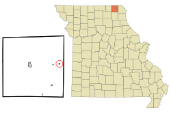 Location of Granger, Missouri | |
| Coordinates: 40°28′3″N 91°58′28″W | |
| Country | United States |
| State | Missouri |
| County | Scotland |
| Area | |
| • Total | 0.16 sq mi (0.41 km2) |
| • Land | 0.16 sq mi (0.41 km2) |
| • Water | 0 sq mi (0 km2) |
| Elevation | 761 ft (232 m) |
| Population | |
| • Total | 34 |
| • Estimate (2016)[3] | 35 |
| • Density | 210/sq mi (83/km2) |
| Time zone | UTC-6 (Central (CST)) |
| • Summer (DST) | UTC-5 (CDT) |
| ZIP code | 63442 |
| Area code(s) | 660 |
| FIPS code | 29-28360[4] |
| GNIS feature ID | 0718692[5] |
History
The town was laid out and surveyed by Henry Hill in September, 1874. Its name pays homage to the Grange Movement, popular in rural America at that time.[6] Granger was incorporated by petition to the Scotland county court on July 3, 1912.[7] Adjacent to the Burlington Northern Railroad, Granger's business district at the time of incorporation included three general stores, two hotels, a bank, drug store, hardware store, grocer, meat market barber shop, livery, and blacksmith.[7] Although no official census was taken of the community in 1910, contemporary estimates place the population at between 150 and 200 residents.[7]
Geography
Granger is located at 40°28′3″N 91°58′28″W (40.467556, -91.974468).[8] According to the United States Census Bureau, the village has a total area of 0.16 square miles (0.41 km2), all land.[1]
Demographics
| Historical population | |||
|---|---|---|---|
| Census | Pop. | %± | |
| 1880 | 47 | — | |
| 1920 | 189 | — | |
| 1930 | 142 | −24.9% | |
| 1940 | 180 | 26.8% | |
| 1950 | 122 | −32.2% | |
| 1960 | 146 | 19.7% | |
| 1970 | 105 | −28.1% | |
| 1980 | 91 | −13.3% | |
| 1990 | 63 | −30.8% | |
| 2000 | 44 | −30.2% | |
| 2010 | 34 | −22.7% | |
| Est. 2016 | 35 | [3] | 2.9% |
| U.S. Decennial Census[9] | |||
2010 census
As of the census[2] of 2010, there were 34 people, 16 households, and 9 families living in the village. The population density was 212.5 inhabitants per square mile (82.0/km2). There were 26 housing units at an average density of 162.5 per square mile (62.7/km2). The racial makeup of the village was 100.0% White.
There were 16 households of which 18.8% had children under the age of 18 living with them, 50.0% were married couples living together, 6.3% had a female householder with no husband present, and 43.8% were non-families. 43.8% of all households were made up of individuals and 18.8% had someone living alone who was 65 years of age or older. The average household size was 2.13 and the average family size was 3.00.
The median age in the village was 48 years. 14.7% of residents were under the age of 18; 11.8% were between the ages of 18 and 24; 14.7% were from 25 to 44; 35.2% were from 45 to 64; and 23.5% were 65 years of age or older. The gender makeup of the village was 47.1% male and 52.9% female.
2000 census
As of the census[4] of 2000, there were 44 people, 22 households, and 10 families living in the village. The population density was 280.5 people per square mile (106.2/km²). There were 26 housing units at an average density of 165.8/sq mi (62.7/km²). The racial makeup of the village was 100.00% White.
There were 22 households out of which 22.7% had children under the age of 18 living with them, 27.3% were married couples living together, 13.6% had a female householder with no husband present, and 54.5% were non-families. 54.5% of all households were made up of individuals and 27.3% had someone living alone who was 65 years of age or older. The average household size was 2.00 and the average family size was 3.20.
In the village, the population was spread out with 22.7% under the age of 18, 6.8% from 18 to 24, 25.0% from 25 to 44, 27.3% from 45 to 64, and 18.2% who were 65 years of age or older. The median age was 40 years. For every 100 females, there were 91.3 males. For every 100 females age 18 and over, there were 88.9 males.
The median income for a household in the village was $20,417, and the median income for a family was $31,250. Males had a median income of $19,583 versus $14,063 for females. The per capita income for the village was $12,400. There were no families and 14.9% of the population living below the poverty line, including no under eighteens and 20.0% of those over 64.
References
- "US Gazetteer files 2010". United States Census Bureau. Archived from the original on 2012-01-25. Retrieved 2012-07-08.
- "U.S. Census website". United States Census Bureau. Retrieved 2012-07-08.
- "Population and Housing Unit Estimates". Retrieved June 9, 2017.
- "U.S. Census website". United States Census Bureau. Retrieved 2008-01-31.
- "US Board on Geographic Names". United States Geological Survey. 2007-10-25. Retrieved 2008-01-31.
- Eaton, David Wolfe (1916). How Missouri Counties, Towns and Streams Were Named. The State Historical Society of Missouri. p. 362.
- "Scotland county history". Genealogy Trails.com reprinting an earlier book. 2014. Retrieved 14 April 2014.
- "US Gazetteer files: 2010, 2000, and 1990". United States Census Bureau. 2011-02-12. Retrieved 2011-04-23.
- "Census of Population and Housing". Census.gov. Retrieved June 4, 2015.
Municipalities and communities of Scotland County, Missouri, United States | ||
|---|---|---|
| Cities | 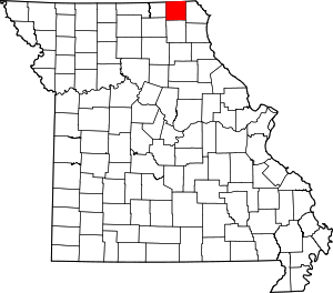 Map of Missouri highlighting Scotland County | |
| Villages | ||
| Townships | ||
| Unincorporated communities | ||