Grampian Mountains
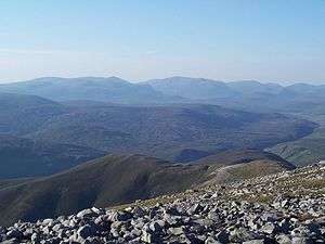
The Grampian Mountains (Am Monadh in Gaelic) are one of the three major mountain ranges in Scotland, occupying a considerable portion of the Scottish Highlands in northern Scotland. The other major mountain ranges in Scotland are the Northwest Highlands and the Southern Uplands. The Grampian range extends southwest to northeast between the Highland Boundary Fault and the Great Glen, occupying almost half of the land area of Scotland and including the Cairngorms and the Lochaber hills. The range includes many of the highest mountains in the British Isles, including Ben Nevis (the highest point in the British Isles at 1,345 m (4,413 ft) above sea level) and Ben Macdui (the second highest at 1,309 m (4,295 ft)).
_Named_(HR).png)
A number of rivers and streams rise in the Grampians, including the Tay, Spey, Cowie Water, Burn of Muchalls, Burn of Pheppie, Burn of Elsick, Cairnie Burn, Don, Dee and Esk.[1] The area is generally sparsely populated.
There is some ambiguity about the extent of the range, and until the 19th century, they were generally considered to be more than one range, which all formed part of the wider Scottish Highlands. This view is still held by many today, and they have no single name in the Scottish Gaelic language or the Doric dialect of Lowland Scots. In both languages, a number of names are used. The name "Grampian" has been used in the titles of organisations covering the area, including the former local government area of Grampian Region (translated into Scots Gaelic as Roinn a' Mhonaidh) and Grampian Television.
Name
Name
The Roman historian Cornelius Tacitus recorded Mons Graupius as the site of the defeat of the native Caledonians by Gnaeus Julius Agricola circa 83 AD. The actual location of Mons Graupius, literally 'Mount Graupius' (the element 'Graupius' is of unknown meaning), is a matter of dispute among historians, though most favour a location within the Grampian massif, possibly at Raedykes, Megray Hill or Kempstone Hill. The spelling Graupius comes from the Codex Aesinas, a mediaeval copy of Tacitus's Germania believed to be from the mid-9th century.[2] "Graupius" was incorrectly rendered "Grampius" only in the 1476 printed edition of Tacitus's biography of Agricola.[3] The name Grampians is believed to have first been applied to the mountain range in 1520 by the Scottish historian Hector Boece, an adaptation of the incorrect Mons Grampius. Thus the range owes its name to this day to a typesetter's mistake.[3] In the Middle Ages, this locale was known as the Mounths, a name still held by a number of geographical features.
Extent
There is some ambiguity about the extent of the range. Fenton Wyness, writing about Deeside, puts the northern edge of the Grampians at the River Dee in the introduction to his 1968 book Royal Valley : The Story Of The Aberdeenshire Dee:
... until comparatively recent times, Deeside was an isolated and little frequented region and the reason for this is the extensive mountain barrier of the Grampians which begins in a low range on the seacoast immediately south of Aberdeen and rise through various intervening heights such as Cairn-mon-earn (1,245 ft), Kerloch (1,747 ft), Mount Battoch (2,555 ft), Mount Keen (3,007 ft), Lochnagar (3,786 ft), Beinn a' Ghlo (3,671 ft), to Beinn Dearg (3,304,089 ft)
— Fenton Wyness[5]
This introduction appears to suggest that Wyness defines the Grampians as being the range of mountains running from immediately south of Aberdeen westward to Beinn Dearg in the Forest of Atholl. Similarly, Adam Watson, when defining the extent of the Cairngorms, specifically excluded the range south of the River Dee, writing:
The other main hill group is the long chain running from Drumochter in the west almost to the sea just south of Aberdeen. Many maps and books have given its name as ‘the Grampians’ but although children have to learn this at school, they do not learn it at home and nowhere is it used in local speech. Some map-makers have confused the issue by printing ‘Grampians’ over the Cairngorms and Strath Don hills as well!
— Adam Watson[6]
Both Wyness and Watson appear to exclude the Cairngorms from the Grampians, regarding them as a separate range. In effect, Wyness' and Watson's definition of the Grampians is as a synonym for the Mounth. However Robert Gordon, writing in the 1650s, used the term Grampians to refer to hills on either side of the River Dee, and thus explicitly included the Cairngorms within the range.[7]
Sub-ranges
The following ranges of hills and mountains fall within the generally recognised definition of the Grampians, i.e lying between the Highland and Great Glen fault lines:
- Cairngorms
- Monadh Liath
- Mounth
- Grey Corries
- Mamores
- Ben Alder Forest
- The mountains of Glen Coe and Glen Etive
- Black Mount
- Breadalbane Hills
- Trossachs
- Arrochar Alps
- Cowal
- The Isle of Arran

References
- United Kingdom Ordnance Survey Map, Landranger 45, Stonehaven and Banchory, 1:50,000 scale, 2002
- Agricola, edited by Ogilvie and Richmond
- History in the making: a Roman map… and an 18th-century hoax. Edited extract from Under Another Sky: Journeys in Roman Britain by Charlotte Higgins published in The Guardian, 19 July 2013
- Andrew, Breeze. "Philology on Tacitus's Graupian Hill and Trucculan Harbour". Missing or empty
|url=(help) - Wyness, Fenton (1968), Royal Valley : The Story Of The Aberdeenshire Dee, Alex P. Reid & Son, Aberdeen, p. 1
- Watson, Adam (1975). The Cairngorms. Edinburgh: The Scottish Mountaineering Trust. p. 19.
- Ian R Mitchell. Scotland's Mountains Before the Mountaineers, pp. 62-63. Published 2013, Luath Press.
External links
- Chisholm, Hugh, ed. (1911). . Encyclopædia Britannica (11th ed.). Cambridge University Press.
| Authority control |
|
|---|