Goessel, Kansas
Goessel is a city in Marion County, Kansas, United States.[1] It was named after Captain Kurt von Goessel (1852–1895) who went down with his ship, the Elbe, in the English Channel after it was rammed. As of the 2010 census, the city population was 539.[6] It is located about 11 miles north of North Newton on the west side of K-15 highway.
Goessel, Kansas | |
|---|---|
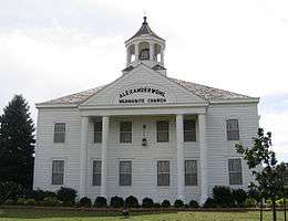 Alexanderwohl Mennonite Church 1 mile north of Goessel (2007) | |
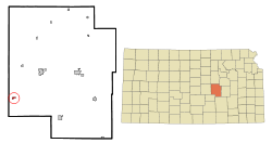 Location within Marion County and Kansas | |
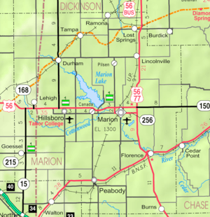 KDOT map of Marion County (legend) | |
| Coordinates: 38°14′49″N 97°20′53″W[1] | |
| Country | United States |
| State | Kansas |
| County | Marion |
| Township | West Branch |
| Platted | 1910 |
| Incorporated | 1952 |
| Named for | Kurt von Goessel |
| Government | |
| • Type | Mayor–Council |
| • Mayor | Dave Schrag [2] |
| Area | |
| • Total | 0.35 sq mi (0.9 km2) |
| • Land | 0.35 sq mi (0.9 km2) |
| • Water | 0 sq mi (0 km2) |
| Elevation | 1,532 ft (467 m) |
| Population | |
| • Total | 539 |
| • Estimate (2018)[5] | 501 |
| • Density | 1,500/sq mi (590/km2) |
| Time zone | UTC-6 (CST) |
| • Summer (DST) | UTC-5 (CDT) |
| ZIP code | 67053 |
| Area code | 620 |
| FIPS code | 20-26750 [1] |
| GNIS ID | 0477764 [1] |
| Website | goesselks.com |
History
Early history
For many millennia, the Great Plains of North America was inhabited by nomadic Native Americans. From the 16th century to 18th century, the Kingdom of France claimed ownership of large parts of North America. In 1762, after the French and Indian War, France secretly ceded New France to Spain, per the Treaty of Fontainebleau.
19th century
In 1802, Spain returned most of the land to France. In 1803, most of the land for modern day Kansas was acquired by the United States from France as part of the 828,000 square mile Louisiana Purchase for 2.83 cents per acre.
In 1854, the Kansas Territory was organized, then in 1861 Kansas became the 34th U.S. state. In 1855, Marion County was established within the Kansas Territory, which included the land for modern day Goessel.[7]
The year 1874 saw the first wave of an immigration of German-speaking Russian Mennonite to south-central Kansas. The move was an attempt to preserve religious heritage and freedom after exclusion from military service was rescinded. During the next decade, one-third of Mennonites in Russia moved to North America. In 1874 a large portion of the Russian village of Alexanderwohl immigrated en masse to the United States aboard the ships Teutonia and Cimbria. This group split into two groups, the Alexanderwohl group sailed on the Cimbria then located around present day Goessel, and the Hoffnungsau group sailed on the Teutonia then located around present day Buhler and Inman.[8]
The Alexanderwohl group split into eight communal villages. The village of Gnadenfeld (translation is Grace Field) was located where Goessel now stands.[9] The village lasted for several years as a communal village then families moved onto their own larger parcels of land nearby. Several years passed before a trading center developed. The first public structure erected in Goessel was the Mennonite Brethren church in 1890. One of the first businesses was a creamery station in the same year. In 1891, a small mercantile store was opened, then in the same year Dr. Peter Richert moved a building that was used as his doctor's office, then later it became a post office. Dr. Richert read the story of Captain Kurt von Goessel, who went down with his steamship Elbe in the English Channel. Dr. Richert decided to submit the name Goessel to the U.S. Postal Department, and it was accepted on April 13, 1895.[10]
20th century

In 1910, Goessel was platted and had a population of 100 people. In 1952, Goessel was incorporated and had a population of 260.[10] In 2010, the United States Census reported 248 households and a population of 539.[11]
On March 13, 1990, Goessel was damaged by an "extreme F5" tornado during a tornado outbreak. The severity of the damage left behind by this tornado led some meteorologists to believe that the Goessel tornado was among the strongest ever documented at that time.[12][13]
Goessel is home to the Mennonite Heritage Museum, a complex of eight buildings which preserve artifacts from early Mennonite households, farms, schools, churches and the Bethesda Mennonite Hospital.[14]
Geography
Goessel is located at 38°14′49″N 97°20′53″W (38.246972, -97.348178).[1] According to the United States Census Bureau, the city has a total area of 0.35 square miles (0.91 km2), all of it land.[3] The county line is 1 mile west of Goessel.
Climate
The climate in this area is characterized by hot, humid summers and generally mild to cool winters with very cold periods.
Area events
- Goessel Threshing Days,[15] located at Mennonite Heritage and Agricultural Museum. 37th annual in 2010. Old-fashioned threshing demonstration and show with more than 100 exhibitors from a 7-state area display and demonstrate antique equipment related to farming during the past century. Numerous antique tractors are displayed. Ethnic Mennonite food is available.
- Goessel Harvest Festival.
Area attractions
- Mennonite Heritage and Agricultural Museum,[16] 200 N Poplar St. The Mennonite Heritage Museum was dedicated in 1974. It is a museum of artifacts of the Mennonites that settled in the Goessel area. The museum has eight buildings that show the life of the immigrants that moved to Goessel.[17]
- Alexanderwohl Mennonite Church,[18] 1 mi north on K-15 Highway.
- Kansas Historical Marker - The Mennonites In Kansas,[19] 1 mi north on K-15 Highway.
Demographics
| Historical population | |||
|---|---|---|---|
| Census | Pop. | %± | |
| 1960 | 327 | — | |
| 1970 | 386 | 18.0% | |
| 1980 | 421 | 9.1% | |
| 1990 | 506 | 20.2% | |
| 2000 | 565 | 11.7% | |
| 2010 | 539 | −4.6% | |
| Est. 2018 | 501 | [5] | −7.1% |
| U.S. Decennial Census | |||
2010 census
As of the census[4] of 2010, there were 539 people, 206 households, and 140 families residing in the city. The population density was 1,540.0 inhabitants per square mile (594.6/km2). There were 231 housing units at an average density of 660.0 per square mile (254.8/km2). The racial makeup of the city was 97.0% White, 0.2% African American, 0.4% Native American, 0.9% from other races, and 1.5% from two or more races. Hispanic or Latino of any race were 2.0% of the population.
There were 206 households of which 28.2% had children under the age of 18 living with them, 57.8% were married couples living together, 7.3% had a female householder with no husband present, 2.9% had a male householder with no wife present, and 32.0% were non-families. 30.1% of all households were made up of individuals and 18% had someone living alone who was 65 years of age or older. The average household size was 2.36 and the average family size was 2.91.
The median age in the city was 48.6 years. 22.6% of residents were under the age of 18; 5.1% were between the ages of 18 and 24; 18.9% were from 25 to 44; 23.4% were from 45 to 64; and 30.1% were 65 years of age or older. The gender makeup of the city was 45.8% male and 54.2% female.
2000 census
As of the census[20] of 2000, there were 565 people, 203 households, and 142 families residing in the city. The population density was 1,870.3 people per square mile (727.2/km2). There were 221 housing units at an average density of 731.6 per square mile (284.4/km2). The racial makeup of the city was 97.70% White, 0.18% Native American, 0.18% from other races, and 1.95% from two or more races. Hispanic or Latino of any race were 0.71% of the population.
There were 203 households out of which 28.6% had children under the age of 18 living with them, 63.1% were married couples living together, 6.4% had a female householder with no husband present, and 30.0% were non-families. 27.6% of all households were made up of individuals and 17.2% had someone living alone who was 65 years of age or older. The average household size was 2.44 and the average family size was 2.98.
In the city, the population was spread out with 21.6% under the age of 18, 7.4% from 18 to 24, 22.8% from 25 to 44, 16.1% from 45 to 64, and 32.0% who were 65 years of age or older. The median age was 43 years. For every 100 females, there were 73.8 males. For every 100 females age 18 and over, there were 71.0 males.
As of 2000 the median income for a household in the city was $33,250, and the median income for a family was $42,727. Males had a median income of $30,313 versus $18,750 for females. The per capita income for the city was $14,106. About 2.2% of families and 14.2% of the population were below the poverty line, including 1.7% of those under age 18 and 39.4% of those age 65 or over.
Government
The Goessel government consists of a mayor and five council members. The council meets the 3rd Monday of each month at 8PM.[2]
- City Hall, 101 S Cedar St.
Education
Public
The community is served by Goessel USD 411 public school district.
- Goessel High School, 100 E Main St.[21]
- Goessel Junior High School, 100 E Main St.[22]
- Goessel Elementary School, 500 E Main St.[23]
Sports
The Goessel High School mascot is a Bluebird. All high school athletic and non-athletic competition is overseen by the Kansas State High School Activities Association. For 2010/2011 seasons, the football team competes as Class 8 Man - Division I.[24]
Past Championships:
Library
Each USD 411 school has a library for student access.
The city is served by the Goessel City Library at 101 South Cedar Street. The library is a member of the North Central Kansas Libraries System, which provides an inter-library book loan service between its members.
Media
Print
- Hillsboro Free Press, free newspaper for greater Marion County area.
- The Newton Kansan, regional newspaper from Newton.
- The Wichita Eagle, major regional newspaper from Wichita.
Radio
Goessel is served by numerous radio stations of the Wichita-Hutchinson listening market area,[27] and satellite radio. See Media in Wichita, Kansas.
Television
Goessel is served by over-the-air ATSC digital TV of the Wichita-Hutchinson viewing market area,[28] cable TV, and satellite TV. See Media in Wichita, Kansas.
Infrastructure
Transportation
K-15 highway runs along the east side of the city.
Utilities
- Internet
- DSL is provided by Moundridge Telephone Company.
- Wireless is provided by Pixius Communications.
- Satellite is provided by HughesNet, StarBand, WildBlue.
- TV
- Cable is provided by Moundridge Telephone Company.
- Satellite is provided by DirecTV, Dish Network.
- Terrestrial is provided by regional digital TV stations.
- Phone
- Landline is provided by Moundridge Telephone Company.
- Electricity
- City is provided by Westar Energy.
- Rural is provided by Westar Energy and Flint Hills RECA.
- Natural Gas
- Service is provided by Kansas Gas Service.
- Water
- Sewer
- Service is provided by City of Goessel.
- Trash
- Service is provided by City of Goessel.
Notable people
- Duane A. Goossen, (born 1955), Kansas House of Representatives,[29] Contractor
- Shirley Knight, (born 1936), American stage, screen, and television actress. Academy Award-nominated actress.
- Duane D. Thiessen, (born 1951), Major General, United States Marine Corps.
Gallery
 Wheat Threshing Demo at Goessel Threshing Days (August 7, 2010)
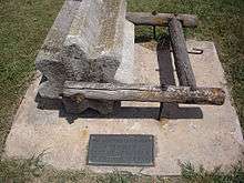 Threshing stone near Alexanderwohl Mennonite Church (2011)
 Karl Unruh (1945)
See also
References
- Geographic Names Information System (GNIS) details for Goessel, Kansas; United States Geological Survey (USGS); October 13, 1978.
- Goessel - Directory of Public Officials
- "US Gazetteer files 2010". United States Census Bureau. Archived from the original on 2012-01-25. Retrieved 2012-07-06.
- "U.S. Census website". United States Census Bureau. Retrieved 2012-07-06.
- "Population and Housing Unit Estimates". Retrieved March 16, 2020.
- "2010 City Population and Housing Occupancy Status". U.S. Census Bureau. Retrieved March 6, 2011.
- The History of Marion County and Courthouse
- Hoffnungsau in Kansas; A.J. Dyck; Mennonite Life; October 1949.
- Alexanderwohl Villages in Kansas, 1874 (map); P.U. Schmidt; Mennonite Life; October 1949.
- Marion County Kansas : Past and Present; Sondra Van Meter; MB Publishing House; LCCN 72-92041; 344 pages; 1972.
- "Archived copy". Retrieved 2015-11-02.
- Thomas P. Grazulis (July 1993). Significant Tornadoes 1680-1991. St. Johnsbury, Vermont: The Tornado Project of Environmental Films. ISBN 1-879362-03-1.
- Michael Smith (April 20, 1990). "Kansas twister might be the strongest ever recorded". Fort Scott Tribune. unknown: Fort Scott Tribune. Retrieved November 6, 2013.
- http://heritagemuseum.mennonite.net/
- Goessel Threshing Days
- Mennonite Heritage Museum
- Kansas Photo Tour - Goessel
- Alexanderwohl Mennonite Church
- Kansas Historical Marker - The Mennonites In Kansas
- "U.S. Census website". United States Census Bureau. Retrieved 2008-01-31.
- "Goessel Senior High School". Archived from the original on 2012-05-20. Retrieved 2010-07-19.
- "Goessel Junior High School". Archived from the original on 2012-03-09. Retrieved 2010-07-19.
- Goessel Elementary School
- KSHSAA Football Class Size Assignments
- "Cross Country". KSHSAA. Retrieved 8 January 2017.
- "Basketball". KSHSAA. Retrieved 3 January 2017.
- Wichita-Hutchinson Radio market.
- Wichita-Hutchinson TV market.
- Kansas Legislators Past & Present Archived August 1, 2010, at the Wayback Machine
Further reading
- In Earlier Days: A History of Goessel, Kansas; Marjorie Jantzen; Mennonite Immigrant Historical Foundation; 1987.
- A Heritage of Care : A History of the Mennonite Bethesda Society, Bethesda Home, Goessel Kansas; Kristine Flaming Schmucker.
- Alexanderwohl Villages in Kansas, 1874 (map); P.U. Schmidt; Mennonite Life; October 1949.
- The Alexanderwohl Church Building; Alvin Gooseen; Mennonite Life; December 1974.
External links
| Wikimedia Commons has media related to Goessel, Kansas. |
- City
- Goessel - Official
- Goessel - Directory of Public Officials, League of Kansas Municipalities
- Historical
- Marion County cemetery list, archive of KsGenWeb
- Marion County history bibliography, Marion County school bibliography, Kansas Historical Society
- Maps
- Goessel City Map, KDOT
- Topo Map of Goessel and Walton area, USGS
- Marion County Maps: Current, Historic, KDOT
Municipalities and communities of Marion County, Kansas, United States | ||
|---|---|---|
| Cities | 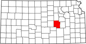 Map of Kansas highlighting Marion County | |
| Unincorporated communities | ||
| Ghost towns | ||
| Townships | ||
| Footnotes | ‡This populated place also has portions in an adjacent county or counties | |
| Authority control |
|
|---|