Godda
Godda is a city and a municipality in Godda district in the Indian state of Jharkhand. The district has an area of 2110 km². The district headquarters is Godda.
Godda | |
|---|---|
city | |
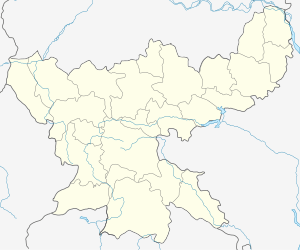
 Godda Location in Jharkhand, India  Godda Godda (India) | |
| Coordinates: 24.83°N 87.22°E | |
| Country | |
| State | Jharkhand |
| District | Godda |
| Government | |
| • Type | State |
| • Body | Substitute |
| Area | |
| • Total | 2,110 km2 (810 sq mi) |
| Elevation | 87 m (285 ft) |
| Population (2011) | |
| • Total | 861,000 |
| • Density | 497/km2 (1,290/sq mi) |
| Languages | |
| • Official | Hindi, Mathili, Santhali |
| Time zone | UTC+5:30 (IST) |
| PIN | 814133 |
| Telephone code | 06422 |
| Vehicle registration | JH17 Jha04111993 / [ BR36 ? (Discontinued )] |
| Website | http://www.godda.nic.in/ |
Geography
Godda is located at 24.83°N 87.22°E.[1] It has an average elevation of 77 metres (252 feet). Godda came into existence as the 55th district of undivided Bihar on 25 May 1983. After the bifurcation of Bihar into Jharkhand state on 15 November 2000, it was one of 18 districts of Jharkhand. National Highway 133 (NH-133) passes through the city of Godda.
Demographics
As of 2011 India census,[2] Godda had a population of 1,311,382. Males constitute 54% of the population and females 46%. Godda has an average literacy rate of 57.68%, lower than the national average of 74.4%: male literacy is 69.56%, and female literacy is 44.90%. In Godda, 15% of the population is under 6 years of age.
The parliamentary constituency is Godda. The assembly constituencies are Madhupur, Jarmundi, Poraiyahat, Mahagama, Godda and Deoghar. Godda was in Dumka Parliamentary constituency in 1957.
History
The district of Godda was created on 17th May, 1983 out of old Santhal Pargana district which was upgraded to the level of division. Present Santhal Pargana division comprises 6 districts, viz. Godda, Dumka, Deoghar, Sahebganj, Pakur and Jamtara. Godda(M), the only one town of the district, is the headquarters of Godda district and Godda subdivision. Godda was a part of undivided Santhal Pargana district until 1981 census. Later, the old Godda sub-division of Santhal Pargana was separated and formed as a new district. As a consequence of the Santhal rebellion of 1845-55 the district of Santhal Paragna was created from portions of Bhagalpur and Birbhum. Godda district at present comprises eight Blocks: Meherma, Mahagama, Boarijor, Pathargama, Godda, Sundurpahari, Poraiyahat, Basantarai and Thakur Gangati. Godda is the only town in the district. There are 2311 villages within the district.
Godda district is devoid of any railway track. Many villages are still deprived of electricity and people suffer from lack of water for farming. Most of the inhabitants are farmers.
Economy
Agriculture is predominant in the region and rice, wheat and maize are the main crops grown here, along with vegetables, linseeds and sugarcane. Fruits like mango, banana, jack fruit, plum grown in the region. Some small & middle scale industries are also present in Godda.
Godda saw industrialization in recent times and many major industrial projects came here. Jindal Steel & Powers at Tesubathan (Sunderpahari) came here with 1320 MW capacity of thermal power plant.[3]
Adani Power is establishing its 1600 MW thermal power plant at Godda and it will become India's first power sector Special Economic Zone.[4]
Rajmahal Coal Mining.Ltd, a subsidiary of Aditya Birla Groups operates the mine of Eastern Coalfields at Mahagama.[5] Lalmatia Colliery of ECL is one of the oldest and biggest mining projects in India. Easten Coalfields also operates mines at Sunderpahari and Boarijore blocks of Godda.
Places of Interest
Yogani Shaktipeeth at Pathargama is one of the Shakti Peetha of Shaktism tradition in India. Here the thighs of Sati fallen when she died and Shiva carried her body while tandava.
Basantrai, the place was named after Raja Basant Rai, the ruler of the region and there a big tank was built by him. It is known for miraculous powers and according to legend, no one has ever been able to cross the tank from one end to another. Fairs are always organised at its bank for 15 days beginning from Chaita Sankranti festival i.e. 14 April.
Sunder Dam is the biggest irrigation project constructed on Sundar river near Rajabhitha village (Pathargama) and this is a beautiful picnic spot for the tourist.
Biodiversity Park, Godda is a newly built park here and consists of various herbs and trees. It is a new point of attraction among local peoples and shooting for Santhali songs.
Notable people
- Bhagwat Jha Azad: Former Chief minister of Bihar
- Rameshwar Thakur: Former Governor of Madhya Pradesh
- Kirti Azad : Former Cricketer, Team India.
- Rashmi Jha: Bollywood Actress
- Anil Kumar Jha: Former Chairman, Coal India Limited
- S.K. Choudhary: Former Chief Secretary, Jharkhand.
- Vibhash Chandra Jha : Vice Chancellor, Tilka Manjhi University, Bhagalpur
- Pradeep Yadav: MLA, Poreyahat
- Dipika Pandey Singh: MLA, Mahagama
- Raghu Nandan Mandal: Former MLA, Godda
- Amit Kumar Mandal: MLA, Godda
References
- Falling Rain Genomics, Inc - Godda
- http://censusindia.gov.in/2011-prov-results/data_files/jharkhand/Jharkhand%20Provisional%20Result%20Data%20sheet%20for%20release.pdf
- Majumdar, Rakhi (30 April 2013). "JSPL to come up with 1320 MW thermal power plant at Godda". The Economic Times. Retrieved 16 January 2020.
- Chandrasekhar, Aruna. "In final days of Modi government, Adani project in Jharkhand becomes India's first power sector SEZ". Scroll.in. Retrieved 16 January 2020.
- "The best site". www.esselmining.com. Retrieved 16 January 2020.