Glostrup Municipality
Glostrup Kommune is a suburban municipality (Danish kommune) and town in Region Hovedstaden on the island of Zealand (Sjælland) approx. 10 km west of Copenhagen in eastern Denmark. The municipality covers an area of 13.31 km², and has a total population of 22,151 (1 April 2014). Its Zip code (Postnummer) is 2600. Its mayor as of 2010 is John Engelhardt, a member of the Liberal Party (Venstre) political party. The municipality was established in 1841 following the municipal reforms of the 1840s, ranking as a parish municipality (sognekommune) until 1950 when suburbanisation of Copenhagen inhabited the municipality and the status was changed to town municipality (købstadskommune). From 1947 to 1960 the population in the municipality doubled due to the expanding suburbs of Copenhagen, reaching the municipality in the post-war period. Glostrup was designated as a new suburb along the western Tåstrup-finger of the Copenhagen Finger Plan of 1947.
Glostrup Municipality Glostrup Kommune | |
|---|---|
 Coat of arms | |
 | |
| Country | Denmark |
| Region | Capital Region |
| Seat | Glostrup |
| Government | |
| • Mayor | John Engelhardt (V) |
| Area | |
| • Total | 13.31 km2 (5.14 sq mi) |
| Population (1 April 2014) | |
| • Total | 22,151 |
| • Density | 1,700/km2 (4,300/sq mi) |
| Time zone | UTC+1 (CET) |
| • Summer (DST) | UTC+2 (CEST) |
| Municipal code | 161 |
| Website | www |
The main town and the site of its municipal council is the town of Glostrup, home to three quarters of the population. Other towns in the municipality are Hvissinge and Ejby. Until 1974 the town of Avedøre also belonged to this municipality. Being an exclave, it was merged into the neighbouring Hvidovre Municipality.
Neighboring municipalities are Rødovre to the east, Herlev and Ballerup to the north, Albertslund to the west, and Brøndby to the south.
Glostrup was not merged with other municipalities by January 1, 2007 as the result of nationwide Kommunalreformen ("The Municipality Reform" of 2007).
The church of Glostrup originates from the 12th century.
Government
Municipal council
Glostrup municipality is governed a municipal council (Danish: kommunalbestyrelse). Council elections are held the third Tuesday of November every four years, the next time in 2013.
Following the 2009 municipal elections, the 19 seats are divided in the following way:
- The Socialdemocrats 6
- Socialist People's Party 4
- Liberal party (Venstre) 3
- Conservative People's Party 2
- The Danish People's Party 3
- Glostruplisten (The Glostrup List) 1
Glostrup municipality has had the following mayors since the municipal reform of 1970:
- Martin Nielsen (Social Democrat): 1970-1983
- Gunnar Larsen (Social Democrat): 1983-2000
- Søren Enemark (Social Democrat): 2000-2010
- John Engelhardt (Liberal party): 2010-
City Hall
After af period of administration in a mansion Glostrup municipality decided to build a new City Hall in 1953. After a competition Arne Jacobsen was chosen as architect. The new city hall was inaugurated in 1959.
Economy
The municipality has twice as many employed within its borders compared with its own workforce, relying on both traditional industry, commerce and public institutions.[1]
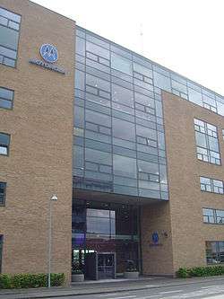
The largest employer in the municipality is Glostrup Hospital with 2,500 employees.[1] Vestforbrænding in Ejby is Denmark's largest incineration plant. Major companies based in the municipality include Pandora, Kopenhagen Fur. International companies, whose Danish subsidiaries are based out of Glostrup, include Grontmij and Motorola's.
Housing
Most of the municipality's housing stock is built between 1950 and 1975. 42 percent of its dwellings are owned by public housing corporations, primarily Glostrup Boligselskab formed by later mayor Valdemar Hansen in 1943. As a result of the influence of the housing corporation, more than half the housing stock is between 60 and 99 square meters.
As a result of the rising population in the Copenhagen area, Glostrup Municipality adopted a strategy in 2011 aiming on building 2000 new dwellings within the next four years. The dwellings are primarily detached houses and terraced houses planned in former industrial areas.[2]
Parks and open spaces

The largest greenspace in Glostrup Municipality is Vestskoven ("The West Forest") that straddles the border with Albertslund where most of its 13 square kilometer are located. The West Rampart follows the eastern boundary of the municipality. Ehby Bog is located in the northeastern corner, on the border with Ballerup.[1]
Population
The table show the population in Glostrup Municipality since 1890. Note the drop in population following the transfer of Avedøre to Hvidovre Municipality in 1974.
| Year | Population | Year | Population |
|---|---|---|---|
| 1890 | 1,709 | 1965 | 26,898 |
| 1916 | 4,948 | 1970 | 28,234 |
| 1921 | 3,836 | 1975 | 20,596 |
| 1925 | 4,480 | 1980 | 19,553 |
| 1935 | 7,034 | 1985 | 19,696 |
| 1940 | 8,623 | 1990 | 19,747 |
| 1945 | 10,082 | 1995 | 20,263 |
| 1950 | 13,025 | 2000 | 20,229 |
| 1955 | 15,883 | 2005 | 20,785 |
| 1960 | 21,845 | 2010 | 21,296 |
Notable people
- Helle Trevino - IFBB professional bodybuilder
- Morten Wieghorst
International relations
Twin towns – Sister cities
Glostrup is twinned with:
.svg.png)

See also
External links
References
- "Glostrup Kommune" (in Danish). AOK. Retrieved 2014-05-29.
- "Archived copy" (PDF). Archived from the original (PDF) on 2014-02-04. Retrieved 2014-01-29.CS1 maint: archived copy as title (link)
- Hassinen, Raino. "Kotka - International co-operation: Twin Cities". City of Kotka. Retrieved 2013-10-22.
- Municipal statistics: NetBorger Kommunefakta, delivered from KMD aka Kommunedata (Municipal Data)
- Municipal mergers and neighbors: Eniro new municipalities map
