Glentunnel
Glentunnel (previously known as Surveyors Gully) is a village located in the Selwyn District of the Canterbury region of New Zealand's South Island.
Glentunnel | |
|---|---|
Village | |
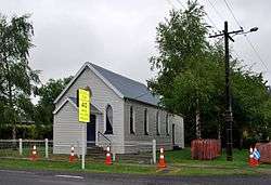 Brethren Chapel in Glentunnel | |
 Glentunnel | |
| Coordinates: 43°29′S 171°56′E | |
| Country | New Zealand |
| Region | Canterbury |
| Territorial authority | Selwyn District |
| Elevation | 260 m (850 ft) |
| Population | |
| • Total | 1,191 |
| Time zone | UTC+12 (New Zealand Standard Time) |
| • Summer (DST) | UTC+13 (New Zealand Daylight Time) |
| Postcode | 7673 |
| Area code(s) | 03 |
It is officially recognised as a "populated area less than a town".[1] The 2018 New Zealand census gave Glentunnel's population as 1,191[2][lower-alpha 1]. It is located on State Highway 77 and the tourist route Inland Scenic Route 72. Glentunnel is 260 meters above sea-level.[3]
History
1800's-2000's
Glentunnel was served by the Whitecliffs Branch, a branch line railway, from the line's opening on 3 November 1875 through to its closure on 31 March 1962. However, the station was not open until 22 April 1876. Few remnants of the railway remain in the town, with the station's platform incorporated into the backyard of a private residence.[4]
An Anglican church used to be situated on the corner of State Highway 77 and Victoria Street, but it caught fire and was demolished. These grounds have also been incorporated into a private residence.
2010 Earthquake
The historic Deans family homestead located in Glentunnel was extensively damaged by the 2010 Canterbury earthquake, so much so that it has been described as being "practically in ruins".[5] It was later demolished and a new homestead was built on the same site.
Industry
Industrial activity such as lignite coal mining and the manufacture of pottery and bricks used to take place in the region around Glentunnel. This was the reason the railway was built, but activity declined sharply in the 20th century and has been effectively non-existent since the 1980s.[6] However, one open-pit coal mine still operates and supplies coal to two nearby dairy factories: Fonterra and Synlait - located in Darfield and Dunsandel, respectively.
Services
Glentunnel has a general store, and a primary school that caters for years 1-6. Two churches are also located here: a Brethren Church (pictured) and a combined denominational church of Anglican, Methodist and Presbyterian called St Andrews. Cafés, a camping ground, garage, golf course, library, museum, playground and a post office are also located in the town.
Glentunnel has many recreational walkways. These include the River Walk, a walkway that follows the Selwyn River from the camping ground to the one-lane bridge at the western end of Glentunnel, and the Millenium Walkway, which follows a now, non-existent tramway route up to the disused tunnel which gave the township its name. This walkway was opened in 2000.
Footnotes
- Total population includes the urban areas of Coalgate and Whitecliffs.
Bibliography
[4] David Leitch and Brian Scott, Exploring New Zealand's Ghost Railways, revised edition (Wellington: Grantham House, 1998 [1995]), 71-2.
References
| Wikimedia Commons has media related to Glentunnel. |
- "Place name detail: Glentunnel". New Zealand Gazetteer. Land Information New Zealand. Retrieved 19 May 2008.
- "2018 Census place summaries | Stats NZ". www.stats.govt.nz. Retrieved 26 April 2020.
- "Glentunnel" (PDF). Selwyn District Council. Retrieved 24 May 2020.
- David Leitch and Brian Scott, Exploring New Zealand's Ghost Railways, revised edition (Wellington: Grantham House, 1998 [1995]), 71-2.
- "Quake destroys historic homeste ad". The New Zealand Herald. 5 September 2010. Retrieved 1 October 2011.
- "Glentunnel and Coalgate". Selwyn District Council. Retrieved 17 June 2020.