Glencoe, Minnesota
Glencoe is the county seat of McLeod County, Minnesota, United States.[6] The population was 5,631 at the 2010 census.[7]
Glencoe | |
|---|---|
 Downtown Glencoe | |
 | |
| Coordinates: 44°46′14″N 94°9′4″W | |
| Country | United States |
| State | Minnesota |
| County | McLeod |
| Area | |
| • Total | 3.14 sq mi (8.14 km2) |
| • Land | 3.13 sq mi (8.12 km2) |
| • Water | 0.01 sq mi (0.02 km2) |
| Elevation | 997 ft (304 m) |
| Population | |
| • Total | 5,631 |
| • Estimate (2018)[3] | 5,467 |
| • Density | 1,755.02/sq mi (677.54/km2) |
| Time zone | UTC-6 (Central (CST)) |
| • Summer (DST) | UTC-5 (CDT) |
| ZIP code | 55336 |
| Area code(s) | 320 |
| FIPS code | 27-23948[4] |
| GNIS feature ID | 0663170[5] |
| Website | City of Glencoe |
Geography
According to the United States Census Bureau, the city has a total area of 3.23 square miles (8.37 km2), of which 3.22 square miles (8.34 km2) is land and 0.01 square miles (0.03 km2) is water.[8] U.S. Highway 212 and Minnesota State Highway 22 are the two main routes in the community.
History
Glencoe was laid out in 1855, and named after Glen Coe, in Scotland.[9] A post office has been in operation at Glencoe since 1856.[10] Glencoe was incorporated as a city in 1909.[9]
Demographics
| Historical population | |||
|---|---|---|---|
| Census | Pop. | %± | |
| 1880 | 1,078 | — | |
| 1890 | 1,649 | 53.0% | |
| 1900 | 1,780 | 7.9% | |
| 1910 | 1,788 | 0.4% | |
| 1920 | 1,747 | −2.3% | |
| 1930 | 1,925 | 10.2% | |
| 1940 | 2,387 | 24.0% | |
| 1950 | 2,801 | 17.3% | |
| 1960 | 3,216 | 14.8% | |
| 1970 | 4,217 | 31.1% | |
| 1980 | 4,396 | 4.2% | |
| 1990 | 4,648 | 5.7% | |
| 2000 | 5,453 | 17.3% | |
| 2010 | 5,631 | 3.3% | |
| Est. 2018 | 5,467 | [3] | −2.9% |
| U.S. Decennial Census | |||
2010 census
As of the census[2] of 2010, there were 5,631 people, 2,220 households, and 1,467 families living in the city. The population density was 1,748.8 inhabitants per square mile (675.2/km2). There were 2,424 housing units at an average density of 752.8 per square mile (290.7/km2). The racial makeup of the city was 92.0% White, 0.6% African American, 0.6% Native American, 0.8% Asian, 4.8% from other races, and 1.2% from two or more races. Hispanic or Latino of any race were 14.8% of the population.
There were 2,220 households of which 33.9% had children under the age of 18 living with them, 52.3% were married couples living together, 9.3% had a female householder with no husband present, 4.4% had a male householder with no wife present, and 33.9% were non-families. 29.3% of all households were made up of individuals and 14.2% had someone living alone who was 65 years of age or older. The average household size was 2.48 and the average family size was 3.06.
The median age in the city was 37.7 years. 26.2% of residents were under the age of 18; 7.7% were between the ages of 18 and 24; 26.5% were from 25 to 44; 22.5% were from 45 to 64; and 17.1% were 65 years of age or older. The gender makeup of the city was 48.5% male and 51.5% female.
2000 census
As of the census[4] of 2000, there were 5,453 people, 2,103 households, and 1,446 families living in the city. The population density was 2,045.6 people per square mile (788.5/km²). There were 2,169 housing units at an average density of 813.7 per square mile (313.7/km²). The racial makeup of the city was 93.25% White, 0.17% African American, 0.28% Native American, 0.57% Asian, 0.13% Pacific Islander, 5.17% from other races, and 0.44% from two or more races. Hispanic or Latino of any race were 12.97% of the population.
There were 2,103 households out of which 34.8% had children under the age of 18 living with them, 57.8% were married couples living together, 8.0% had a female householder with no husband present, and 31.2% were non-families. 27.3% of all households were made up of individuals and 14.9% had someone living alone who was 65 years of age or older. The average household size was 2.53 and the average family size was 3.10.
In the city, the population was spread out with 27.9% under the age of 18, 7.0% from 18 to 24, 28.6% from 25 to 44, 19.1% from 45 to 64, and 17.3% who were 65 years of age or older. The median age was 36 years. For every 100 females, there were 93.5 males. For every 100 females age 18 and over, there were 87.8 males.
The median income for a household in the city was $46,723, and the median income for a family was $55,496. Males had a median income of $36,113 versus $25,230 for females. The per capita income for the city was $20,450. About 0.8% of families and 2.1% of the population were below the poverty line, including 1.4% of those under age 18 and 3.0% of those age 65 or over.
Climate
| Month | Jan | Feb | Mar | Apr | May | Jun | July | Aug | Sep | Oct | Nov | Dec | Year |
|---|---|---|---|---|---|---|---|---|---|---|---|---|---|
| Average High°F | 20 | 27 | 39 | 55 | 70 | 80 | 83 | 80 | 72 | 59 | 39 | 25 | 54 |
| Average Low°F | 1 | 8 | 21 | 34 | 47 | 57 | 62 | 59 | 48 | 36 | 22 | 8 | 34 |
| Average Precipitation " | 0.66 | 0.6 | 1.58 | 2.48 | 3.44 | 4.71 | 3.62 | 4.41 | 2.93 | 2.05 | 1.71 | 0.69 | 28.88 |
Film
The town was the subject of the French film director Louis Malle's 1985 documentary God's Country. Numerous townspeople were interviewed by Malle, including dairy farmer and banker Clayton Hoese and his sons.[12]
References
- "2017 U.S. Gazetteer Files". United States Census Bureau. Retrieved Jan 3, 2019.
- "U.S. Census website". United States Census Bureau. Retrieved 2012-11-13.
- "Population and Housing Unit Estimates". Retrieved September 14, 2019.
- "U.S. Census website". United States Census Bureau. Retrieved 2008-01-31.
- "US Board on Geographic Names". United States Geological Survey. 2007-10-25. Retrieved 2008-01-31.
- "Find a County". National Association of Counties. Archived from the original on May 31, 2011. Retrieved 2011-06-07.
- "2010 Census Redistricting Data (Public Law 94-171) Summary File". American FactFinder. United States Census Bureau. Retrieved 27 April 2011.
- "US Gazetteer files 2010". United States Census Bureau. Archived from the original on January 12, 2012. Retrieved 2012-11-13.
- Upham, Warren (1920). Minnesota Geographic Names: Their Origin and Historic Significance. Minnesota Historical Society. p. 317.
- "McLeod County". Jim Forte Postal History. Archived from the original on 17 January 2016. Retrieved 19 July 2015.
- "Glencoe Historical Averages". intellicast.com. Retrieved 2015-02-28.
- “Malle's 'God's Country' in Minnesota,” New York Times, John Corry, December 11, 1985 https://www.nytimes.com/1985/12/11/movies/malle-s-god-s-countyry-in-minnesota.html Retrieved November 22, 2016.
External links

- City of Glencoe
- Glencoe - Silver Lake Schools
- Louis Malle's Documentary about Glencoe
Municipalities and communities of McLeod County, Minnesota, United States | ||
|---|---|---|
| Cities | 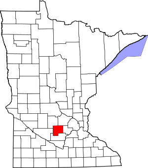 Map of Minnesota highlighting McLeod County | |
| Townships | ||
| Unincorporated communities | ||
| Ghost town | ||
| Authority control |
|---|