Gillsville, Georgia
Gillsville is a city in Banks and Hall counties in the U.S. state of Georgia. The population was 235 at the 2010 census.[5]
Gillsville, Georgia | |
|---|---|
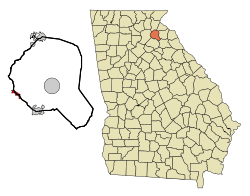 Location in Banks County and the state of Georgia | |
| Coordinates: 34°18′33″N 83°38′8″W | |
| Country | United States |
| State | Georgia |
| Counties | Hall, Banks |
| Area | |
| • Total | 1.11 sq mi (2.88 km2) |
| • Land | 1.11 sq mi (2.88 km2) |
| • Water | 0.00 sq mi (0.00 km2) |
| Elevation | 942 ft (287 m) |
| Population (2010) | |
| • Total | 235 |
| • Estimate (2018)[2] | 240 |
| • Density | 216.02/sq mi (83.43/km2) |
| Time zone | UTC-5 (Eastern (EST)) |
| • Summer (DST) | UTC-4 (EDT) |
| ZIP code | 30543 |
| Area code(s) | 770 |
| FIPS code | 13-32860[3] |
| GNIS feature ID | 0356015[4] |
| Website | gillsvillega |
The Hall County portion of Gillsville is part of the Gainesville, GA Metropolitan Statistical Area.
History
The community was named after the local Gills family.[6]
Geography
Gillsville is located at 34°18′33″N 83°38′8″W (34.309090, -83.635621).[7]
According to the United States Census Bureau, the city has a total area of 1.1 square miles (2.8 km2), all land.
Demographics
| Historical population | |||
|---|---|---|---|
| Census | Pop. | %± | |
| 1910 | 216 | — | |
| 1920 | 225 | 4.2% | |
| 1930 | 176 | −21.8% | |
| 1940 | 157 | −10.8% | |
| 1950 | 152 | −3.2% | |
| 1960 | 140 | −7.9% | |
| 1970 | 100 | −28.6% | |
| 1980 | 142 | 42.0% | |
| 1990 | 113 | −20.4% | |
| 2000 | 195 | 72.6% | |
| 2010 | 235 | 20.5% | |
| Est. 2018 | 240 | [2] | 2.1% |
| U.S. Decennial Census[8] | |||
At the 2000 census there were 195 people in 79 households, including 57 families, in the city. The population density was 171.3 people per square mile (66.0/km²). There were 90 housing units at an average density of 79.1 per square mile (30.5/km²). The racial makeup of the city was 99.49% White, and 0.51% from two or more races. Hispanic or Latino of any race were 1.54%.[3]
Of the 79 households 30.4% had children under the age of 18 living with them, 67.1% were married couples living together, 5.1% had a female householder with no husband present, and 26.6% were non-families. 21.5% of households were one person and 15.2% were one person aged 65 or older. The average household size was 2.47 and the average family size was 2.91.
The age distribution was 20.0% under the age of 18, 7.7% from 18 to 24, 27.2% from 25 to 44, 25.6% from 45 to 64, and 19.5% 65 or older. The median age was 42 years. For every 100 females, there were 93.1 males. For every 100 females age 18 and over, there were 90.2 males.
The median household income was $51,500 and the median family income was $62,750. Males had a median income of $35,417 versus $28,750 for females. The per capita income for the city was $27,551. None of the families and 3.7% of the population were living below the poverty line, including no under eighteens and 7.5% of those over 64.
References
- "2018 U.S. Gazetteer Files". United States Census Bureau. Retrieved Feb 12, 2020.
- "Population and Housing Unit Estimates". Retrieved June 4, 2019.
- "U.S. Census website". United States Census Bureau. Retrieved 2008-01-31.
- "US Board on Geographic Names". United States Geological Survey. 2007-10-25. Retrieved 2008-01-31.
- "Geographic Identifiers: 2010 Demographic Profile Data (G001): Gillsville city, Georgia". U.S. Census Bureau, American Factfinder. Archived from the original on February 12, 2020. Retrieved October 29, 2013.
- Krakow, Kenneth K. (1975). Georgia Place-Names: Their History and Origins (PDF). Macon, GA: Winship Press. p. 93. ISBN 0-915430-00-2.
- "US Gazetteer files: 2010, 2000, and 1990". United States Census Bureau. 2011-02-12. Retrieved 2011-04-23.
- "Census of Population and Housing". Census.gov. Retrieved June 4, 2015.
Municipalities and communities of Banks County, Georgia, United States | ||
|---|---|---|
| Cities |  Map of Georgia highlighting Banks County | |
| Towns | ||
| Unincorporated communities | ||
| Footnotes | ‡This populated place also has portions in an adjacent county or counties | |
Municipalities and communities of Hall County, Georgia, United States | ||
|---|---|---|
| City | 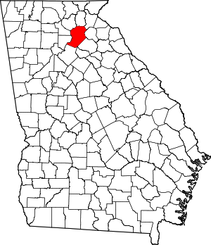 Map of Georgia highlighting Hall County | |
| Towns | ||
| Unincorporated communities | ||
| Footnotes | ‡This populated place also has portions in an adjacent county or counties | |