Flowery Branch, Georgia
Flowery Branch is a city in Hall County, Georgia, United States. As of the 2010 census, the city had a population of 5,679.[2] It is part of the Gainesville, Georgia metropolitan area, and lies on the shores of Lake Lanier.
Flowery Branch, Georgia | |
|---|---|
City | |
 Main Street | |
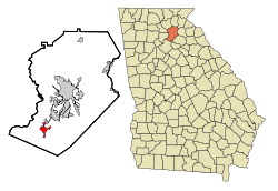 Location in Hall County and the state of Georgia | |
| Coordinates: 34°11′9″N 83°55′28″W | |
| Country | United States |
| State | Georgia |
| County | Hall |
| Area | |
| • Total | 7.22 sq mi (18.70 km2) |
| • Land | 7.10 sq mi (18.40 km2) |
| • Water | 0.12 sq mi (0.30 km2) |
| Elevation | 1,122 ft (342 m) |
| Population | |
| • Total | 5,679 |
| • Estimate (2018)[3] | 7,934 |
| • Density | 1,116.84/sq mi (431.21/km2) |
| Time zone | UTC−5 (Eastern (EST)) |
| • Summer (DST) | UTC−4 (EDT) |
| ZIP code | 30542 |
| Area code | 770 |
| FIPS code | 13-30340[4] |
| GNIS feature ID | 0331733[5] |
| Website | www |
History
Flowery Branch was originally named Anaguluskee, a Cherokee Indian word meaning "flowers on the branch." [6] Other sources claim the original name was Nattagasska ("Blossom Creek"), which long-term residents recall as an alternative nickname for the town.[7]
Andrew Jackson passed through Flowery Branch on his way to the First Seminole War in 1818.[8]
The Atlanta Falcons football team's training camp has been located in Flowery Branch since the start of the 2005 season.[9] The city also hosts the Historic Caboose exhibit and the Historic Train Depot museum.
Geography
Flowery Branch is located at 34°11′9″N 83°55′28″W (34.185801, -83.924479).[10] According to the United States Census Bureau, the town has a total area of 6.32 square miles (16.4 km2), of which, 6.32 square miles (16.4 km2) of it is land and 0.40% is water.[2] Flowery Branch borders Chestnut Mountain and Oakwood. City limits are 1 mile (1.6 km) from Gainesville and Braselton. Flowery Branch is on the shores of Lake Lanier.
Demographics
| Historical population | |||
|---|---|---|---|
| Census | Pop. | %± | |
| 1880 | 289 | — | |
| 1890 | 350 | 21.1% | |
| 1900 | 420 | 20.0% | |
| 1910 | 373 | −11.2% | |
| 1920 | 461 | 23.6% | |
| 1930 | 418 | −9.3% | |
| 1940 | 506 | 21.1% | |
| 1950 | 610 | 20.6% | |
| 1960 | 741 | 21.5% | |
| 1970 | 779 | 5.1% | |
| 1980 | 755 | −3.1% | |
| 1990 | 1,251 | 65.7% | |
| 2000 | 1,806 | 44.4% | |
| 2010 | 5,679 | 214.5% | |
| Est. 2018 | 7,934 | [3] | 39.7% |
| U.S. Decennial Census[11] | |||
As of the census[4] of 2000, there were 1,806 people, 706 households, and 475 families residing in the town. The population density was 725.3 people per square mile (280.0/km²). There were 820 housing units at an average density of 329.3 per square mile (127.2/km²). The racial makeup of the town was 80.22% White, 10.18% African American, 0.44% Native American, 0.28% Asian, 2.21% from other races, and 0.66% from two or more races. Hispanic or Latino of any race were 9.69% of the population.
There were 706 households out of which 33.3% had children under the age of 18 living with them, 43.6% were married couples living together, 17.0% had a female householder with no husband present, and 32.6% were non-families. 23.8% of all households were made up of individuals and 7.1% had someone living alone who was 65 years of age or older. The average household size was 2.56 and the average family size was 3.01.
In the town, the age distribution of the population shows 25.7% under the age of 18, 12.1% from 18 to 24, 35.4% from 25 to 44, 18.1% from 45 to 64, and 8.6% who were 65 years of age or older. The median age was 31 years. For every 100 females, there were 103.4 males. For every 100 females age 18 and over, there were 96.3 males.
The median income for a household in the town was $35,478, and the median income for a family was $38,500. Males had a median income of $29,572 versus $21,382 for females. The per capita income for the town was $16,970. About 9.5% of families and 13.3% of the population were below the poverty line, including 13.1% of those under age 18 and 21.6% of those age 65 or over.
Education
Public education in Flowery Branch is served by Hall County Schools. Flowery Branch High School is the city's local high school.
Notable people
- Brad Keller, pitcher for the Kansas City Royals of Major League Baseball
- Connor Shaw, previous starting quarterback for the University of South Carolina football team, currently plays for the Chicago Bears of the NFL
References
- "2018 U.S. Gazetteer Files". United States Census Bureau. Retrieved Feb 12, 2020.
- "Archived copy". Archived from the original on 2012-05-05. Retrieved 2012-05-05.CS1 maint: archived copy as title (link)
- "Population and Housing Unit Estimates". Retrieved June 4, 2019.
- "U.S. Census website". United States Census Bureau. Retrieved 2008-01-31.
- "US Board on Geographic Names". United States Geological Survey. 2007-10-25. Retrieved 2008-01-31.
- Hopper, Buz. "Jackson at Young's Tavern". GeorgiaInfo: an Online Georgia Almanac. Digital Library of Georgia. Retrieved November 30, 2016.
- "City of Flowery Branch » Falcons Campus". Archived from the original on 2007-05-29. Retrieved 2007-05-15.
- "US Gazetteer files: 2010, 2000, and 1990". United States Census Bureau. 2011-02-12. Retrieved 2011-04-23.
- "Census of Population and Housing". Census.gov. Retrieved June 4, 2015.
External links
- The Flowery Branch Depot historical marker
Municipalities and communities of Hall County, Georgia, United States | ||
|---|---|---|
| City | 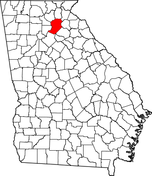 Map of Georgia highlighting Hall County | |
| Towns | ||
| Unincorporated communities | ||
| Footnotes | ‡This populated place also has portions in an adjacent county or counties | |
| Authority control |
|---|