Gelendzhik
Gelendzhik or Gelenjik (Russian: Геленджи́к) is a resort town in Krasnodar Krai, Russia, located on the Gelendzhik Bay of the Black Sea, between Novorossiysk (31 kilometers (19 mi) to the northwest) and Tuapse (93 kilometers (58 mi) to the southeast). Greater Gelendzhik sprawls for 102 kilometers (63 mi) along the coastline and covers an area of 122,754 hectares (303,330 acres), although only 1,926 hectares (4,760 acres) fall within the boundaries of Gelendzhik proper. Population: 54,980 (2010 Census);[2] 50,012 (2002 Census);[7] 47,711 (1989 Census).[8]
Gelendzhik Геленджик | |
|---|---|
Town[1] | |
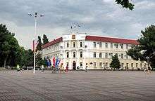
 View of Gelendzhik | |
.png) Flag .png) Coat of arms | |
Location of Gelendzhik 
| |
 Gelendzhik Location of Gelendzhik .svg.png) Gelendzhik Gelendzhik (Krasnodar Krai) | |
| Coordinates: 44°34′N 38°05′E | |
| Country | Russia |
| Federal subject | Krasnodar Krai[1] |
| Founded | 1831 |
| Town status since | 1915 |
| Government | |
| • Head | Viktor Khrestin |
| Area | |
| • Total | 123 km2 (47 sq mi) |
| Elevation | 30 m (100 ft) |
| Population | |
| • Total | 54,980 |
| • Estimate (2018)[3] | 76,830 (+39.7%) |
| • Rank | 302nd in 2010 |
| • Density | 450/km2 (1,200/sq mi) |
| • Subordinated to | Town of Gelendzhik[1] |
| • Capital of | Town of Gelendzhik[1] |
| • Urban okrug | Gelendzhik Urban Okrug[4] |
| • Capital of | Gelendzhik Urban Okrug[4] |
| Time zone | UTC+3 (MSK |
| Postal code(s)[6] | 353460, 353461, 353465–353468, 353475, 353477 |
| Dialing code(s) | +7 86141 |
| OKTMO ID | 03708000001 |
| Twin towns | Hildesheim, Angoulême, Agia Napa |
| Website | gelendzhik |
History
In antiquity, the Gelendzhik Bay was the site of a minor Greek outpost, mentioned as Torikos in the Periplus of Pseudo-Scylax. It is unknown to Hellenistic sources, but reappears in Roman ones under the name of Pagrae in 64 BC.[9] The colony was wiped out by the invading Huns, which were succeeded by the Zygii soon after. During the Middle Ages, the bay was of some mercantile importance to the Genoese traders who referred to the seaside village as Maurolaca.
Before Russia secured the coast by the Treaty of Adrianople (1829), a brisk slave trade had been carried on between the mountaineers and the Ottoman Empire. Since the Circassian beauties were usually traded for gold and other commodities before being taken to Turkish seraglios, the market place became known as "Gelendzhik" (from "gelincik"), literally, "little bride" in Turkish Language. In 1831, one of the first forts of the Black Sea Coastal Line was set up at Gelendzhik. At the outbreak of the Crimean War the fort had to be blown up and abandoned, but it was resettled by the Cossacks in 1864, at the conclusion of the Russian-Circassian War, and became known as the stanitsa of Gelendzhiksaya. Town status was granted to Gelendzhik in 1915.
Description
During the Soviet period, Gelendzhik was developed as a resort town. It possesses sand beaches, three waterparks, two chairlift lines, and two Orthodox churches (from 1909 and 1913, respectively). The environs of Gelendzhik are noted for a chain of waterfalls, an outcrop of dolmens, two extremely ancient pine and juniper groves, and the Sail Rock, located 17 kilometers (11 mi) from the town's central area. The coastal village of Arkhipo-Osipovka, administrated from Gelendzhik, contains the terminus of the Blue Stream gas pipeline. An annual hydroaviasalon is held in Gelendzhik since 1996.
Administrative and municipal status
Within the framework of administrative divisions, it is, together with twenty rural localities, incorporated as the Town of Gelendzhik—an administrative unit with the status equal to that of the districts.[1] As a municipal division, the Town of Gelendzhik is incorporated as Gelendzhik Urban Okrug.[4]
Climate
The climate of Gelendzhik is a cooler humid subtropical (Köppen climate classification Cfa) closely bordering the semi-arid climate (Köppen climate classification BSk). Winters are mild and snowfall is light. Summers are hot with warm evenings. Sometimes Gelendzhik has experienced big floods as it happened in 2012 (2012 Krasnodar Krai floods).
| Climate data for Gelendzhik | |||||||||||||
|---|---|---|---|---|---|---|---|---|---|---|---|---|---|
| Month | Jan | Feb | Mar | Apr | May | Jun | Jul | Aug | Sep | Oct | Nov | Dec | Year |
| Record high °C (°F) | 20.0 (68.0) |
21.0 (69.8) |
26.4 (79.5) |
28.2 (82.8) |
32.0 (89.6) |
36.0 (96.8) |
39.0 (102.2) |
38.7 (101.7) |
34.0 (93.2) |
29.3 (84.7) |
25.5 (77.9) |
22.0 (71.6) |
39.0 (102.2) |
| Average high °C (°F) | 6.4 (43.5) |
7.3 (45.1) |
10.9 (51.6) |
16.6 (61.9) |
21.5 (70.7) |
24.7 (76.5) |
28.6 (83.5) |
29.9 (85.8) |
23.9 (75.0) |
18.9 (66.0) |
12.5 (54.5) |
8.2 (46.8) |
16.8 (62.2) |
| Daily mean °C (°F) | 3.9 (39.0) |
4.0 (39.2) |
7.1 (44.8) |
12.0 (53.6) |
17.0 (62.6) |
20.6 (69.1) |
23.9 (75.0) |
24.6 (76.3) |
19.2 (66.6) |
14.1 (57.4) |
8.9 (48.0) |
5.3 (41.5) |
13.0 (55.4) |
| Average low °C (°F) | 1.3 (34.3) |
0.7 (33.3) |
3.3 (37.9) |
7.4 (45.3) |
12.4 (54.3) |
16.4 (61.5) |
19.1 (66.4) |
18.4 (65.1) |
14.4 (57.9) |
9.3 (48.7) |
5.2 (41.4) |
2.4 (36.3) |
9.2 (48.6) |
| Record low °C (°F) | −22.0 (−7.6) |
−15.7 (3.7) |
−11.0 (12.2) |
−7 (19) |
0.3 (32.5) |
5.6 (42.1) |
9.5 (49.1) |
6.9 (44.4) |
1.0 (33.8) |
−18.0 (−0.4) |
−19.6 (−3.3) |
−16.1 (3.0) |
−22.0 (−7.6) |
| Average precipitation mm (inches) | 85.4 (3.36) |
70.8 (2.79) |
72.3 (2.85) |
61.7 (2.43) |
70.6 (2.78) |
67.2 (2.65) |
39.8 (1.57) |
39.1 (1.54) |
45.4 (1.79) |
51.7 (2.04) |
72.6 (2.86) |
94.1 (3.70) |
770.7 (30.34) |
| Source: meteoblue.com[10] | |||||||||||||
Twin towns – sister cities
References
Notes
- Reference Information #34.01-707/13-03
- Russian Federal State Statistics Service (2011). "Всероссийская перепись населения 2010 года. Том 1" [2010 All-Russian Population Census, vol. 1]. Всероссийская перепись населения 2010 года [2010 All-Russia Population Census] (in Russian). Federal State Statistics Service.
- http://krsdstat.gks.ru/wps/wcm/connect/rosstat_ts/krsdstat/resources/b98c9c8044d9a869b7d6bfde4cdebdf4/Оценка+численности_01.01.2018.htm; retrieved: 23 March 2018.
- Law #668-KZ
- "Об исчислении времени". Официальный интернет-портал правовой информации (in Russian). June 3, 2011. Retrieved January 19, 2019.
- Почта России. Информационно-вычислительный центр ОАСУ РПО. (Russian Post). Поиск объектов почтовой связи (Postal Objects Search) (in Russian)
- Russian Federal State Statistics Service (May 21, 2004). "Численность населения России, субъектов Российской Федерации в составе федеральных округов, районов, городских поселений, сельских населённых пунктов – районных центров и сельских населённых пунктов с населением 3 тысячи и более человек" [Population of Russia, Its Federal Districts, Federal Subjects, Districts, Urban Localities, Rural Localities—Administrative Centers, and Rural Localities with Population of Over 3,000] (XLS). Всероссийская перепись населения 2002 года [All-Russia Population Census of 2002] (in Russian).
- "Всесоюзная перепись населения 1989 г. Численность наличного населения союзных и автономных республик, автономных областей и округов, краёв, областей, районов, городских поселений и сёл-райцентров" [All Union Population Census of 1989: Present Population of Union and Autonomous Republics, Autonomous Oblasts and Okrugs, Krais, Oblasts, Districts, Urban Settlements, and Villages Serving as District Administrative Centers]. Всесоюзная перепись населения 1989 года [All-Union Population Census of 1989] (in Russian). Институт демографии Национального исследовательского университета: Высшая школа экономики [Institute of Demography at the National Research University: Higher School of Economics]. 1989 – via Demoscope Weekly.
- A tiny Greek settlement excavated in Gelendzhik has been identified by some researchers with Torikos. Pagrae was described as an eastern limit of the Bosporan Kingdom. The record of these settlements is so fragmentary that it is impossible to make sound conclusions. See: Онайко Н.А., Архаический Торик. Античный город на северо-востоке Понта. Moscow, 1980.
- "Meteoblue". Retrieved June 28, 2012.
- "Побратимские и партнёрские связи". gelendzhik.org (in Russian). Gelendzhik. Retrieved February 5, 2020.
Sources
- Управление по взаимодействию с органами местного самоуправления Администрации Краснодарского края. Справочная информация №34.01-707/13-03 от 23 мая 2013 г. «Реестр административно-территориальных единиц Краснодарского края». (Department of Cooperation with the Organs of the Local Self-Government of the Administration of Krasnodar Krai. Reference Information #34.01-707/13-03 of May 23, 2013 Registry of the Administrative-Territorial Units of Krasnodar Krai. ).
- Законодательное Собрание Краснодарского края. Закон №668-КЗ от 10 марта 2004 г. «Об установлении границ муниципального образования город-курорт Геленджик и наделении его статусом городского округа», в ред. Закона №1756-КЗ от 3 июня 2009 г «О внесении изменений в некоторые законодательные акты Краснодарского края об установлении границ муниципальных образований». Вступил в силу со дня официального опубликования. Опубликован: "Кубанские новости", №37–38, 13 марта 2004 г. (Legislative Assembly of Krasnodar Krai. Law #668-KZ of March 10, 2004 On Establishing the Borders of the Municipal Formation of the Resort Town of Gelendzhik and on Granting It Urban Okrug Status, as amended by the Law #1756-KZ of June 3, 2009 On Amending Various Legislative Acts of Krasnodar Krai on Establishing the Borders of the Municipal Formations. Effective as of the day of the official publication.).
| Wikimedia Commons has media related to Gelendzhik. |
| Authority control |
|
|---|