Gaylord, Michigan
Gaylord is a city in and the county seat of Otsego County, Michigan, United States.[6] The population was 3,645 at the 2010 census. The city is also the seat of the Roman Catholic Diocese of Gaylord, the smallest settlement by far serving as the location of an active Roman Catholic cathedral in the United States.
Gaylord, Michigan | |
|---|---|
| Nickname(s): The Alpine Village | |
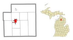 Location within Otsego County | |
 Gaylord Location within the state of Michigan | |
| Coordinates: 45°01′29″N 84°40′36″W | |
| Country | United States |
| State | Michigan |
| County | Otsego |
| Government | |
| • Type | Council–manager |
| • Mayor | Jason Schillig |
| Area | |
| • Total | 5.00 sq mi (12.95 km2) |
| • Land | 4.97 sq mi (12.89 km2) |
| • Water | 0.03 sq mi (0.06 km2) |
| Elevation | 1,348 ft (411 m) |
| Population | |
| • Total | 3,645 |
| • Estimate (2018)[3] | 3,701 |
| • Density | 741.11/sq mi (286.13/km2) |
| Time zone | UTC-5 (Eastern (EST)) |
| • Summer (DST) | UTC-4 (EDT) |
| ZIP code(s) | 49734, 49735 |
| Area code(s) | 989 |
| FIPS code | 26-31720[4] |
| GNIS feature ID | 0626696[5] |
| Website | Official website |
Gaylord styles itself as an "alpine village"[7] and the city center features many buildings with Tyrolean traverse style motifs. Receiving abundant snowfall and experiencing mild summer temperatures, the area around Gaylord has long been known for its many skiing and golf resorts, one of the largest such concentrations in the Midwest.
History
Gaylord was named for an attorney employed with the Michigan Central Railroad.[8]
Geography
- According to the United States Census Bureau, the city has a total area of 4.83 square miles (12.51 km2), of which, 4.80 square miles (12.43 km2) is land and 0.03 square miles (0.08 km2) is water.[9]
- Gaylord experiences heavy lake effect snow during the winter and is in the middle of the Northern Michigan snowbelt.
- Highway signs denote that Gaylord rests on the 45th parallel line[10] – halfway between the equator and the North Pole. This is one of 29 places (six are in Michigan) in the U.S.A. where such signs are known to exist.[11]
- It is considered to be part of Northern Michigan.
- Hartwick Pines State Park is just 28 miles (45 km) to the south, and is one of the last remaining stands of old growth virgin Eastern white pine forest.
- The Huron-Manistee National Forests is nearby.
Climate
This climatic region has large seasonal temperature differences, with warm to hot (and often humid) summers and cold (sometimes severely cold) winters. According to the Köppen Climate Classification system, Gaylord has a humid continental climate, abbreviated "Dfb" on climate maps.[12]
| Climate data for Gaylord | |||||||||||||
|---|---|---|---|---|---|---|---|---|---|---|---|---|---|
| Month | Jan | Feb | Mar | Apr | May | Jun | Jul | Aug | Sep | Oct | Nov | Dec | Year |
| Average high °F (°C) | 25.5 (−3.6) |
29.1 (−1.6) |
39.2 (4.0) |
54.3 (12.4) |
66.6 (19.2) |
75.7 (24.3) |
79.4 (26.3) |
77.0 (25.0) |
68.8 (20.4) |
55.7 (13.2) |
41.6 (5.3) |
29.5 (−1.4) |
53.5 (11.9) |
| Daily mean °F (°C) | 18.2 (−7.7) |
20.3 (−6.5) |
28.9 (−1.7) |
42.4 (5.8) |
53.9 (12.2) |
63.5 (17.5) |
67.7 (19.8) |
65.8 (18.8) |
58.1 (14.5) |
46.3 (7.9) |
34.5 (1.4) |
23.4 (−4.8) |
43.6 (6.4) |
| Average low °F (°C) | 10.9 (−11.7) |
11.6 (−11.3) |
18.5 (−7.5) |
30.5 (−0.8) |
41.3 (5.2) |
51.3 (10.7) |
55.9 (13.3) |
54.5 (12.5) |
47.4 (8.6) |
36.9 (2.7) |
27.4 (−2.6) |
17.2 (−8.2) |
33.6 (0.9) |
| Average precipitation inches (mm) | 2.68 (68) |
1.95 (50) |
2.10 (53) |
2.36 (60) |
3.02 (77) |
2.91 (74) |
2.99 (76) |
3.64 (92) |
3.67 (93) |
3.70 (94) |
3.23 (82) |
3.05 (77) |
35.31 (897) |
| Average snowfall inches (cm) | 37.3 (95) |
24.8 (63) |
15.8 (40) |
7.4 (19) |
0.5 (1.3) |
0 (0) |
0 (0) |
0 (0) |
0 (0) |
3.2 (8.1) |
19.4 (49) |
35.1 (89) |
143.5 (364) |
| Average precipitation days (≥ 0.01 in) | 16.1 | 11.6 | 10.3 | 9.2 | 9.5 | 8.8 | 8.5 | 9.4 | 10.7 | 12.5 | 13.3 | 16.2 | 136.1 |
| Average snowy days (≥ 0.1 in) | 15.8 | 11.5 | 7.2 | 3.1 | 0.2 | 0 | 0 | 0 | 0 | 1.6 | 7.2 | 14.4 | 61 |
| Source: NOAA [13] | |||||||||||||
Demographics
| Historical population | |||
|---|---|---|---|
| Census | Pop. | %± | |
| 1880 | 292 | — | |
| 1890 | 661 | 126.4% | |
| 1900 | 1,561 | 136.2% | |
| 1910 | 1,538 | −1.5% | |
| 1920 | 1,701 | 10.6% | |
| 1930 | 1,627 | −4.4% | |
| 1940 | 2,055 | 26.3% | |
| 1950 | 2,271 | 10.5% | |
| 1960 | 2,568 | 13.1% | |
| 1970 | 3,012 | 17.3% | |
| 1980 | 3,011 | 0.0% | |
| 1990 | 3,256 | 8.1% | |
| 2000 | 3,681 | 13.1% | |
| 2010 | 3,645 | −1.0% | |
| Est. 2018 | 3,701 | [3] | 1.5% |
| U.S. Decennial Census[14] | |||
2010 census
As of the census[2] of 2010, there were 3,645 people, 1,610 households, and 826 families residing in the city. The population density was 759.4 inhabitants per square mile (293.2/km2). There were 1,847 housing units at an average density of 384.8 per square mile (148.6/km2). The racial makeup of the city was 94.8% White, 0.9% African American, 0.8% Native American, 1.0% Asian, 0.2% from other races, and 2.3% from two or more races. Hispanic or Latino of any race were 1.8% of the population.
There were 1,610 households of which 27.8% had children under the age of 18 living with them, 33.7% were married couples living together, 13.5% had a female householder with no husband present, 4.1% had a male householder with no wife present, and 48.7% were non-families. 42.0% of all households were made up of individuals and 19.1% had someone living alone who was 65 years of age or older. The average household size was 2.14 and the average family size was 2.95.
The median age in the city was 39.3 years. 22.7% of residents were under the age of 18; 10.9% were between the ages of 18 and 24; 23.2% were from 25 to 44; 23.2% were from 45 to 64; and 20% were 65 years of age or older. The gender makeup of the city was 45.9% male and 54.1% female.
2000 census
As of the census[4] of 2000, there were 3,681 people, 1,584 households, and 888 families residing in the city. The population density was 932.8 per square mile (359.8/km²). There were 1,773 housing units at an average density of 449.3 per square mile (173.3/km²). The racial makeup of the city was 96.50% White, 0.30% African American, 0.95% Native American, 0.30% Asian, 0.08% Pacific Islander, 0.33% from other races, and 1.55% from two or more races. Hispanic or Latino of any race were 1.71% of the population.
There were 1,584 households out of which 29.0% had children under the age of 18 living with them, 38.8% were married couples living together, 13.4% had a female householder with no husband present, and 43.9% were non-families. 38.1% of all households were made up of individuals and 19.0% had someone living alone who was 65 years of age or older. The average household size was 2.22 and the average family size was 2.97.
In the city, the population was spread out with 24.9% under the age of 18, 9.4% from 18 to 24, 26.6% from 25 to 44, 18.6% from 45 to 64, and 20.4% who were 65 years of age or older. The median age was 38 years. For every 100 females, there were 79.4 males. For every 100 females age 18 and over, there were 76.0 males.
The median income for a household in the city was $28,770, and the median income for a family was $36,654. Males had a median income of $33,264 versus $19,815 for females. The per capita income for the city was $17,313. About 8.8% of families and 9.7% of the population were below the poverty line, including 8.8% of those under age 18 and 13.6% of those age 65 or over.
Transportation


- Old 27 is the former route of US 27 and is a major north–south local route through the city and the rest of Otsego County.[17]
- Gaylord Regional Airport is located at 1100 Aero Drive, Gaylord, MI 49735. (989) 732-4218 Phone. It is owned and operated by the County of Otsego. The Airport is licensed by the Michigan Aeronautics Commission as a General Utility Airport. It is listed as a tier one airport in all categories of the Michigan Airport System Plan.[18][19]
- Indian Trails provides daily intercity bus service between St. Ignace and East Lansing, Michigan.[20]
Recreation
Due to the distance from Lake Michigan and the elevation, snowfall is greatly increased and is often referred to as Lake Effect Snow. The affected area is known as the snow belt and has prodigious snowfall. Combined with local Terrain and Topography many Winter Recreation opportunities abound.
- Much of the old train system has been converted to trails for biking or Snow Mobile riding. The North Central State Trail north to Mackinaw City is a Rails to trails converted remnant of a spur line of the Michigan Central Railroad that used to serve Gaylord.[21]
- Fall colors and snowshoeing are highlights in several of the local parks.
- Cross country skiing is an important tourist activity near Gaylord. With two of the top-rated cross country venues in Michigan, namely Hartwick Pines State Park Trails and Mason Tract Pathway nearby.[22] Forbush corners in nearby Frederic, Michigan is a world-recognized center for education and training in cross country skiing, and benefits from early and late snow due to a 'snow belt micro climate.' Accomplished amateur ski racer David Forbush designed, maintains, and grooms "one of the finest privately owned systems in the Midwest."[23]
- Downhill Skiing and Snowboarding are also highly accessible with several Resorts operating in the area.
- Water Skiing, Wakeboarding, and Jetskiing are also available on Otsego Lake.
- Otsego Lake State Park, swimming, boating, and camping.
- Otsego Club & Resort
An annual event in July, Alpenfest, encourages participants to dress in traditional Swiss fashions. This event brings in numerous people from all around and provides a vast array of activities. Some of these activities include carnival rides and games, music, shops, and a local 'Queen's Pageant'. A parade takes place on the final day.
Media
- Local newspaper Gaylord Herald Times serves the area.[24]
- Regionally available is the Weekly Choice Publication.
- WMJZ, "Eagle" 101.5 FM, features a classic hits format and is the primary local (Gaylord/Otsego County-focused) commercial radio station.
- Also licensed to Gaylord are WBLW 88.1 FM and WPHN 90.5 FM (The Promise FM), which both feature non-commercial Christian religious programming. Also, Charlevoix-based Catholic radio station WTCK operates a translator in Gaylord at 92.1 FM.
- WSRT 106.7 FM, a talk radio station (formerly WKPK "The Peak," a locally legendary top 40 station) which, although licensed to Gaylord, is based in Traverse City.
- WQON, Q100.3, The Only Place for Rock & Roll and play-by-play for Detroit Lions Football and University of Michigan Football/Basketball.[25]
- WGRY AM/FM, Y101.1/AM1230, YOUR Sports Talk in Northern Michigan, CBS Sports Talk and home of Detroit Tiger Baseball, Detroit Red Wing Hockey, and Detroit Pistons Basketball.[26]
Gaylord is also served by radio and TV broadcasts from Traverse City, Petoskey, Charlevoix, Cadillac, Grayling, Houghton Lake, Cheboygan, and Alpena.
Notable people
- Claude Shannon, the "father of information theory"
References
- "2017 U.S. Gazetteer Files". United States Census Bureau. Retrieved Jan 3, 2019.
- "U.S. Census website". United States Census Bureau. Retrieved 2012-11-25.
- "Population and Housing Unit Estimates". Retrieved November 7, 2019.
- "U.S. Census website". United States Census Bureau. Retrieved 2008-01-31.
- "US Board on Geographic Names". United States Geological Survey. 2007-10-25. Retrieved 2008-01-31.
- "Find a County". National Association of Counties. Archived from the original on May 31, 2011. Retrieved 2011-06-07.
- http://www.michigan.org/City/Default.aspx?city=G3073
- Gannett, Henry (1905). The Origin of Certain Place Names in the United States. Govt. Print. Off. pp. 135.
- "US Gazetteer files 2010". United States Census Bureau. Archived from the original on January 12, 2012. Retrieved 2012-11-25.
- Gaylord signs denoting the 45th Parallel.
- "45th Parallel North America". wurlington-bros.com.
- "Gaylord, Michigan Köppen Climate Classification (Weatherbase)". Weatherbase.
- "NOWData - NOAA Online Weather Data". National Oceanic and Atmospheric Administration. Retrieved 2012-08-16.
- "Census of Population and Housing". Census.gov. Retrieved June 4, 2015.
- Christopher J. Bessert. "Michigan Highways: Business Connections 32 through 94". michiganhighways.org.
- Christopher J. Bessert. "Michigan Highways: Route Listings: Routes 30-39". michiganhighways.org.
- Old US 27 history Archived 2008-02-22 at the Wayback Machine
- Gaylord Airport, County page. Archived 2008-02-19 at the Wayback Machine
- "EAST LANSING-PETOSKEY-ST. IGNACE" (PDF). Indian Trails. January 15, 2013. Archived from the original (PDF) on 2014-06-29. Retrieved 2013-02-27.
- "North Central State Trail". Michigan Trails, Traillink. 2015. Retrieved 2015-08-07.
- Rankings of best cross country skiing in Michigan. Archived 2008-04-04 at the Wayback Machine
- Rankings and Discussion of Forbush corners Archived 2005-05-07 at the Wayback Machine Forbush Corners website
- "Gaylord". Petoskey News-Review.
- Owned and Operated locally by Blarney Stone Broadcasting, Inc. Streaming live @ www.q100-fm.com / Free Smart Phone App: Search WQON
- Owned and Operated by Blarney Stone Broadcasting.
External links
Municipalities and communities of Otsego County, Michigan, United States | ||
|---|---|---|
| City |  Map of Michigan highlighting Otsego County.svg | |
| Village | ||
| Civil townships | ||
| Unincorporated communities | ||
| Footnotes | ‡This populated place also has portions in an adjacent county or counties | |