Garbakoïra
Garbakoïra is a commune and village of the Cercle of Diré in the Tombouctou Region of Mali.[3] The village lies on the left bank of the left arm of the River Niger, 35 km south west of the town of Timbuktu and 37 km north east of the town of Diré.
Garbakoïra | |
|---|---|
Commune and village | |
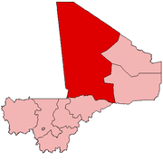
 Garbakoïra Location in Mali | |
| Coordinates: 16.507°N 3.182°W | |
| Country | |
| Region | Tombouctou Region |
| Cercle | Diré Cercle |
| Area | |
| • Total | 198 km2 (76 sq mi) |
| Population (2009 census)[2] | |
| • Total | 4,011 |
| • Density | 20/km2 (52/sq mi) |
| Time zone | UTC+0 (GMT) |
| Climate | BWh |
References
- Schéma Directeur de Lutte Contre l’Ensablement dans le Nord du Mali (6ème et 7ème Régions): Monographie de la Commune de Garbakoira (PDF) (in French), Ministère de l’Environnement et de l’Assainissement, République du Mali, 2004, archived from the original (PDF) on 2011-07-22
- Resultats Provisoires RGPH 2009 (Région de Tombouctou) (PDF) (in French), République de Mali: Institut National de la Statistique, archived from the original (PDF) on 2011-07-22
- The name of the village is written as "Garbey Koyra" on Google maps.
External links
Plan de Sécurite Alimentaire Commune Rurale de Garbakoïra 2006-2010 (PDF) (in French), Commissariat à la Sécurité Alimentaire, République du Mali, USAID-Mali, 2006, archived from the original (PDF) on 2011-07-20, retrieved 2011-02-09.
Capital: Timbuktu | ||
| Diré Cercle |
|  |
| Goundam Cercle |
| |
| Gourma-Rharous Cercle | ||
| Niafunké Cercle | ||
| Timbuktu Cercle |
| |
This article is issued from Wikipedia. The text is licensed under Creative Commons - Attribution - Sharealike. Additional terms may apply for the media files.