Galloping Goose Regional Trail
The Galloping Goose Regional Trail is a 55-kilometre (34 mi) rail trail between Victoria, British Columbia, Canada, and the ghost town of Leechtown, north of Sooke, where it meets the old Sooke Flowline. The trail forms part of the Trans-Canada Trail, and intersects the Lochside Regional Trail. It is maintained by the Capital Regional District (CRD).
| Galloping Goose Regional Trail | |
|---|---|
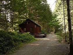 A restored train station on the Galloping Goose Trail near the Sooke Potholes | |
| Length | 55 km (34 mi) |
| Location | British Columbia, Canada |
| Trailheads | Victoria Leechtown |
| Use | Hiking, Running, Cycling, Skateboarding, Horse Riding |
| Hiking details | |
| Trail difficulty | Accessible to Easy |
| Hazards | Road Crossings |
Galloping Goose | |||||||||||||||||||||||||||||||||||||||||||||||||||||||||||||||||||||||||||||||||||||||||||||||||||||||||||||||||||||||||||||||||||||||||||||||||||||||||||||||||||||||||||||||||||||||||||||||||||||||||||||||||||||||||||||||||||||||||||||||||||||||||||||||||||||||||||||||||||||||||||||||||||||
|---|---|---|---|---|---|---|---|---|---|---|---|---|---|---|---|---|---|---|---|---|---|---|---|---|---|---|---|---|---|---|---|---|---|---|---|---|---|---|---|---|---|---|---|---|---|---|---|---|---|---|---|---|---|---|---|---|---|---|---|---|---|---|---|---|---|---|---|---|---|---|---|---|---|---|---|---|---|---|---|---|---|---|---|---|---|---|---|---|---|---|---|---|---|---|---|---|---|---|---|---|---|---|---|---|---|---|---|---|---|---|---|---|---|---|---|---|---|---|---|---|---|---|---|---|---|---|---|---|---|---|---|---|---|---|---|---|---|---|---|---|---|---|---|---|---|---|---|---|---|---|---|---|---|---|---|---|---|---|---|---|---|---|---|---|---|---|---|---|---|---|---|---|---|---|---|---|---|---|---|---|---|---|---|---|---|---|---|---|---|---|---|---|---|---|---|---|---|---|---|---|---|---|---|---|---|---|---|---|---|---|---|---|---|---|---|---|---|---|---|---|---|---|---|---|---|---|---|---|---|---|---|---|---|---|---|---|---|---|---|---|---|---|---|---|---|---|---|---|---|---|---|---|---|---|---|---|---|---|---|---|---|---|---|---|---|---|---|---|---|---|---|---|---|---|---|---|---|---|---|---|---|---|---|---|---|---|---|---|---|---|---|---|---|
| |||||||||||||||||||||||||||||||||||||||||||||||||||||||||||||||||||||||||||||||||||||||||||||||||||||||||||||||||||||||||||||||||||||||||||||||||||||||||||||||||||||||||||||||||||||||||||||||||||||||||||||||||||||||||||||||||||||||||||||||||||||||||||||||||||||||||||||||||||||||||||||||||||||
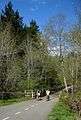
The trail is a popular route both for commuting and recreation, including within urban areas of Victoria (Vic West and Burnside-Gorge). It is frequented by people walking, running, cycling, skateboarding and (in places) riding horses. It connects up with many other trails and parks in the area.
The trail was created in 1987 on the former right-of-way of the Canadian National Railway, and runs through the communities of Sooke, Metchosin, Colwood, Langford, View Royal, Saanich, and Victoria as well as the unincorporated community of East Sooke.
The trail surface is paved between the west terminus (Johnson Street Bridge) to Wale Road in Colwood, approximately 13 km, or one quarter of its total length. It connects to a multi-use path across the bridge and bike lanes along Pandora Avenue.
In 1996 two important connecting links were opened. The rebuilt Selkirk Trestle across the Selkirk Water and the Switch Bridge over the Trans-Canada Highway.
The trail was named after the local gas-powered passenger car (No. 15813) that ran on the line from 1922 to 1931. However, the name is disputed by the Sooke Region Museum and longtime Sooke residents who say that the term Galloping Goose was not used for the old rail line; it was applied by CRD marketing staff to the trail.
Although maps show Leechtown as being the end of the trail, since 2007 this area is restricted as part of the Greater Victoria water supply. In 2010 a warning sign and locked gate greet hikers before the end of the trail. Leechtown is not accessible.
 Saanich Area
- Sooke Area
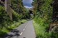
 Switch Bridge area
 Charters Creek Trestle
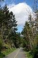 Biking
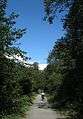
 Cyclist trail
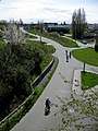 Switch Bridge area
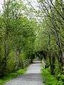 Glen Lake Area
 Millstream Creek Area
References
- "Equipment gas car no. 15813". Canada Science and Technology Museum. Archived from the original on October 17, 2013.
External links
- Capital Regional District's Regional Trails Brochure
- "Galloping Goose Regional Trail". Capital Regional District. Retrieved 2011-03-16.
- Galloping Goose Web-Site
- Explore Vancouver Island
- 55 km Galloping Goose Regional Trail