Gò Vấp District
Gò Vấp is a district of Ho Chi Minh City. Since the 80s, it has undergone significant urbanization. It is larger than most of the other districts.
Gò Vấp District Quận Gò Vấp | |
|---|---|
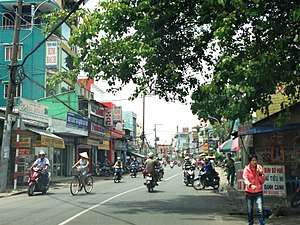
 Gia Dinh park in Go Vap district | |
 Position in HCMC's core | |
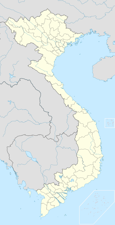 Gò Vấp District Location in Vietnam | |
| Coordinates: 10°50′30″N 106°40′00″E | |
| Country | |
| Centrally governed city | Ho Chi Minh City |
| Seat | 19 Quang Trung |
| Wards | 16 wards |
| Area | |
| • Total | 20 km2 (8 sq mi) |
| Population (2017) | |
| • Total | 663,313 |
| • Density | 33,000/km2 (86,000/sq mi) |
| Demographics | |
| • Main ethnic groups | predominantly Kinh |
| Time zone | UTC+07 (ICT) |
| Website | govap.hochiminhcity.gov.vn |
A high urbanization rate has made Gò Vấp become one of the three districts that has high population growth in the city. Specifically, Gò Vấp had 144,000 people in 1976, and the population increased to 223,000 people in 1995, 231,000 people in 2000, 413,000 people in 2003, and 455,000 people in 2004. From 1980 to 2003, the population of Gò Vấp increased to nearly 3 times its population, and on average, increased 13.66% annually. According to the population census in 2017, the population of Gò Vấp was 663,313 people.[1]
Geography and administration
Gò Vấp is an urban district located in the north and northwest of Hồ Chí Minh City, Vietnam. Gò Vấp borders District 12 in the north and west, Phú Nhuận District in the south, Tân Bình District in the west, and Bình Thạnh District in the east. The total land area is 20 km2 (7.7 sq mi).
In July 1976, two wards (Bình Hòa and Thạnh Mỹ Tây) split from Gò Vấp District to create Bình Thạnh District. Later, the ward of Mỹ Bình joined Củ Chi District, and Nha Binh, Thành Lộc, An Phú Đông and Tân Thới Hiệp joined Hóc Môn District. Gò Vấp District now consists of 16 wards—1, 3, 4, 5, 6, 7, 8, 9, 10, 11, 12, 13, 14, 15, 16 and 17—and is mostly residential.
Historically, Gò Vấp was part of Gia Định Province until 1976, when the province was renamed Hồ Chí Minh City.
Population
According to the population census in 2017 of Ho Chi Minh City's Census Bureau, the district's population was 663,313 people,[1] and the population density was 33,602 people per square kilometer. There are 8 ethnic groups in Gò Vấp, which are the Kinh people (98%), the Hoa people (1.8%), and the other 6 minor ethnic groups (0.2%).
References
- "HCMC's Population and Labor in 2017". HCMC Office of Statistics. Retrieved Apr 16, 2019.
Bến Nghé · Bến Thành · Cầu Kho · Cầu Ông Lãnh · Cô Giang · Đa Kao · Nguyễn Cư Trinh · Nguyễn Thái Bình · Phạm Ngũ Lão · Tân Định | 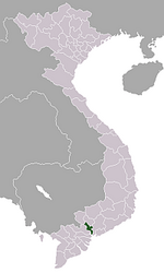 | |
An Khánh · An Lợi Đông · An Phú · Bình An · Bình Khánh · Bình Trưng Đông · Bình Trưng Tây · Cát Lái · Thảo Điền · Thủ Thiêm · Thạnh Mỹ Lợi | ||
Ward 1 · Ward 2 · Ward 3 · Ward 4 · Ward 5 · Ward 6 · Ward 7 · Ward 8 · Ward 9 · Ward 10 · Ward 11 · Ward 12 · Ward 13 · Ward 14 | ||
Ward 1 · Ward 2 · Ward 3 · Ward 4 · Ward 5 · Ward 6 · Ward 8 · Ward 9 · Ward 10 · Ward 12 · Ward 13 · Ward 14 · Ward 15 · Ward 16 · Ward 18 | ||
Ward 1 · Ward 2 · Ward 3 · Ward 4 · Ward 5 · Ward 6 · Ward 7 · Ward 8 · Ward 9 · Ward 10 · Ward 11 · Ward 12 · Ward 13 · Ward 14 · Ward 15 | ||
Ward 1 · Ward 2 · Ward 3 · Ward 4 · Ward 5 · Ward 6 · Ward 7 · Ward 8 · Ward 9 · Ward 10 · Ward 11 · Ward 12 · Ward 13 · Ward 14 | ||
Bình Thuận · Phú Mỹ · Phú Thuận · Tân Hưng · Tân Kiểng · Tân Phong · Tân Phú · Tân Quy · Tân Thuận Tây · Tân Thuận Đông | ||
Ward 1 · Ward 2 · Ward 3 · Ward 4 · Ward 5 · Ward 6 · Ward 7 · Ward 8 · Ward 9 · Ward 10 · Ward 11 · Ward 12 · Ward 13 · Ward 14 · Ward 15 · Ward 16 | ||
Hiệp Phú · Long Bình · Long Phước · Long Trường · Long Thạnh Mỹ · Phú Hữu · Phước Bình · Phước Long A · Phước Long B · Tăng Nhơn Phú A · Tăng Nhơn Phú B · Tân Phú · Trường Thạnh | ||
Ward 1 · Ward 2 · Ward 3 · Ward 4 · Ward 5 · Ward 6 · Ward 7 · Ward 8 · Ward 9 · Ward 10 · Ward 11 · Ward 12 · Ward 13 · Ward 14 · Ward 15 | ||
Ward 1 · Ward 2 · Ward 3 · Ward 4 · Ward 5 · Ward 6 · Ward 7 · Ward 8 · Ward 9 · Ward 10 · Ward 11 · Ward 12 · Ward 13 · Ward 14 · Ward 15 · Ward 16 | ||
An Phú Đông · Đông Hưng Thuận · Hiệp Thành · Tân Chánh Hiệp · Tân Hưng Thuận · Tân Thới Hiệp · Tân Thới Nhất · Thạnh Lộc · Thạnh Xuân · Thới An · Trung Mỹ Tây | ||
An Lạc · An Lạc A · Bình Hưng Hòa · Bình Hưng Hòa A · Bình Hưng Hòa B · Bình Trị Đông · Bình Trị Đông A · Bình Trị Đông B · Tân Tạo · Tân Tạo A | ||
Ward 1 · Ward 2 · Ward 3 · Ward 5 · Ward 6 · Ward 7 · Ward 11 · Ward 12 · Ward 13 · Ward 14 · Ward 15 · Ward 17 · Ward 19 · Ward 21 · Ward 22 · Ward 24 · Ward 25 · Ward 26 · Ward 27 · Ward 28 | ||
Ward 1 · Ward 3 · Ward 4 · Ward 5 · Ward 6 · Ward 7 · Ward 8 · Ward 9 · Ward 10 · Ward 11 · Ward 12 · Ward 13 · Ward 14 · Ward 15 · Ward 16 · Ward 17 | ||
Ward 1 · Ward 2 · Ward 3 · Ward 4 · Ward 5 · Ward 7 · Ward 8 · Ward 9 · Ward 10 · Ward 11 · Ward 12 · Ward 13 · Ward 14 · Ward 15 · Ward 17 | ||
Ward 1 · Ward 2 · Ward 3 · Ward 4 · Ward 5 · Ward 6 · Ward 7 · Ward 8 · Ward 9 · Ward 10 · Ward 11 · Ward 12 · Ward 13 · Ward 14 · Ward 15 | ||
Hiệp Tân · Hoà Thạnh · Phú Thạnh · Phú Thọ Hòa · Phú Trung · Sơn Kỳ · Tân Quý · Tân Sơn Nhì · Tân Thành · Tân Thới Hòa · Tây Thạnh | ||
Bình Chiểu · Bình Thọ · Hiệp Bình Chánh · Hiệp Bình Phước · Linh Chiểu · Linh Đông · Linh Tây · Linh Trung · Linh Xuân · Tam Bình · Tam Phú · Trường Thọ | ||
Tân Túc · An Phú Tây · Bình Chánh · Bình Hưng · Bình Lợi · Đa Phước · Hưng Long · Lê Minh Xuân · Phạm Văn Hai · Phong Phú · Quy Đức · Tân Kiên · Tân Nhựt · Tân Quý Tây · Vĩnh Lộc A · Vĩnh Lộc B | ||
Cần Thạnh · An Thới Đông · Bình Khánh · Long Hòa · Lý Nhơn · Tam Thôn Hiệp · Thạnh An | ||
Củ Chi · An Nhơn Tây · An Phú · Bình Mỹ · Hòa Phú · Nhuận Đức · Phú Mỹ Hưng · Phạm Văn Cội · Phú Hòa Đông · Phước Hiệp · Phước Thạnh · Phước Vĩnh An · Tân An Hội · Tân Phú Trung · Tân Thạnh Đông · Tân Thạnh Tây · Tân Thông Hội · Thái Mỹ · Trung An · Trung Lập Hạ · Trung Lập Thượng | ||
Hóc Môn · Bà Điểm · Đông Thạnh · Nhị Bình · Tân Hiệp · Tân Thới Nhì · Tân Xuân · Thới Tam Thôn · Trung Chánh · Xuân Thới Đông · Xuân Thới Sơn · Xuân Thới Thượng | ||
Nhà Bè · Phú Xuân · Hiệp Phước · Long Thới · Nhơn Đức · Phước Kiển · Phước Lộc | ||
| Ho Chi Minh City |  | |
|---|---|---|
| Bà Rịa-Vũng Tàu Province | ||
| Bình Dương Province |
| |
| Bình Phước Province |
| |
| Đồng Nai Province | ||
| Tây Ninh Province |
| |
※ denotes provincial seat | ||