Bình Tân District, Ho Chi Minh City
Bình Tân is an urban district of Ho Chi Minh City, Vietnam, and is known as a large inner city of migrant workers. In 2010 the district had a population of 611,170, in an area of 52 km².[1] The name is a combination of Bình Hưng Hoà, Bình Trị Đông and Tân Tạo.
Binh Tan District Quận Bình Tân | |
|---|---|
 Position in HCMC's core | |
 Binh Tan District Location in Vietnam | |
| Coordinates: 10°51′28″N 106°44′28″E | |
| Country | |
| Centrally governed city | Ho Chi Minh City |
| Wards | 10 phường |
| Government | |
| • People's Committee | Huỳnh Văn Chính |
| Area | |
| • Total | 52 km2 (20 sq mi) |
| Population (2011) | |
| • Total | 702,650 |
| • Density | 14,000/km2 (35,000/sq mi) |
| Demographics | |
| Time zone | UTC+07 (ICT) |
| Website | binhtan.hochiminhcity.gov.vn |
Geographical location

Bình Tân district borders District 12 and Hóc Môn District to the north, District 8 and Bình Chánh District to the south, District 6, District 8 and Tân Bình District to the east, and Bình Chánh District to the west.
Administration
Bình Tân district consists of ten wards:
|
|
Healthcare
Located in Binh Tan district, Hoa Lam-Shangri-La Healthcare Techpark is the first healthcare park in Ho Chi Minh City and Vietnam with 1,700 bed capacity. There are two commissioned hospitals, including City International Hospital and Gia An 115 Hospital serving a population of 700 thousands in the region, from primary care to tertiary care.
References
- "HCMC's Population and population density in 2010 by district". HCMC Office of Statistics. Retrieved Feb 4, 2014.
Bến Nghé · Bến Thành · Cầu Kho · Cầu Ông Lãnh · Cô Giang · Đa Kao · Nguyễn Cư Trinh · Nguyễn Thái Bình · Phạm Ngũ Lão · Tân Định | 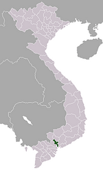 | |
An Khánh · An Lợi Đông · An Phú · Bình An · Bình Khánh · Bình Trưng Đông · Bình Trưng Tây · Cát Lái · Thảo Điền · Thủ Thiêm · Thạnh Mỹ Lợi | ||
Ward 1 · Ward 2 · Ward 3 · Ward 4 · Ward 5 · Ward 6 · Ward 7 · Ward 8 · Ward 9 · Ward 10 · Ward 11 · Ward 12 · Ward 13 · Ward 14 | ||
Ward 1 · Ward 2 · Ward 3 · Ward 4 · Ward 5 · Ward 6 · Ward 8 · Ward 9 · Ward 10 · Ward 12 · Ward 13 · Ward 14 · Ward 15 · Ward 16 · Ward 18 | ||
Ward 1 · Ward 2 · Ward 3 · Ward 4 · Ward 5 · Ward 6 · Ward 7 · Ward 8 · Ward 9 · Ward 10 · Ward 11 · Ward 12 · Ward 13 · Ward 14 · Ward 15 | ||
Ward 1 · Ward 2 · Ward 3 · Ward 4 · Ward 5 · Ward 6 · Ward 7 · Ward 8 · Ward 9 · Ward 10 · Ward 11 · Ward 12 · Ward 13 · Ward 14 | ||
Bình Thuận · Phú Mỹ · Phú Thuận · Tân Hưng · Tân Kiểng · Tân Phong · Tân Phú · Tân Quy · Tân Thuận Tây · Tân Thuận Đông | ||
Ward 1 · Ward 2 · Ward 3 · Ward 4 · Ward 5 · Ward 6 · Ward 7 · Ward 8 · Ward 9 · Ward 10 · Ward 11 · Ward 12 · Ward 13 · Ward 14 · Ward 15 · Ward 16 | ||
Hiệp Phú · Long Bình · Long Phước · Long Trường · Long Thạnh Mỹ · Phú Hữu · Phước Bình · Phước Long A · Phước Long B · Tăng Nhơn Phú A · Tăng Nhơn Phú B · Tân Phú · Trường Thạnh | ||
Ward 1 · Ward 2 · Ward 3 · Ward 4 · Ward 5 · Ward 6 · Ward 7 · Ward 8 · Ward 9 · Ward 10 · Ward 11 · Ward 12 · Ward 13 · Ward 14 · Ward 15 | ||
Ward 1 · Ward 2 · Ward 3 · Ward 4 · Ward 5 · Ward 6 · Ward 7 · Ward 8 · Ward 9 · Ward 10 · Ward 11 · Ward 12 · Ward 13 · Ward 14 · Ward 15 · Ward 16 | ||
An Phú Đông · Đông Hưng Thuận · Hiệp Thành · Tân Chánh Hiệp · Tân Hưng Thuận · Tân Thới Hiệp · Tân Thới Nhất · Thạnh Lộc · Thạnh Xuân · Thới An · Trung Mỹ Tây | ||
An Lạc · An Lạc A · Bình Hưng Hòa · Bình Hưng Hòa A · Bình Hưng Hòa B · Bình Trị Đông · Bình Trị Đông A · Bình Trị Đông B · Tân Tạo · Tân Tạo A | ||
Ward 1 · Ward 2 · Ward 3 · Ward 5 · Ward 6 · Ward 7 · Ward 11 · Ward 12 · Ward 13 · Ward 14 · Ward 15 · Ward 17 · Ward 19 · Ward 21 · Ward 22 · Ward 24 · Ward 25 · Ward 26 · Ward 27 · Ward 28 | ||
Ward 1 · Ward 3 · Ward 4 · Ward 5 · Ward 6 · Ward 7 · Ward 8 · Ward 9 · Ward 10 · Ward 11 · Ward 12 · Ward 13 · Ward 14 · Ward 15 · Ward 16 · Ward 17 | ||
Ward 1 · Ward 2 · Ward 3 · Ward 4 · Ward 5 · Ward 7 · Ward 8 · Ward 9 · Ward 10 · Ward 11 · Ward 12 · Ward 13 · Ward 14 · Ward 15 · Ward 17 | ||
Ward 1 · Ward 2 · Ward 3 · Ward 4 · Ward 5 · Ward 6 · Ward 7 · Ward 8 · Ward 9 · Ward 10 · Ward 11 · Ward 12 · Ward 13 · Ward 14 · Ward 15 | ||
Hiệp Tân · Hoà Thạnh · Phú Thạnh · Phú Thọ Hòa · Phú Trung · Sơn Kỳ · Tân Quý · Tân Sơn Nhì · Tân Thành · Tân Thới Hòa · Tây Thạnh | ||
Bình Chiểu · Bình Thọ · Hiệp Bình Chánh · Hiệp Bình Phước · Linh Chiểu · Linh Đông · Linh Tây · Linh Trung · Linh Xuân · Tam Bình · Tam Phú · Trường Thọ | ||
Tân Túc · An Phú Tây · Bình Chánh · Bình Hưng · Bình Lợi · Đa Phước · Hưng Long · Lê Minh Xuân · Phạm Văn Hai · Phong Phú · Quy Đức · Tân Kiên · Tân Nhựt · Tân Quý Tây · Vĩnh Lộc A · Vĩnh Lộc B | ||
Cần Thạnh · An Thới Đông · Bình Khánh · Long Hòa · Lý Nhơn · Tam Thôn Hiệp · Thạnh An | ||
Củ Chi · An Nhơn Tây · An Phú · Bình Mỹ · Hòa Phú · Nhuận Đức · Phú Mỹ Hưng · Phạm Văn Cội · Phú Hòa Đông · Phước Hiệp · Phước Thạnh · Phước Vĩnh An · Tân An Hội · Tân Phú Trung · Tân Thạnh Đông · Tân Thạnh Tây · Tân Thông Hội · Thái Mỹ · Trung An · Trung Lập Hạ · Trung Lập Thượng | ||
Hóc Môn · Bà Điểm · Đông Thạnh · Nhị Bình · Tân Hiệp · Tân Thới Nhì · Tân Xuân · Thới Tam Thôn · Trung Chánh · Xuân Thới Đông · Xuân Thới Sơn · Xuân Thới Thượng | ||
Nhà Bè · Phú Xuân · Hiệp Phước · Long Thới · Nhơn Đức · Phước Kiển · Phước Lộc | ||
| Ho Chi Minh City | 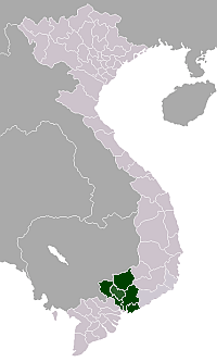 | |
|---|---|---|
| Bà Rịa-Vũng Tàu Province | ||
| Bình Dương Province |
| |
| Bình Phước Province |
| |
| Đồng Nai Province | ||
| Tây Ninh Province |
| |
※ denotes provincial seat | ||