Friendship, Tennessee
Friendship is a city in Crockett County, Tennessee. The population was 668 at the 2010 census.
Friendship, Tennessee | |
|---|---|
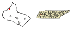 Location of Friendship in Crockett County, Tennessee. | |
| Coordinates: 35°54′37″N 89°14′31″W | |
| Country | United States |
| State | Tennessee |
| County | Crockett |
| Area | |
| • Total | 1.32 sq mi (3.42 km2) |
| • Land | 1.32 sq mi (3.42 km2) |
| • Water | 0.00 sq mi (0.00 km2) |
| Elevation | 400 ft (122 m) |
| Population (2010) | |
| • Total | 668 |
| • Estimate (2018)[2] | 672 |
| • Density | 509.48/sq mi (196.76/km2) |
| Time zone | UTC-6 (Central (CST)) |
| • Summer (DST) | UTC-5 (CDT) |
| ZIP code | 38034 |
| Area code(s) | 731 |
| FIPS code | 47-27960[3] |
| GNIS feature ID | 1284921[4] |
Geography
Friendship is located at 35°54′37″N 89°14′31″W (35.910370, -89.241827).[5]
According to the United States Census Bureau, the city has a total area of 1.3 square miles (3.4 km2), all land.
Demographics
| Historical population | |||
|---|---|---|---|
| Census | Pop. | %± | |
| 1880 | 243 | — | |
| 1890 | 255 | 4.9% | |
| 1920 | 487 | — | |
| 1930 | 487 | 0.0% | |
| 1940 | 451 | −7.4% | |
| 1950 | 452 | 0.2% | |
| 1960 | 399 | −11.7% | |
| 1970 | 441 | 10.5% | |
| 1980 | 763 | 73.0% | |
| 1990 | 467 | −38.8% | |
| 2000 | 608 | 30.2% | |
| 2010 | 668 | 9.9% | |
| Est. 2018 | 672 | [2] | 0.6% |
| Sources:[6][7] | |||
As of the census[3] of 2000, there were 608 people, 246 households, and 171 families residing in the city. The population density was 466.4 people per square mile (180.6/km²). There were 264 housing units at an average density of 202.5 per square mile (78.4/km²). The racial makeup of the city was 85.36% White, 11.68% African American, 0.33% Native American, 2.14% from other races, and 0.49% from two or more races. Hispanic or Latino of any race were 3.45% of the population.
There were 246 households out of which 32.5% had children under the age of 18 living with them, 49.6% were married couples living together, 15.9% had a female householder with no husband present, and 30.1% were non-families. 28.0% of all households were made up of individuals and 10.2% had someone living alone who was 65 years of age or older. The average household size was 2.47 and the average family size was 2.97.
In the city, the population was spread out with 26.5% under the age of 18, 9.7% from 18 to 24, 27.0% from 25 to 44, 20.7% from 45 to 64, and 16.1% who were 65 years of age or older. The median age was 38 years. For every 100 females, there were 91.8 males. For every 100 females age 18 and over, there were 93.5 males.
The median income for a household in the city was $24,583, and the median income for a family was $35,909. Males had a median income of $29,375 versus $19,792 for females. The per capita income for the city was $14,641. About 16.1% of families and 23.0% of the population were below the poverty line, including 26.2% of those under age 18 and 27.5% of those age 65 or over.
Notable people
- William Fones, jurist who served on the Tennessee Supreme Court, was born in Friendship
References
- "2018 U.S. Gazetteer Files". United States Census Bureau. Retrieved February 23, 2020.
- "Population and Housing Unit Estimates". United States Census Bureau. June 27, 2019. Retrieved June 4, 2019.
- "U.S. Census website". United States Census Bureau. Retrieved 2008-01-31.
- "US Board on Geographic Names". United States Geological Survey. 2007-10-25. Retrieved 2008-01-31.
- "US Gazetteer files: 2010, 2000, and 1990". United States Census Bureau. 2011-02-12. Retrieved 2011-04-23.
- "Census of Population and Housing: Decennial Censuses". United States Census Bureau. Retrieved 2012-03-04.
- "Incorporated Places and Minor Civil Divisions Datasets: Subcounty Resident Population Estimates: April 1, 2010 to July 1, 2012". Population Estimates. U.S. Census Bureau. Archived from the original on 17 June 2013. Retrieved 11 December 2013.
External links
Municipalities and communities of Crockett County, Tennessee, United States | ||
|---|---|---|
| Cities | ||
| Towns | ||
| Unincorporated communities | ||
| Authority control |
|
|---|