Bells, Tennessee
Bells is a city in Crockett County, Tennessee. The population was 2,437 at the 2010 census.[5]
Bells, Tennessee | |
|---|---|
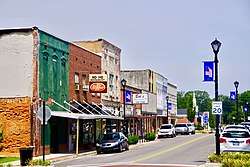 Main Street in Bells | |
 Location of Bells in Crockett County, Tennessee. | |
| Coordinates: 35°43′6″N 89°5′7″W | |
| Country | United States |
| State | Tennessee |
| County | Crockett |
| Area | |
| • Total | 2.38 sq mi (6.16 km2) |
| • Land | 2.37 sq mi (6.14 km2) |
| • Water | 0.01 sq mi (0.02 km2) |
| Elevation | 325 ft (99 m) |
| Population (2010) | |
| • Total | 2,437 |
| • Estimate (2018)[2] | 2,458 |
| • Density | 1,036.69/sq mi (400.28/km2) |
| Time zone | UTC-6 (Central (CST)) |
| • Summer (DST) | UTC-5 (CDT) |
| ZIP code | 38006 |
| Area code(s) | 731 |
| FIPS code | 47-04720[3] |
| GNIS feature ID | 1305093[4] |
| Website | cityofbellstn |
History
Bells was established in the late 1820s on land acquired by brothers John and William Bell. When a city was founded on this land in 1855, it was given the name "Bells Depot." The city was incorporated in 1868, and the "Depot" was dropped from the name in 1880.[6]
Bells was the home of the now-defunct West Tennessee Okra Festival. The festival included a horse show, beauty pageant, street carnival and other activities and shows. The Festival was always held during August, the peak of the okra season.
Geography
Bells is located at 35°43′6″N 89°5′7″W (35.718423, -89.085385).[7] The city is concentrated around the intersection of a congruent stretch of U.S. Route 70A and U.S. Route 79, which approaches from Brownsville to the southwest and continues northeastwardly to Humboldt, and State Route 88, which connects the city to Alamo to the northwest and Jackson to the southeast. The South Fork of the Forked Deer River passes just south of Bells.
According to the United States Census Bureau, the city has a total area of 2.3 square miles (6.0 km2), of which 2.3 square miles (6.0 km2) is land and 0.44% is water.
Demographics
| Historical population | |||
|---|---|---|---|
| Census | Pop. | %± | |
| 1880 | 540 | — | |
| 1890 | 690 | 27.8% | |
| 1900 | 758 | 9.9% | |
| 1910 | 753 | −0.7% | |
| 1920 | 920 | 22.2% | |
| 1930 | 919 | −0.1% | |
| 1940 | 1,054 | 14.7% | |
| 1950 | 1,225 | 16.2% | |
| 1960 | 1,232 | 0.6% | |
| 1970 | 1,474 | 19.6% | |
| 1980 | 1,571 | 6.6% | |
| 1990 | 1,643 | 4.6% | |
| 2000 | 2,171 | 32.1% | |
| 2010 | 2,437 | 12.3% | |
| Est. 2018 | 2,458 | [2] | 0.9% |
| Sources:[8][9] | |||
As of the census[3] of 2000, there were 2,171 people, 806 households, and 559 families residing in the city. The population density was 955.6 people per square mile (369.3/km2). There were 878 housing units at an average density of 386.5 per square mile (149.3/km2). The racial makeup of the city was 67.11% White, 21.19% African American, 0.46% Native American, 10.78% from other races, and 0.46% from two or more races. Hispanic or Latino of any race were 22.80% of the population.
There were 806 households, out of which 36.5% had children under the age of 18 living with them, 49.5% were married couples living together, 14.3% had a female householder with no husband present, and 30.6% were non-families. 27.9% of all households were made up of individuals, and 11.8% had someone living alone who was 65 years of age or older. The average household size was 2.69 and the average family size was 3.28.
In the city, the population was spread out, with 29.6% under the age of 18, 10.9% from 18 to 24, 29.4% from 25 to 44, 18.1% from 45 to 64, and 12.0% who were 65 years of age or older. The median age was 30 years. For every 100 females, there were 98.1 males. For every 100 females age 18 and over, there were 90.8 males.
The median income for a household in the city was $29,238, and the median income for a family was $31,827. Males had a median income of $26,184 versus $19,602 for females. The per capita income for the city was $12,455. About 14.9% of families and 22.9% of the population were below the poverty line, including 28.6% of those under age 18 and 15.3% of those age 65 or over.
References
- "2018 U.S. Gazetteer Files". United States Census Bureau. Retrieved February 23, 2020.
- "Population and Housing Unit Estimates". United States Census Bureau. June 27, 2019. Retrieved June 4, 2019.
- "U.S. Census website". United States Census Bureau. Retrieved 2008-01-31.
- "US Board on Geographic Names". United States Geological Survey. 2007-10-25. Retrieved 2008-01-31.
- Tennessee Department of Economic and Community Development, Certified Population of Tennessee Incorporated Municipalities and Counties Archived 2014-06-30 at the Wayback Machine, State of Tennessee official website, 14 July 2011. Retrieved: 6 December 2013.
- City of Bells History, official site. Accessed 10 August 2018.
- "US Gazetteer files: 2010, 2000, and 1990". United States Census Bureau. 2011-02-12. Retrieved 2011-04-23.
- "Census of Population and Housing: Decennial Censuses". United States Census Bureau. Retrieved 2012-03-04.
- "Incorporated Places and Minor Civil Divisions Datasets: Subcounty Resident Population Estimates: April 1, 2010 to July 1, 2012". Population Estimates. U.S. Census Bureau. Archived from the original on 11 June 2013. Retrieved 11 December 2013.
External links

Municipalities and communities of Crockett County, Tennessee, United States | ||
|---|---|---|
| Cities | ||
| Towns | ||
| Unincorporated communities | ||