Frederick E. Hyde Fjord
Frederick E. Hyde Fjord is a fjord in Peary Land, far northern Greenland.
| Frederick E. Hyde Fjord | |
|---|---|
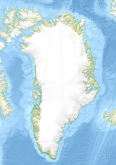 Frederick E. Hyde Fjord Location in Greenland | |
| Location | Arctic |
| Coordinates | 83°04′N 31°15′W |
| Ocean/sea sources | Wandel Sea, Arctic Ocean |
| Basin countries | Greenland |
| Max. length | 140 km (87 mi) |
| Max. width | 7 km (4.3 mi) |
| Frozen | All year |
| Settlements | None |
History
The fjord was named after Frederick Erastus Hyde by Robert Peary, one of the founding members and first vice-president of the Peary Arctic Club in New York.[1]
The landscape of this desolate fjord caused an impression on Danish Arctic explorer Eigil Knuth:
The journey through Frederick E. Hyde Fjord was not only my greatest experience in Peary Land, but revealed the most beautiful scenery I have ever seen in Greenland.[2]
Geography
To the east Frederick E. Hyde Fjord opens into the Arctic Ocean with its mouth just to the north of Cape John Flagler and south of Cape Bridgman.[3]
Freja Fjord, Thor Fjord and Odin Fjord are branches on the southern shore of the fjord, about 65 km (40 mi), 95 km (59 mi) and 120 km (75 mi) from the mouth respectively; smaller Citronen Fjord lies about 45 km (28 mi) from the mouth.[4] Frigg Fjord is an offshoot on the northern shore located 95 km (59 mi) from the mouth.[5]
The Roosevelt Range, the northernmost mountain range on earth, extends from west to east on the northern side of the fjord along with its subranges. The 1,280 m (4,200 ft) high Nordkrone plateau is located on the southern side of Frederick E. Hyde Fjord. Nordkrone has many glaciers and is intersected by deep ravines with steep sides. 1,737 m (5,699 ft) high Wistar Bjerg, one of the highest points in Peary Land, rises above the fjord between the Freya and Thor fjords at the edge of the plateau. [6]
 Map of Far Northeastern Greenland
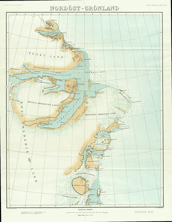 1911 map of NE Greenland showing only a short stretch of the Frederick E. Hyde Fjord
See also
References
- How Did Frederick E. Hyde Fjord Get Its Name?
- Knuth, Eigil, The Danish expedition to Peary Land. Geographical Journal. 118. p. 8
- "Frederick E. Hyde Fjord". Mapcarta. Retrieved 5 May 2016.
- Greenland Geology Map
- Prostar Sailing Directions 2005 Greenland and Iceland Enroute, p. 130
- Den grønlandske Lods - Geodatastyrelsen