Cape Bridgman
Cape Bridgman (Danish: Kap Bridgman) is a headland in the Wandel Sea, Arctic Ocean, northeast Greenland.
| Cape Bridgman | |
|---|---|
| Kap Bridgman | |
 | |
| Location | Northeast Greenland National Park, Greenland |
| Coordinates | 83°25′N 26°42′W |
| Offshore water bodies | Wandel Sea, Arctic Ocean |
| Area | Arctic |
The cape was named by Robert Peary after Herbert L. Bridgman, one of the members of the Peary Arctic Club in New York.[1]
Geography
Cape Bridgman is located on the northern side of the mouth of Frederick E. Hyde Fjord , Peary Land.[2][3] Administratively it is part of the Northeast Greenland National Park.
In 1900 this headland was Robert Peary's easternmost accurate geographic exploration in the north of Greenland, for further south he encountered fog. In 1907 it became an important landmark for the Denmark expedition which mapped for the first time the unknown area to the south and southeast of the cape, as well as part of the Daly Range, rising to the west above the plain.[4]
 Map of Greenland section. |
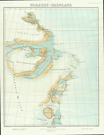 1911 map of NE Greenland by J. P. Koch showing at the top his northernmost explorations. |
References
- How Did Frederick E. Hyde Fjord Get Its Name?
- Prostar Sailing Directions 2005 Greenland and Iceland Enroute, p. 125
- "Kap Bridgman". Mapcarta. Retrieved 11 February 2019.
- Spencer Apollonio, Lands That Hold One Spellbound: A Story of East Greenland, 2008 p. 101