Forster, New South Wales
Forster is a coastal town in the Mid North Coast region of New South Wales, Australia, in the Mid-Coast Council LGA, about 308 km north-north-east of Sydney.[2] It is immediately adjacent to its twin, Tuncurry, which is the smaller of the two towns. Forster is known for its stunning waters & Manning Valley beauty.
| Forster New South Wales | |||||||||||||||
|---|---|---|---|---|---|---|---|---|---|---|---|---|---|---|---|
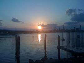 View of Tuncurry from Forster side | |||||||||||||||
Forster | |||||||||||||||
| Coordinates | 32°10′50″S 152°30′42″E | ||||||||||||||
| Population | 13,740 (2016 census)[1] | ||||||||||||||
| Postcode(s) | 2428 | ||||||||||||||
| Elevation | 6 m (20 ft) | ||||||||||||||
| Time zone | AEST (UTC+10) | ||||||||||||||
| • Summer (DST) | AEDT (UTC+11) | ||||||||||||||
| Location | |||||||||||||||
| LGA(s) | Mid-Coast Council | ||||||||||||||
| Region | Mid North Coast | ||||||||||||||
| County | Gloucester | ||||||||||||||
| State electorate(s) | Myall Lakes | ||||||||||||||
| Federal Division(s) | Lyne | ||||||||||||||
| |||||||||||||||
At the 2016 census, the Forster-Tuncurry area had a population of 19,918 people,[3] while the permanent population of Forster alone was 13,740.[1]
History
Forster is named after William Forster, who also was the 2nd Premier of New South Wales and who later served as Agent-General in London.[4] The first post office in Forster opened on 1 October 1872, with John Wyllie Breckenridge as postmaster at a salary of £10 a year.[5]
Population
According to the 2016 census of Population, there were 13,740 people in Forster.
- Aboriginal and Torres Strait Islander people made up 5.8% of the population.
- 82.0% of people were born in Australia. The next most common countries of birth were England 3.4% and New Zealand 1.1%.
- 89.8% of people spoke only English at home.
- The most common responses for religion were Anglican 28.4%, No Religion 23.4% and Catholic 22.3%.[1]
Tourism
Because of its close proximity to Sydney, just under 4 hours drive, Forster-Tuncurry has established itself as a popular summer holiday destination; in the hotter months the population increases considerably. Due to this most of its shops and restaurants work on seasonal income, with some opening in the Summer months exclusively.
The school holidays in the colder months also bring a considerable number of holidaymakers. Forster-Tuncurry is predominantly a family holiday location with large lakes and white sandy beaches. Notable nearby attractions the Bicentennial Trail, Cape Hawke, and Booti Booti National Park.[6]
The most popular beaches are Forster Main Beach and One Mile Beach, serviced by Forster and Cape Hawke Surf Lifesaving Clubs respectively. Pebbly Beach is popular with local surfers.
The relatively small Forster SLSC achieved national recognition in 1996 when their under-18 beach sprint relay team won gold at the Australian Championships.
Climate
| Climate data for Forster (Forster-Tuncurry Marine Rescue, 1896–2013) | |||||||||||||
|---|---|---|---|---|---|---|---|---|---|---|---|---|---|
| Month | Jan | Feb | Mar | Apr | May | Jun | Jul | Aug | Sep | Oct | Nov | Dec | Year |
| Record high °C (°F) | 37.5 (99.5) |
38.0 (100.4) |
33.5 (92.3) |
30.0 (86.0) |
28.2 (82.8) |
26.4 (79.5) |
25.0 (77.0) |
30.0 (86.0) |
39.1 (102.4) |
37.0 (98.6) |
36.0 (96.8) |
43.0 (109.4) |
43.0 (109.4) |
| Average high °C (°F) | 26.4 (79.5) |
26.3 (79.3) |
25.5 (77.9) |
23.6 (74.5) |
21.0 (69.8) |
18.8 (65.8) |
18.0 (64.4) |
19.3 (66.7) |
21.6 (70.9) |
22.7 (72.9) |
23.6 (74.5) |
25.5 (77.9) |
22.7 (72.9) |
| Average low °C (°F) | 19.6 (67.3) |
19.5 (67.1) |
17.6 (63.7) |
15.1 (59.2) |
11.8 (53.2) |
9.8 (49.6) |
8.7 (47.7) |
9.2 (48.6) |
11.7 (53.1) |
13.8 (56.8) |
16.3 (61.3) |
18.0 (64.4) |
14.3 (57.7) |
| Record low °C (°F) | 12.0 (53.6) |
14.0 (57.2) |
11.5 (52.7) |
6.6 (43.9) |
4.5 (40.1) |
3.9 (39.0) |
2.5 (36.5) |
2.0 (35.6) |
4.7 (40.5) |
5.6 (42.1) |
9.0 (48.2) |
10.0 (50.0) |
2.0 (35.6) |
| Average rainfall mm (inches) | 107.4 (4.23) |
121.1 (4.77) |
148.8 (5.86) |
128.7 (5.07) |
117.9 (4.64) |
118.9 (4.68) |
87.3 (3.44) |
71.5 (2.81) |
66.5 (2.62) |
78.7 (3.10) |
82.0 (3.23) |
92.4 (3.64) |
1,221.6 (48.09) |
| Average precipitation days | 8.3 | 8.7 | 9.9 | 9.0 | 9.1 | 8.7 | 7.9 | 7.2 | 6.9 | 8.1 | 8.5 | 7.9 | 100.2 |
| Average relative humidity (%) | 73 | 74 | 70 | 69 | 64 | 68 | 63 | 59 | 64 | 68 | 72 | 72 | 68 |
| Source: Bureau of Meteorology[7] | |||||||||||||
Clubs
Forster has a range of sporting clubs in the area.
- Forster Bodyboarding Club – "Forster Bodyboarding Club".
- Cape Hawke Surf Club – "Cape Hawke Surf Club".
- Pacific Palms Surf Life Saving Club – "Pacific Palms Surf Life Saving Club".
- Black Head Surf Life Saving Club – "Black Head Surf Life Saving Club".
- Great Lakes United Football Club – "Great Lakes United Football Club".
References
- Australian Bureau of Statistics (27 June 2017). "Forster (NSW) (State Suburb)". 2016 Census QuickStats. Retrieved 6 July 2017.

- "Forster". Geographical Names Register (GNR) of NSW. Geographical Names Board of New South Wales. Retrieved 29 March 2019.
- Australian Bureau of Statistics (27 June 2017). "Forster – Tuncurry (Urban Centre/Locality)". 2016 Census QuickStats. Retrieved 21 March 2013.
- Reed, A.W. (1969) Place-Names of New South Wales: Their Origins and Meanings, Sydney: A.H & A.W. Reed
- "Images". NSW State Records. Archived from the original on 21 May 2013. Retrieved 16 May 2013.
- "Forster". Destination NSW. Retrieved 16 May 2013.
- "Forster Tuncurry Marine Rescue". Climate statistics for Australian locations. Bureau of Meteorology. Retrieved 4 August 2013.
External links
| Wikimedia Commons has media related to Forster, New South Wales. |
| Authority control |
|
|---|