Faitroun
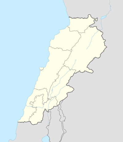
Faitroun (Arabic: فيطرون; also spelled Faytroun) is a town in the Keserwan District of Mount Lebanon. Located 33 kilometers north of Beirut and at an average altitude of 1,200 meters above sea level and its total land area of 743 hectares.[1] Its inhabitants are predominantly Maronite Christians.[2] Faitroun has a public school, which had 229 students as of 2008.[1] The town is home to a number of hotels and restaurants.
Faitroun فيطرون | |
|---|---|
Municipality | |
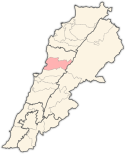
 Faitroun Location within Lebanon | |
| Coordinates: 33°59′31″N 35°44′15″E | |
| Country | Lebanon |
| Governorate | Mount Lebanon |
| District | Keserwan |
| Area | |
| • Total | 7.43 km2 (2.87 sq mi) |
| Elevation | 1,200 m (3,900 ft) |
| Highest elevation | 1,350 m (4,430 ft) |
| Time zone | UTC+2 (EET) |
| • Summer (DST) | UTC+3 (EEST) |
| Dialing code | +961 |
The name of the town is a derivative of the Aramaic words meaning "throne of the lord".[3] Some of the main attractions in the town are the Church of Saint George, which was built in the 18th century and the ancient citadel with wells.[3]
References
- "Faytroun". Localiban. Localiban. 2008-01-19. Retrieved 2016-02-12.
- "Elections municipales et ikhtiariah au Mont-Liban" (PDF). Localiban. Localiban. 2010. p. 19. Archived from the original (pdf) on 2015-07-24. Retrieved 2016-02-12.
- "layout_CAZA KESEROUAN" (PDF). Archived from the original (PDF) on 2005-11-02. Retrieved 2007-04-04.
Capital: Jounieh | ||
| Towns and villages |
|  |
| Notable landmarks | ||
This article is issued from Wikipedia. The text is licensed under Creative Commons - Attribution - Sharealike. Additional terms may apply for the media files.