Faraya
Faraya (Arabic: فاريا) is a village and municipality in the Keserwan District of the Mount Lebanon Governorate, Lebanon. It is located 46 kilometers north of Beirut. Elevation start from 1290 meters to 2000 meters above sea level and its total land area is 870 hectares.[1] Faraya's inhabitants are predominantly Maronite Christians.[2]
Faraya فاريا | |
|---|---|
Municipality | |
 Faraya Location in Lebanon | |
| Coordinates: 34°0′44″N 35°49′26″E | |
| Country | |
| Governorate | Mount Lebanon |
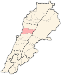
| District | Keserwan |
| Area | |
| • Total | 8.7 km2 (3.4 sq mi) |
| Highest elevation | 2,000 m (7,000 ft) |
| Lowest elevation | 1,200 m (3,900 ft) |
| Population | |
| • Total | 2,700 |
| • Density | 310/km2 (800/sq mi) |
| Time zone | UTC+2 (EET) |
| • Summer (DST) | UTC+3 (EEST) |
| Dialing code | +961 |
Geography
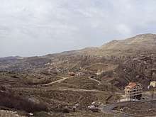
The name "Faraya" stands for "The land of fruits and vegetables" in Phoenician due to its soil fertility. Faraya is located in the Keserwan District in Lebanon, 42 km away from Beirut, and 20 km away from Jounieh , Faraya has an altitude ranging from 1200 m to 2000 m. The road to Faraya from the coastal highway passes through Ajaltoun, Ashqout, Faytroun, Mairouba, and Hrajel and 5 min to mzaar ski resort
In 2007, the Chabrouh Dam was inaugurated creating one of the highest reservoirs in the Middle-east region, but as a result, flooded more than three quarter of the orchards
In 2017, Lebanon's largest statue of Saint Charbel was inaugurated making it one of the most visited pilgrimage sites in Lebanon.
Climate
In winter, Faraya has a cold climate with snow accumulations that can reach more than 1.5 metres (5 ft) and temperature drops to −6 °C (21 °F) or lower in winter. In summer temperatures can reach over 30 °C (86 °F) in
| Climate data for Faraya | |||||||||||||
|---|---|---|---|---|---|---|---|---|---|---|---|---|---|
| Month | Jan | Feb | Mar | Apr | May | Jun | Jul | Aug | Sep | Oct | Nov | Dec | Year |
| Average high °C (°F) | 7.8 (46.0) |
8.4 (47.1) |
11.4 (52.5) |
15.9 (60.6) |
20.3 (68.5) |
24.8 (76.6) |
26.6 (79.9) |
27.8 (82.0) |
25.0 (77.0) |
21.1 (70.0) |
15.7 (60.3) |
10.3 (50.5) |
17.9 (64.2) |
| Daily mean °C (°F) | 4.2 (39.6) |
4.7 (40.5) |
7.1 (44.8) |
11.1 (52.0) |
15.1 (59.2) |
19.4 (66.9) |
21.1 (70.0) |
22.3 (72.1) |
19.5 (67.1) |
16.0 (60.8) |
11.4 (52.5) |
6.7 (44.1) |
13.2 (55.8) |
| Average low °C (°F) | 0.7 (33.3) |
1.0 (33.8) |
2.9 (37.2) |
6.4 (43.5) |
9.9 (49.8) |
14.1 (57.4) |
15.7 (60.3) |
16.9 (62.4) |
14.0 (57.2) |
11.0 (51.8) |
7.2 (45.0) |
3.1 (37.6) |
8.6 (47.4) |
| Average precipitation mm (inches) | 269 (10.6) |
231 (9.1) |
206 (8.1) |
87 (3.4) |
34 (1.3) |
2 (0.1) |
1 (0.0) |
1 (0.0) |
6 (0.2) |
39 (1.5) |
119 (4.7) |
222 (8.7) |
1,217 (47.7) |
| Source: Climate-Data.org[3] | |||||||||||||
References
- "Faraya". Localiban. Localiban. 2008-01-19. Retrieved 2016-02-12.
- "Elections municipales et ikhtiariah au Mont-Liban" (PDF). Localiban. Localiban. 2010. p. 19. Archived from the original (pdf) on 2015-07-24. Retrieved 2016-02-12.
- "Climate: Faraya". November 2011.
Capital: Jounieh | ||
| Towns and villages |
|  |
| Notable landmarks | ||