Eriyodu
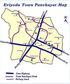
Eriyodu (or Eriodu) is a panchayat town is Located in Madurai Region in the state of Tamil Nadu, India. Eriyodu is in the administrative district of Dindigul. Eriyodu is located in Dindigul next to Karur State Highway road (SH 74).
Eriyodu Eriyodu | |
|---|---|
Panchayat town | |
| Nickname(s): Eri | |
 Eriyodu Location in Tamil Nadu, India | |
| Coordinates: 10.533°N 78.067°E | |
| Country | |
| State | Tamil Nadu |
| District | Dindigul |
| Zone | Madurai |
| Area | |
| • Total | 15 km2 (6 sq mi) |
| Elevation | 260 m (850 ft) |
| Population (2001) | |
| • Total | 7,866 |
| • Density | 520/km2 (1,400/sq mi) |
| Languages | |
| • Official | Tamil |
| Time zone | UTC+5:30 (IST) |
| PIN | 624702 |
| Telephone code | 91 4551 |
| Vehicle registration | TN 57 |
| Sex ratio | 1:1 ♂/♀ |
| Literacy | 66% |
| Website | www |
Eriyodu's Railway station is an important stop for Bengaluru trains. Eriyodu has a public library, an Electricity Board office, a post office, a police station, and a government hospital. Tamil Nadu Mercantile Bank, Canara Bank are the banks available in Eriyodu. There are ten dependent villages scattered around Eriyodu.
Geography
Eriyodu has an average elevation of 260 metres (850 ft).
The nearest airport is at Madurai and the nearest major railway station is the Dindigul Railway Junction.
There are some tourist spots in and around Eriyodu:
- "Kodaikanal" - One of the coolest hill station for summer destination in Tamil Nadu.
- Dindigul Fort - It is a historical place (19 km).
- Trichy Fort - It is a historical place (85 km).
- Palani - Palani Arulmigu Shri Dhandayuthapani temple is one of the Six Abodes of Murugan (63 km).
- Madurai Meenakshi Amman Temple - Famous temple which was nominated for one of the world wonders (86 km).
Climate
The climate is dry and hot, with rains from October to December. Temperatures during summer reach a maximum of 40 and a minimum of 25 degrees Celsius, while winter temperatures range between 25 and 18 degrees Celsius.
Education
Eriyodu has two government schools and two private primary schools. One Government Arts and Science College is also there.
The government schools, which are more than 50 years old, are:
- Government Higher Secondary School
- Government Middle School
The private schools, which are more than 20 years old, are:
- Vani Nursery and Primary School
- Kalaivani Nursery and Primary School
Demographics
As of the 2001 India census, Eriyodu had a population of 7866. Males constitute 51% of the population and females 49%. Eriyodu has an average literacy rate of 66%, higher than the national average of 59.5%; male literacy is 76%, and female literacy is 55%. In Eriyodu, 11% of the population is under 6 years of age.
Favourites
Mango Hills, a small hill which is located 6 km from Eriyodu. It is one of the best trekking spot during monsoon season. On the way to the hill you can spot lot of peacocks. occasionally people spotted fox and deer as well.
Original Honey, The villagers surrounded Mango hills sell original honey without mixing any additional / artificial elements in it. Sometimes you can directly go with them to watch how they extract honey from honeycombs.
Politics
Eriyodu Assembly Constituency is part of Karur (Lok Sabha constituency).
Nearest towns
Places adjacent to Eriyodu | ||||||||||
|---|---|---|---|---|---|---|---|---|---|---|
| ||||||||||
| Near towns | Distance |
|---|---|
| Dindigul | 20 km |
| Karur | 54 km |
| Palani | 64 km |
| Madurai | 70 km |
| Trichy | 97 km |
References
- 1) "Census of India 2001: Data from the 2001 Census, including cities, villages and towns (Provisional)". Census Commission of India. Archived from the original on 2004-06-16..