Elm Tree Plat Historic District
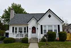
The Elm Tree Plat Historic District encompasses an early 20th-century neighborhood of East Providence, Rhode Island. Developed beginning in 1924, it contains 53 single-family residences and one commercial building, most of which were built between 1925 and 1935 as a streetcar suburb development serving the Providence area. Most of the houses were built by a single pair of developers, Severin Carlson and Carl Johnson, and are one and two-story Bungalow-style houses. It is roughly bounded by Willett, Harvey, and Fenner Avenues and Charlotte Street, in southern East Providence.[2]
Elm Tree Plat Historic District | |
 | |
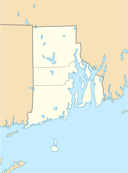  | |
| Location | Charlotte & Elinora Sts., Fenner, Harvey & Willett Aves., East Providence, Rhode Island |
|---|---|
| Coordinates | 41.7702°N 71.3528°W |
| Area | 6.5 acres (2.6 ha) |
| NRHP reference No. | 15000829[1] |
| Added to NRHP | November 19, 2015 |
The district was listed on the National Register of Historic Places in 2015.[1]
References
- "National Register Information System". National Register of Historic Places. National Park Service. January 23, 2007.
- "NRHP nomination for Elm Tree Plat Historic District" (PDF). Rhode Island Preservation. Archived from the original (PDF) on 2015-09-05. Retrieved 2015-11-29.
| Topics | |
|---|---|
| Lists by state |
|
| Lists by insular areas | |
| Lists by associated state | |
| Other areas | |
| Related | |
| |
This article is issued from Wikipedia. The text is licensed under Creative Commons - Attribution - Sharealike. Additional terms may apply for the media files.