El Alto
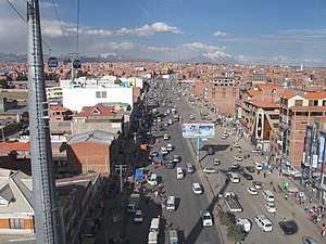
El Alto (Spanish for "The Heights"[1]) is the second-largest city in Bolivia, located adjacent to La Paz in Pedro Domingo Murillo Province on the Altiplano highlands. El Alto is today one of Bolivia's fastest-growing urban centers, with an estimated population of 943,558 in 2020.[2] El Alto is the highest major metropolis in the world, with an average elevation of 4,150 m (13,615 ft).
El Alto | |
|---|---|
City and municipality | |
 El Alto City | |
 Flag  Coat of arms | |
| Motto(s): Desde la cumbre más alta del mundo levantase la ciudad donde jamás se pondrá el sol de nuestra raza (From the highest summit in the world rises the city where the sun of our race will never set) | |
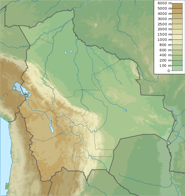 El Alto Location within Bolivia  El Alto El Alto (South America) | |
| Coordinates: 16°31′S 68°10′W | |
| Country | |
| Department | |
| Province | Pedro Domingo Murillo |
| Municipality | El Alto Municipality |
| Government | |
| • Mayor | Soledad Chapetón Tancara |
| Area | |
| • City and municipality | 363 km2 (140 sq mi) |
| Elevation | 4,150 m (13,620 ft) |
| Population (2012 Census) | |
| • Rank | 2nd |
| • Urban | 842,378 |
| Time zone | UTC−4 (BOT) |
| Website | Official website |
The El Alto-La Paz metropolitan area, formed by La Paz, El Alto, Achocalla, Viacha, and Mecapaca constitutes the second most populous urban area of Bolivia, with a population of 1.8 million, only surpassed by the metropolitan area of the country's largest city of Santa Cruz de la Sierra with a population of 2.3 million.[3]
History
The dry and inclement plain above La Paz was uninhabited until 1903 when the newly built railways from Lake Titicaca and Arica reached the rim of the canyon, where the La Paz terminus, railyards and depots were built along with a settlement of railway workers (a spur line down into the canyon opened in 1905). In 1925, the airfield was built as base for the new air force, which attracted additional settlement. In 1939, El Alto's first elementary school opened. El Alto started to grow tremendously in the 1950s when the settlement was connected to La Paz's water supply (before this, all water had to be transported from La Paz in tanker vehicles) and building land in the canyon became more and more scarce and expensive. In an administrative reform in March 1985, the district of El Alto and surroundings was politically separated from the City of La Paz (this date is officially referred to and celebrated as the city's "founding day"). In 1987, El Alto was formally incorporated as a city. In 1994, the city became the seat of the Roman Catholic Diocese of El Alto.
El Alto, known for its teeming streets and traffic, broke gender barriers by hiring "cholitas" in December 2013. These Aymara women dress in traditional, multi-layered Andean skirts and brightly embroidered vests, and work as traffic cops to bring order to its road chaos. In recent years, Bolivia’s cholitas have been breaking social barriers, conducting television programs, working in offices, holding public posts, and participating in native fashion shows and beauty contests.[4]
El Alto can also mean "The Halt" in Spanish, and a story states that the conquistador Alonso de Mendoza stopped in El Alto on the 23rd October 1548 on his way to founding the city of La Paz.
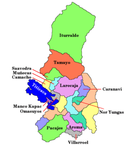
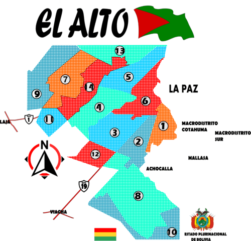
El Alto's districts
El Alto's autonomous government identifies 14 districts composing the Andean city.
Demographics
El Alto is the largest city in Latin America with a mostly Amerindian population. About 76% of its inhabitants are Aymara, 9% are Quechua, 15% are Mestizo (descendants of Amerindian and White Europeans), and less than 0.1% are Criollos (White). El Alto was once known as La Paz's bedroom community, though recent growth of commerce and industry has led some local authorities to claim the title of "Bolivia's Economic Capital." With this industrial growth, there is concern about water pollution by businesses, including tanneries and slaughterhouse, for the city and communities downstream.[5] Rapid population growth means the city struggles to bring potable water and sewer service to parts of the population, especially on the fringes of the expanding urban area.[6] Much of the city's roads are unpaved and most citizens do not have access to running water, sewerage, electricity, or garbage collection for their homes.
Geography
The city contains La Paz’s El Alto International Airport. El Alto is one of the highest major cities in the world, up to 4,150 meters (13,615 feet) above mean sea level. It has a cold climate, with the highest average monthly maximum temperature being 17 °C (63 °F) in November. It is one of the fastest-growing cities in Bolivia, due to a trend in migration from Bolivia’s rural areas to the La Paz region that started with the rural reform of 1952 and increased in the last 10 years. Some migrants say the difficulty of growing crops in the countryside drove them to move to the city.[7]
Climate
The Köppen climate classification system classifies El Alto's climate as a rare cold-summer variety of a subtropical highland climate (Cwc).
The water supply in El Alto has been impacted by drought caused by shrinking glaciers.[8] In 2016 the three main dams supplying water to the city were almost dry due to lack of glacial melt water.[9]
| Climate data for El Alto, Bolivia (El Alto International Airport, elevation 4,058 m) | |||||||||||||
|---|---|---|---|---|---|---|---|---|---|---|---|---|---|
| Month | Jan | Feb | Mar | Apr | May | Jun | Jul | Aug | Sep | Oct | Nov | Dec | Year |
| Record high °C (°F) | 25.4 (77.7) |
22.8 (73.0) |
25.1 (77.2) |
22.9 (73.2) |
24.0 (75.2) |
20.0 (68.0) |
23.0 (73.4) |
21.0 (69.8) |
23.0 (73.4) |
23.0 (73.4) |
24.2 (75.6) |
22.0 (71.6) |
25.4 (77.7) |
| Average high °C (°F) | 14.3 (57.7) |
14.3 (57.7) |
14.2 (57.6) |
14.4 (57.9) |
14.4 (57.9) |
14.0 (57.2) |
13.5 (56.3) |
13.7 (56.7) |
15.3 (59.5) |
15.3 (59.5) |
17.0 (62.6) |
15.7 (60.3) |
15.0 (59.0) |
| Daily mean °C (°F) | 9.3 (48.7) |
9.0 (48.2) |
8.9 (48.0) |
8.8 (47.8) |
8.2 (46.8) |
7.3 (45.1) |
6.8 (44.2) |
8.2 (46.8) |
8.7 (47.7) |
10.0 (50.0) |
10.5 (50.9) |
9.7 (49.5) |
8.8 (47.8) |
| Average low °C (°F) | 4.4 (39.9) |
4.4 (39.9) |
3.6 (38.5) |
1.0 (33.8) |
−1.9 (28.6) |
−4.3 (24.3) |
−4.4 (24.1) |
−3 (27) |
−1.0 (30.2) |
1.5 (34.7) |
2.1 (35.8) |
3.6 (38.5) |
0.5 (32.9) |
| Record low °C (°F) | −3.3 (26.1) |
−3.3 (26.1) |
−2.7 (27.1) |
−4.7 (23.5) |
−10.3 (13.5) |
−12.4 (9.7) |
−11.9 (10.6) |
−10 (14) |
−10 (14) |
−5.4 (22.3) |
−5 (23) |
−2.8 (27.0) |
−12.4 (9.7) |
| Average precipitation mm (inches) | 133.7 (5.26) |
104.7 (4.12) |
71.7 (2.82) |
31.7 (1.25) |
14.3 (0.56) |
5.1 (0.20) |
7.1 (0.28) |
15.2 (0.60) |
35.5 (1.40) |
38.1 (1.50) |
50.5 (1.99) |
94.9 (3.74) |
602.5 (23.72) |
| Average precipitation days (≥ 0.1 mm) | 20.7 | 15.8 | 14.2 | 9.8 | 3.6 | 2.8 | 2.8 | 5.1 | 8.2 | 10.4 | 11.5 | 15.5 | 120.3 |
| Average snowy days | 0.07 | 0.0 | 0.0 | 0.03 | 0.0 | 0.03 | 0.13 | 0.67 | 0.37 | 0.17 | 0.17 | 0.03 | 1.67 |
| Average relative humidity (%) | 66 | 72 | 67 | 59 | 48 | 42 | 43 | 42 | 48 | 49 | 51 | 60 | 54 |
| Mean monthly sunshine hours | 179.8 | 155.4 | 148.8 | 165.0 | 229.4 | 240.0 | 235.6 | 226.3 | 192.0 | 179.8 | 171.0 | 180.0 | 2,303.1 |
| Mean daily sunshine hours | 5.8 | 5.5 | 4.8 | 5.5 | 7.4 | 8.0 | 7.6 | 7.3 | 6.4 | 5.8 | 5.7 | 6.0 | 6.3 |
| Source 1: Deutscher Wetterdienst,[10] Servicio Nacional de Meteorología e Hidrología de Bolivia (snowy days 1981–2010)[11] | |||||||||||||
| Source 2: Meteo Climat (extremes 1942–present)[12] | |||||||||||||
Attractions
Museo de Arte Antonio Paredes Candia opened in 2002. From 2003, access from La Paz to the international airport, as well to oil and gas supplies, has been frequently blocked by protesting social leaders and some of the most powerful players in the politics of Bolivia. El Alto remains one of the major centers of the Bolivian gas conflict.
There is a large open-air market.[13]
Gallery
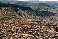 El Alto, Bolivia
 University in El Alto (Universidad Franz Tamayo)
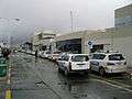 El Alto Airport
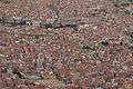 El Alto, La Paz Department
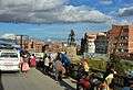 El Alto, Bolivia
.jpg) Winter morning in El Alto
Winter morning in El Alto_on_the_right_-_LPB_airport_(in_El_Alto)_at_4160m_-_(24720405392).jpg) El Alto, Bolivia
El Alto, Bolivia
Government
El Alto is a municipality within the province of Murillo. The government of the city is divided into the executive and legislative branches. The mayor of El Alto is the head of the city government, elected for a term of five years by general election. The legislative branch consists of the municipal council, which elects a president, vice president, and secretary from a group of 11 members.
The current mayor is Soledad Chapetón, who became the city's first female mayor in May 2015. The previous election was held April 4, 2010 and results of that regional election are given below:
| Mayoral Candidate | Party | Votes for Mayor | Percentage | Council Members | |
|---|---|---|---|---|---|
| Edgar Patana | Movement for Socialism (MAS-IPSP) | 146.394 | 38,8% | 5 | |
| Soledad Chapetón | National Unity Front (UN) | 114.886 | 30,4% | 3 | |
| Abel Mamani | Without Fear Movement (MSM) | 91.987 | 24,4% | 3 | |
| Óscar Chirinos | Movement for Sovereignty (MPS) | 14.736 | 3,9% | 0 | |
| Patriotic Social Alliance (ASP) | 9.666 | 2,6% | 0 | ||
| Valid votes | 377.669 | 86,2% | |||
| Blank votes | 25.475 | 5,8% | |||
| Null votes | 34.815 | 7,9% | |||
| Total votes | 437.959 | 88,9% of registered voters | 11 | ||
| All party percentages are the percent of valid votes. Percentages of valid, blank, and null votes are the percent of total votes emitted. Source: Corte Nacional Electoral, Acto de Computo Nacional | |||||
The Government of El Alto faces competition in providing public services, security and participation with the grassroots and highly successful Fejuve movement.
Transportation
El Alto is connected to La Paz by two lines of the Mi Teleférico system. The city is connected to domestic and international destinations by El Alto International Airport.
See also
- List of highest large cities in the world
References
- Neuman, William (2013-05-13). "A Colorful Bolivian Bastion, Floating Above It All". The New York Times. ISSN 0362-4331. Retrieved 2017-10-07.
- INE, Bolivia. "LA PAZ: POBLACIÓN TOTAL PROYECTADA, POR SEXO, SEGÚN PROVINCIA Y SECCIÓN DE PROVINCIA". INE Bolivia. Retrieved 26 May 2012.
- "Bolivia: Proyecciones de Población según Departamento y Municipio, 2012-2020" [[Bolivia: Population Projections by Department and Municipality 2012-2020.]]. INE Bolivia. Instituto Nacional de Estadística, Estado Plurinacional de Bolivia (Bolivia's National Institute of Statistics). Archived from the original on 2020-05-29. Retrieved 2020-05-29.
- AP (23 December 2013). "Bolivian City Hires 'cholita' Traffic Policewomen". USAHerald. Archived from the original on 24 December 2013. Retrieved 23 December 2013.
- Shahriari, Sara (12 Jan 2012). "Urban population boom threatens Lake Titicaca". The Guardian. Retrieved 26 May 2012.
- Shahriari, Sara (25 Jan 2012). "Dry Toilets: The Answer to a Bolivian City's Sewage Crisis?". The Pulitzer Center on Crisis Reporting. Retrieved 26 May 2012.
- Vidal, John (12 April 2011). "El Alto, city of rural migrants whose crops failed when the climate changed". The Guardian. Retrieved 26 May 2012.
- Rosenthal, Elisabeth (2009-12-13). "In Bolivia, Water and Ice Tell of Climate Change". The New York Times. ISSN 0362-4331. Retrieved 2019-09-28.
- Rocha, Jan (2016-11-28). "Shrinking glaciers cause state-of-emergency drought in Bolivia". The Guardian. ISSN 0261-3077. Retrieved 2019-09-28.
- "Klimatafel von La Paz - El Alto (Int. Flugh.) / Bolivien" (PDF). Baseline climate means (1961-1990) from stations all over the world (in German). Deutscher Wetterdienst. Retrieved January 24, 2016.
- "Base de datos Sistema Meteorológico–SISMET" (in Spanish). Servicio Nacional de Meteorología e Hidrología de Bolivia. Archived from the original on 21 September 2019. Retrieved 22 September 2019.
- "Station La Paz" (in French). Meteo Climat. Retrieved 11 June 2016.
- William Neuman (May 13, 2013). "A Colorful Bolivian Bastion, Floating Above It All". The New York Times. Retrieved May 14, 2013.
Further reading
- Lazar, Sian (2008), El Alto, Rebel City, Duke University Press, ISBN 978-0-8223-4154-3
External links
| Wikimedia Commons has media related to El Alto. |
- Weather in El Alto
- Alto Bolivia
- El Alto Bolivia(ES)
- Cultura en las Alturas(Spanish)
- INE - Instituto Nacional de Estadística de Bolivia
- NYTimes feature