Easton, California
Easton (formerly, Covel[6] and Covell[5]) is a census-designated place (CDP) in Fresno County, California, United States. The population was 2,083 at the 2010 census, up from 1,966 at the 2000 census. Easton is located 7.5 miles (12.1 km) south of downtown Fresno,[6] at an elevation of 276 feet (84 m).[5]
Easton | |
|---|---|
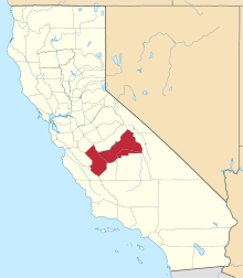
 Location in Fresno County and the state of California | |
 Easton Location in the United States | |
| Coordinates: 36°39′01″N 119°47′27″W | |
| Country | |
| State | |
| County | Fresno |
| Government | |
| • State Senator | Anna Caballero (D)[1] |
| • State Assembly | Joaquin Arambula (D)[2] |
| • U. S. Congress | TJ Cox (D)[3] |
| Area | |
| • Total | 3.011 sq mi (7.799 km2) |
| • Land | 3.011 sq mi (7.799 km2) |
| • Water | 0 sq mi (0 km2) 0% |
| Elevation | 276 ft (84 m) |
| Population (2010) | |
| • Total | 2,083 |
| • Density | 690/sq mi (270/km2) |
| Time zone | UTC-8 (PST) |
| • Summer (DST) | UTC-7 (PDT) |
| ZIP code | 93706 |
| Area code(s) | 559 |
| FIPS code | 06-20928 |
| GNIS feature IDs | 277503, 2408041 |
Geography
According to the United States Census Bureau, the CDP has a total area of 3.0 square miles (7.8 km2), all of it land.
History
Easton post office was established in 1881, moved in 1883, and closed in 1902.[6] It reopened in 1952.[6] The name honors O.W. Easton, a land agent.[6]
Demographics
| Historical population | |||
|---|---|---|---|
| Census | Pop. | %± | |
| U.S. Decennial Census[7] | |||
2010
At the 2010 census Easton had a population of 2,083. The population density was 691.7 people per square mile (267.1/km²). The racial makeup of Easton was 1,248 (59.9%) White, 13 (0.6%) African American, 58 (2.8%) Native American, 68 (3.3%) Asian, 0 (0.0%) Pacific Islander, 593 (28.5%) from other races, and 103 (4.9%) from two or more races. Hispanic or Latino of any race were 1,308 persons (62.8%).[8]
The whole population lived in households, no one lived in non-institutionalized group quarters and no one was institutionalized.
There were 629 households, 266 (42.3%) had children under the age of 18 living in them, 369 (58.7%) were opposite-sex married couples living together, 91 (14.5%) had a female householder with no husband present, 50 (7.9%) had a male householder with no wife present. There were 32 (5.1%) unmarried opposite-sex partnerships, and 5 (0.8%) same-sex married couples or partnerships. 102 households (16.2%) were one person and 46 (7.3%) had someone living alone who was 65 or older. The average household size was 3.31. There were 510 families (81.1% of households); the average family size was 3.66.
The age distribution was 566 people (27.2%) under the age of 18, 231 people (11.1%) aged 18 to 24, 474 people (22.8%) aged 25 to 44, 532 people (25.5%) aged 45 to 64, and 280 people (13.4%) who were 65 or older. The median age was 35.1 years. For every 100 females, there were 104.0 males. For every 100 females age 18 and over, there were 101.7 males.
There were 667 housing units at an average density of 221.5 per square mile (85.5/km²),of which 629 were occupied, 423 (67.2%) by the owners and 206 (32.8%) by renters. The homeowner vacancy rate was 1.2%; the rental vacancy rate was 5.5%. 1,365 people (65.5% of the population) lived in owner-occupied housing units and 718 people (34.5%) lived in rental housing units.
2000
At the 2000 census there were 1,966 people, 623 households, and 499 families in the CDP. The population density was 652.5 people per square mile (252.2/km²). There were 648 housing units at an average density of 215.1 per square mile (83.1/km²). The racial makeup of the CDP was 58.04% White, 0.61% Black or African American, 3.36% Native American, 3.97% Asian, 29.35% from other races, and 4.68% from two or more races. 51.78% of the population were Hispanic or Latino of any race.[9] Of the 623 households 35.2% had children under the age of 18 living with them, 62.3% were married couples living together, 12.4% had a female householder with no husband present, and 19.9% were non-families. 17.5% of households were one person and 8.3% were one person aged 65 or older. The average household size was 3.16 and the average family size was 3.57.
The age distribution was 30.2% under the age of 18, 8.6% from 18 to 24, 24.8% from 25 to 44, 23.0% from 45 to 64, and 13.3% 65 or older. The median age was 35 years. For every 100 females, there were 102.3 males. For every 100 females age 18 and over, there were 95.7 males.
The median household income was $31,172 and the median family income was $36,250. Males had a median income of $39,583 versus $21,071 for females. The per capita income for the CDP was $13,598. About 16.8% of families and 24.0% of the population were below the poverty line, including 37.7% of those under age 18 and 11.2% of those age 65 or over.
Notable residents
- Marjaree Mason, for whom Fresno County's Marjaree Mason Center is named, was born in Easton.
- Deshawn Stevenson, basketball player for the Dallas Mavericks, lived in Easton.
- Matt Garza, Major League Baseball pitcher for the Chicago Cubs, grew up and attended high school in Easton.
References
- "Senators". State of California. Retrieved April 6, 2013.
- "Members Assembly". State of California. Retrieved April 6, 2013.
- "California's 21st Congressional District - Representatives & District Map". Civic Impulse, LLC. Retrieved April 6, 2013.
- "2010 Census U.S. Gazetteer Files – Places – California". United States Census Bureau.
- U.S. Geological Survey Geographic Names Information System: Easton, California
- Durham, David L. (1998). California's Geographic Names: A Gazetteer of Historic and Modern Names of the State. Clovis, Calif.: Word Dancer Press. p. 1030. ISBN 1-884995-14-4.
- "Census of Population and Housing". Census.gov. Retrieved June 4, 2016.
- "2010 Census Interactive Population Search: CA - Easton CDP". U.S. Census Bureau. Archived from the original on July 15, 2014. Retrieved July 12, 2014.
- "U.S. Census website". United States Census Bureau. Retrieved 2008-01-31.
| Authority control |
|
|---|