Dursley
Dursley is a market town and civil parish in southern Gloucestershire, England, situated almost equidistantly between the cities of Bristol and Gloucester. It is under the northeast flank of Stinchcombe Hill, and about 3 3⁄4 miles (6.0 km) southeast of the River Severn. The town is adjacent to Cam which, though a village, is a slightly larger community in its own right.
| Dursley | |
|---|---|
| Market town | |
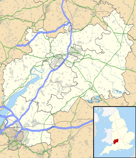 Dursley Location within Gloucestershire | |
| Population | 6,697 (2011 Census) |
| OS grid reference | ST756981 |
| Civil parish |
|
| District |
|
| Shire county | |
| Region | |
| Country | England |
| Sovereign state | United Kingdom |
| Post town | DURSLEY |
| Postcode district | GL11 |
| Dialling code | 01453 |
| Police | Gloucestershire |
| Fire | Gloucestershire |
| Ambulance | South Western |
| UK Parliament | |
Governance
An electoral ward in the same name exists. The population and area of this ward are identical to that of the parish.
History

Dursley once had a castle, built by Roger de Berkeley in 1153.[1]
Dursley gained borough status in 1471 and lost it in 1886. From 1837 to 1851 it was the administrative centre of Dursley Registration District which recorded vital records of people living in the parishes of North Nibley, Coaley, Slimbridge, Stinchcombe, Uley, Dursley, Cam, Nympsfield, Kingswood, Wotton-under-Edge and Owlpen.[2] From 1886 until 1974 it was the administrative centre of Dursley Rural District (RDC). In 1974 the RDC became part of Stroud District.
The Grade I listed[3] parish church of St. James the Great dates from the 13th century. The modern building is largely of 14th and 15th century construction and carries the Tudor coat of arms on the outside below the guttering, indicating that some of its construction was funded by the Tudor royals. The original church spire collapsed in January 1699 during a bell-ringing session, causing casualties. The current belltower, in an imposing Gothic survival style, was built by Thomas Sumsion of Colerne in 1708–09.
The pillared market house, complete with statue of Queen Anne and bell turret, dates from 1738, when the town's markets attracted farmers and traders from miles around. It is now maintained by the Dursley Town Trust who also look after Jacob's House and the Heritage Centre.[1]
In 1856 a short branch line railway opened,[4] called the "Dursley Donkey" by locals, linking Dursley and Cam to the Bristol–Gloucester main line at Coaley Junction. The branch line was closed in 1968 and Coaley Junction station was also closed at about this time. However, in 1994 a new station called Cam and Dursley was opened on the main line, 330 yards north of the site of Coaley Junction.
In the 19th and 20th centuries, Dursley was a large-scale manufacturing town, and engines built here by the Lister engine company were used around the world. That company's successor, Lister Petter, was based in the town until 2014, though much of the original 92-acre (37 ha) factory site was acquired in 2000 by the South West Regional Development Agency and then in 2011 by Stroud District Council. It is now being developed as a large housing development with some industrial units.[5] The Towers, a large gothic-style house, formerly part of the Lister Petter estate, still overlooks the town and has been converted into flats and a residential care home.[6]

Other large factories based in the town included Mawdsley's, an electrical equipment manufacturer; Bymack's, an upholsterers; and the Bailey Newspaper Group, a newspaper printer, all of which have reduced or closed operations in recent years.
Ancient historical sites in the vicinity give evidence of earlier occupation. Uley Bury is an Iron Age hill fort dating from around 300BC. The area also has neolithic long barrows; one called "Hetty Pegler's Tump" can be entered. Notable Roman remains exist at Frocester, West Hill near Uley, Woodchester and Calcot Manor.
Character and amenities
The town sits on the edge of the Cotswolds escarpment where it drops off towards the Severn Vale and the River Severn. It is adjacent with Cam which, though a village, is a community of double the size. The two communities (combined population about 12,000) share many facilities.
Dursley's main watercourse is the River Ewelme which becomes the River Cam when it enters Cam. The town is surrounded by beautiful woodland and countryside and the Cotswold Way long distance trail passes through Dursley town centre.
In March 2010 Sainsbury's opened a newly built 20,000 sq ft supermarket within walking distance of the town centre.[7] Other recent arrivals include Lidl (November 2009, in premises on Kingshill Road previously occupied by the Regal Cinema and then Kwik Save[8]) and Iceland (July 2010, replacing Somerfield in the town centre[9]). The Co-op has operated a smaller store in Rosebery Road since 2002. The town centre also has a traditional ironmonger's, a haberdashery, an old fashioned sweet shop, a florist, a butcher, a baker, a greengrocer, a camera shop, and a vintage clothing shop. There are a number of cafes.
A range of markets are held at the Market Place in the centre of the town; a farmers' market is held there on the second Saturday of every month and a craft market on the fourth Saturday of each month. There is an active Transition group in Cam and Dursley (part of the global Transition town network) which looks after Dursley's Secret Garden, among other projects. Continuing urban sprawl now joins Dursley and the nearby village of Cam.
Dursley has a number of licensed premises and the Old Spot pub is regularly voted Gloucestershire 'Pub of the Year'. The pub was also named as 2007 CAMRA National Pub of the year.[10]
Around 1496, the Christian writer and martyr William Tyndale was born near here, probably at Slimbridge.
Mikael Pedersen invented the Pedersen bicycle in Dursley in the 19th century.[11]
Railways
The nearest railway station is at Cam and Dursley on the Bristol and Gloucester Railway, with trains operated by Great Western Railway.
Notable residents
- It is claimed that William Shakespeare may have spent part or all of the eight years between 1582 and 1590, a period of his life of which little is known, in Dursley, possibly working as a school teacher.
- The writer Evelyn Waugh lived in nearby Stinchcombe between 1937 and 1956.
- The writer Peter Currell Brown wrote the cult classic 1965 surrealist novel Smallcreep's Day while working in Dursley.
Popular culture
- Author JK Rowling, born in nearby Yate, named the Dursley family in the Harry Potter books after the town.
- In Richard II there is reference to "the wolds of Gloucestershire", and when Bolingbrook asks how far it is to Berkeley as "these wild hills and rough uneven ways draw out for miles", the reply given is "there stands the castle beyond that tuft of trees". Many people understand this as a conversation taking place on Stinchcombe Hill overlooking the Vale of Berkeley and its castle.
See also
References
- Dursley Location Information Archived 25 October 2005 at the Wayback Machine
- Smith, Cecil R. Humphery. The Phillimore Atlas and Index of Parish Registers. Digitized images. Institute of Heraldic and Genealogical Studies, Canterbury, Kent, England. Accessed 13 April 2013 via paid subscription site: Great Britain, Atlas and Index of Parish Registers. Provo, UT, USA: Ancestry.com Operations, Inc., 2014.
- Historic England. "Church of St James (1290832)". National Heritage List for England. Retrieved 14 April 2019.
- citing from Branch lines of Gloucestershire Archived 31 March 2008 at the Wayback Machine ISBN 0-86299-959-6
- "Littlecombe, Dursley". South West RDA. 2005. Archived from the original on 4 May 2009. Retrieved 16 April 2017.
- "New Lease of Life for Historic Lister Petter Home". South West RDA. 20 February 2006. Archived from the original on 4 May 2009. Retrieved 16 April 2017.
- New Sainsburys Supermarket
- New Lidl Store
- New Iceland store
- "Gloucestershire Pub Voted Best Pub in Britain! 15/02/08 – CAMRA". Archived from the original on 27 February 2008. Retrieved 15 February 2008.
- Dursley Pedersen Bicycle Homepage – The ultimate site of Dursley Pedersen cycles
External links
| Wikimedia Commons has media related to Dursley. |
- Dursley Chamber of Trade Website
- Dursley Gazette Website
- Dursley Town Council
- Dursley Town Trust
- A history of Dursley's railways
- Vale Vision Community Development covering Dursley, Cam and the surrounding villages
- Community Plan for Cam and Dursley area for 2012 onward
- Stroud Voices (Dursley filter) - oral history site
- Dursley local history pages
| Following the Cotswold Way | |
|---|---|
| Towards Bath | Towards Chipping Campden |
| 11 km (6.8 mi) to Wotton-under-Edge | 14 km (8.7 mi) to Stroud |
| Unitary authorities | |
|---|---|
| Boroughs or districts | |
| Major settlements |
|
| Rivers |
|
| Topics | |
| Authority control |
|
|---|