Dunaújváros District
Dunaújváros (Hungarian: Dunaújvárosi járás) is a district in south-eastern part of Fejér County. Dunaújváros is also the name of the town where the district seat is found. The district is located in the Central Transdanubia Statistical Region.
Dunaújváros District Dunaújvárosi járás | |
|---|---|
 Coat of arms | |
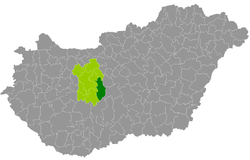 Dunaújváros District within Hungary and Fejér County. | |
| Country | |
| County | Fejér |
| District seat | Dunaújváros |
| Area | |
| • Total | 650.05 km2 (250.99 sq mi) |
| Area rank | 3rd in Fejér |
| Population (2011 census) | |
| • Total | 94,414 |
| • Rank | 2nd in Fejér |
| • Density | 145/km2 (380/sq mi) |
Geography
Dunaújváros District borders with Martonvásár District to the northeast, Ráckeve District (Pest County) and Kunszentmiklós District (Bács-Kiskun County) to the east, Paks District (Tolna County) to the south, Sárbogárd District, Székesfehérvár District and Gárdony District to the west. The number of the inhabited places in Dunaújváros District is 16.
Municipalities
The district has 1 urban county, 3 towns, 3 large villages and 9 villages. (ordered by population, as of 1 January 2012)[1]
- Adony (3,912)
- Baracs (3,484)
- Beloiannisz (1,100)
- Besnyő (1,779)
- Daruszentmiklós (1,597)
- Dunaújváros (48,010) – district seat
- Előszállás (2,186)
- Iváncsa (2,899)
- Kisapostag (1,414)
- Kulcs (2,728)
- Mezőfalva (4,677)
- Nagykarácsony (1,361)
- Nagyvenyim (4,051)
- Perkáta (3,942)
- Pusztaszabolcs (5,997)
- Rácalmás (4,488)
The bolded municipalities are cities, italics municipalities are large villages.
See also
- List of cities and towns in Hungary
References
External links
| City with county rights (1) |
| |
|---|---|---|
| Towns (3) | ||
| Large villages (3) | ||
| Villages (9) | ||