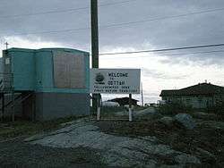
Dettah
Dettah, sometimes, incorrectly, as Detah,[5] is a First Nations[6] community in the North Slave Region of the Northwest Territories, Canada. Located just southeast of the capital of Yellowknife, it is a 6.5 km (4.0 mi) drive from that city by ice road across the north arm of Great Slave Lake in winter or a 27 km (17 mi) drive via the Ingraham Trail, year-round. The name means 'Burnt Point' in the Tli Cho language and refers to a traditional fishing camp used by the Dene for hundreds of years.
Dettah T'èɂehdaà | |
|---|---|
Yellowknives Dene First Nation (Dettah) | |
 | |
 Dettah  Dettah | |
| Coordinates: 62°24′41″N 114°18′27″W | |
| Country | Canada |
| Territory | Northwest Territories |
| Region | North Slave Region |
| Territorial electoral district | Tu Nedhé-Wiilideh |
| Census division | Region 6 |
| Government | |
| • Chief | Edward Sangris |
| • Chief Executive Officer | Juanita Sangris |
| • MLA | Bob Bromley |
| Area | |
| • Land | 1.34 km2 (0.52 sq mi) |
| Elevation | 179 m (587 ft) |
| Population (2016)[1] | |
| • Total | 219 |
| • Density | 163.9/km2 (424/sq mi) |
| Time zone | UTC−07:00 (MST) |
| • Summer (DST) | UTC−06:00 (MDT) |
| Canadian Postal code | X1A |
| Area code(s) | 867 |
| Telephone exchanges | 444 445 446 669 765 766 873 920 |
| Sources: Department of Municipal and Community Affairs,[2] Prince of Wales Northern Heritage Centre,[3] Canada Flight Supplement[4] | |
Demographics
| Historical population | ||||||||||||||||||||||||||||||||||||||||||||||||||||||||||
|---|---|---|---|---|---|---|---|---|---|---|---|---|---|---|---|---|---|---|---|---|---|---|---|---|---|---|---|---|---|---|---|---|---|---|---|---|---|---|---|---|---|---|---|---|---|---|---|---|---|---|---|---|---|---|---|---|---|---|
|
| |||||||||||||||||||||||||||||||||||||||||||||||||||||||||
| Sources: NWT Bureau of Statistics (2001 - 2017)[7] | ||||||||||||||||||||||||||||||||||||||||||||||||||||||||||
According to the 2016 Census, Dettah had a population of 219 people, an increase of 4.3% from the 2011 Census, consisting almost entirely of First Nations and a few Métis.[1][8] In 2017, the Government of the Northwest Territories reported that the population was 245 with an average yearly growth rate of -0.2% from 2007.[8] Both it and Ndilǫ are the communities of the Yellowknives. Dettah is represented by the Yellowknives Dene First Nation (Dettah) and are part of the Akaitcho Territory Government.[9]
Gallery
 Bear skin drying
 Kateri Tekakwitha church
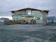 Government building
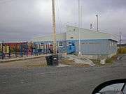 Kaw Tay Whee School
Climate
| Climate data for Yellowknife Airport, approximately 9 km (5.6 mi) northwest of Dettah. 1981–2010 normals, extremes 1942–present | |||||||||||||
|---|---|---|---|---|---|---|---|---|---|---|---|---|---|
| Month | Jan | Feb | Mar | Apr | May | Jun | Jul | Aug | Sep | Oct | Nov | Dec | Year |
| Record high humidex | 2.9 | 6.1 | 8.9 | 20.2 | 25.6 | 34.0 | 35.4 | 34.3 | 27.2 | 18.1 | 6.3 | 1.6 | 35.4 |
| Record high °C (°F) | 3.4 (38.1) |
6.2 (43.2) |
9.3 (48.7) |
20.4 (68.7) |
26.3 (79.3) |
31.1 (88.0) |
32.5 (90.5) |
30.9 (87.6) |
26.1 (79.0) |
19.0 (66.2) |
7.8 (46.0) |
2.8 (37.0) |
32.5 (90.5) |
| Average high °C (°F) | −21.6 (−6.9) |
−18.1 (−0.6) |
−10.8 (12.6) |
0.4 (32.7) |
9.7 (49.5) |
18.1 (64.6) |
21.3 (70.3) |
18.1 (64.6) |
10.4 (50.7) |
0.9 (33.6) |
−10.0 (14.0) |
−17.8 (0.0) |
0.0 (32.0) |
| Daily mean °C (°F) | −25.6 (−14.1) |
−22.9 (−9.2) |
−16.8 (1.8) |
−5.3 (22.5) |
4.6 (40.3) |
13.3 (55.9) |
17.0 (62.6) |
14.2 (57.6) |
7.2 (45.0) |
−1.7 (28.9) |
−13.7 (7.3) |
−21.8 (−7.2) |
−4.3 (24.3) |
| Average low °C (°F) | −29.5 (−21.1) |
−27.5 (−17.5) |
−22.7 (−8.9) |
−11.0 (12.2) |
−0.5 (31.1) |
8.5 (47.3) |
12.6 (54.7) |
10.2 (50.4) |
4.0 (39.2) |
−4.2 (24.4) |
−17.5 (0.5) |
−25.7 (−14.3) |
−8.6 (16.5) |
| Record low °C (°F) | −51.2 (−60.2) |
−51.2 (−60.2) |
−43.3 (−45.9) |
−40.6 (−41.1) |
−22.8 (−9.0) |
−4.4 (24.1) |
0.6 (33.1) |
−0.6 (30.9) |
−9.7 (14.5) |
−28.9 (−20.0) |
−44.4 (−47.9) |
−48.3 (−54.9) |
−51.2 (−60.2) |
| Record low wind chill | −64.0 | −61.0 | −56.8 | −53.2 | −31.8 | −11.2 | 0.0 | −4.8 | −16.4 | −36.3 | −54.7 | −58.9 | −64.0 |
| Average precipitation mm (inches) | 14.3 (0.56) |
14.1 (0.56) |
13.9 (0.55) |
11.3 (0.44) |
18.4 (0.72) |
28.9 (1.14) |
40.8 (1.61) |
39.3 (1.55) |
36.3 (1.43) |
30.3 (1.19) |
24.8 (0.98) |
16.2 (0.64) |
288.6 (11.36) |
| Average rainfall mm (inches) | 0.1 (0.00) |
0.0 (0.0) |
0.2 (0.01) |
2.5 (0.10) |
13.8 (0.54) |
28.9 (1.14) |
40.8 (1.61) |
39.2 (1.54) |
32.7 (1.29) |
12.1 (0.48) |
0.3 (0.01) |
0.2 (0.01) |
170.7 (6.72) |
| Average snowfall cm (inches) | 19.7 (7.8) |
20.0 (7.9) |
18.5 (7.3) |
10.3 (4.1) |
4.7 (1.9) |
0.0 (0.0) |
0.0 (0.0) |
0.1 (0.0) |
3.5 (1.4) |
20.9 (8.2) |
36.5 (14.4) |
23.5 (9.3) |
157.6 (62.0) |
| Average precipitation days (≥ 0.2 mm) | 10.7 | 10.0 | 8.4 | 5.0 | 6.6 | 7.6 | 9.6 | 10.5 | 11.2 | 13.4 | 14.4 | 11.2 | 118.5 |
| Average rainy days (≥ 0.2 mm) | 0.2 | 0.1 | 0.3 | 1.2 | 5.3 | 7.5 | 9.6 | 10.4 | 10.6 | 5.5 | 0.6 | 0.2 | 51.3 |
| Average snowy days (≥ 0.2 cm) | 11.9 | 11.0 | 9.2 | 4.4 | 2.1 | 0.1 | 0.0 | 0.1 | 1.2 | 10.0 | 16.0 | 12.8 | 78.6 |
| Average relative humidity (%) | 64.6 | 61.6 | 54.7 | 52.5 | 45.9 | 45.2 | 47.9 | 55.7 | 64.7 | 75.2 | 77.8 | 69.2 | 59.6 |
| Mean monthly sunshine hours | 50.6 | 107.3 | 188.4 | 276.4 | 335.7 | 373.8 | 358.0 | 276.2 | 157.7 | 65.0 | 42.7 | 24.6 | 2,256.5 |
| Percent possible sunshine | 26.8 | 43.5 | 51.8 | 62.2 | 60.8 | 63.0 | 61.2 | 55.5 | 40.3 | 21.0 | 20.2 | 15.4 | 43.5 |
| Average ultraviolet index | 0 | 0 | 1 | 2 | 4 | 5 | 5 | 4 | 2 | 1 | 0 | 0 | 2 |
| Source: Environment Canada[10][11][12][13] and Weather Atlas[14] | |||||||||||||
References
- Census Profile, 2016 Census Detah, Settlement (Census subdivision), Northwest Territories and Northwest Territories (Territory)
- "NWT Communities - Dettah". Government of the Northwest Territories: Department of Municipal and Community Affairs. Retrieved 2017-10-29.
- "Northwest Territories Official Community Names and Pronunciation Guide". Prince of Wales Northern Heritage Centre. Yellowknife: Education, Culture and Employment, Government of the Northwest Territories. Archived from the original on 2016-01-13. Retrieved 2016-01-13.
- Canada Flight Supplement. Effective 0901Z 30 January 2020 to 0901Z 26 March 2020.
- We've spelled this N.W.T. community's name wrong for almost 50 years
- Differences in Community Government Structures
- Population Estimates By Community from the GNWT
- Detah - Statistical Profile
- Indian and Northern Affairs Canada Archived 2007-06-11 at Archive.today
- "Yellowknife A". Canadian Climate Normals 1981–2010. Environment Canada. Climate ID: 2204100. Retrieved 10 March 2015.
- "Daily Data Report for April 2010". Canadian Climate Data. Environment Canada. Climate ID: 2204100. Retrieved 16 June 2016.
- "Daily Data Report for June 2013". Canadian Climate Data. Environment Canada. Climate ID: 2204101. Retrieved 16 June 2016.
- "Daily Data Report for May 2015". Canadian Climate Data. Environment Canada. Climate ID: 2204101. Retrieved 16 June 2016.
- "Yellowknife, Canada - Monthly weather forecast and Climate data". Weather Atlas. Retrieved 3 July 2019.
Further reading
- Northwest Territories, and BHP Billiton Diamonds Inc. Communities and Diamonds Socio-Economic Impacts in the Communities of Behchoko, Gameti, Whati, Wekweeti, Detah, Ndilo, Lutsel K'e, and Yellowknife: 2005 Annual Report of the Government of the Northwest Territories Under the BHP Billiton, Diavik and De Beers Socio-Economic Agreements. [Yellowknife]: Govt. of the Northwest Territories, 2006.
External links
![]()
| Census divisions | |||||||
|---|---|---|---|---|---|---|---|
| Former census divisions | |||||||
| Dehcho Region |
| ||||||
| Inuvik Region |
| ||||||
| North Slave Region |
| ||||||
| Sahtu Region |
| ||||||
| South Slave Region |
| ||||||
| Weather stations (outside of communities) | |||||||
| Mine sites |
| ||||||
| DEW line and NWS sites |
| ||||||
| Hudson's Bay Company trading posts | |||||||
| Former districts |
| ||||||
| |||||||