Denver City, Texas
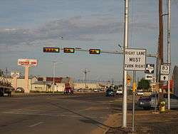
Denver City is a town located partly in Gaines County, but mostly in Yoakum County in the far western portion of the U.S. state of Texas, just a short distance from the New Mexico boundary. It is named for the petroleum company, Denver Productions. The population was 4,479 at the 2010 census. The town is located at the intersection of Texas State Highways 214 and 83.
Denver City | |
|---|---|
| Denver City, Texas | |
 Denver City, Texas | |
| Nickname(s): DC | |
| Motto(s): "A Forest of Steel Giants Against the Daylight Sky", Paul W. Scott | |
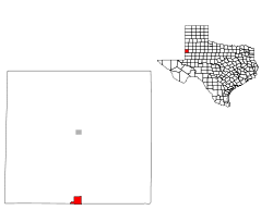
 Location of Denver City, Texas | |
 | |
| Coordinates: 32.9645°N 102.8291°W | |
| Country | United States |
| State | Texas |
| Counties | Yoakum |
| Area | |
| • Total | 2.5 sq mi (6 km2) |
| • Land | 2.5 sq mi (6 km2) |
| • Water | 0.0 sq mi (0 km2) |
| Elevation | 3,573 ft (1,089 m) |
| Population (2010) | |
| • Total | 4,479 |
| • Estimate (2018) | 4,878 |
| • Density | 1,800/sq mi (690/km2) |
| Time zone | UTC-6 (Central (CST)) |
| • Summer (DST) | UTC-5 (CDT) |
| ZIP code | 79323 |
| Area code(s) | 806 |
| FIPS code | 48-19984[1] |
| GNIS feature ID | 1334272[2] |
Oil and ranching remain important to Denver City. The first well was drilled by the wildcatter "Red" Davidson of Fort Worth on the ranch lands of L.P. and Ruth Bennett and her father, Dr. J. R. Smith. Oil gushed to the surface for the first time on October 10, 1935. A part of this Wasson Field, as it is known, is the site of the Yoakum County Park, donated in 1964 by Gene H. Bennett (1921–1998), the youngest son of the Bennetts.[3]
According to the Denver City Chamber of Commerce, Denver City is home to a fully functional hospital, a car dealership, a grocery store, an airport, two hotels, three churches, and six financial institutions.[4]
In 2008, the Denver City Independent School District presented a bond package for new and renovated facilities. Upgrades included a new high school, tennis courts, a junior-high band hall, an industrial arts facility, a sports complex, a maintenance center, an athletics field house, and a bus barn. Renovations included classrooms, science labs, offices and foyer, a parking lot, a main field house, and a bus barn for the junior-high campus.[5]
On May 11, 2013, voters in both Denver City and Yoakum County, as well as Crosby County, also in West Texas, all previously under local-option prohibition laws, approved the sale of liquor.[6]
Geography
Denver City is located at 32°58′07″N 102°49′52″W (32.968580, −102.831218).[7]
According to the United States Census Bureau, Denver City has a total area of 2.5 square miles (6.5 km2), all of it land.
Demographics[8]
| Historical population | |||
|---|---|---|---|
| Census | Pop. | %± | |
| 1950 | 1,858 | — | |
| 1960 | 4,302 | 131.5% | |
| 1970 | 4,133 | −3.9% | |
| 1980 | 4,704 | 13.8% | |
| 1990 | 5,145 | 9.4% | |
| 2000 | 3,985 | −22.5% | |
| 2010 | 4,479 | 12.4% | |
| Est. 2018 | 4,878 | [9] | 8.9% |
| U.S. Decennial Census[10] | |||
As of the census of 2010, 4,479 people, 1,770 households, and 1,578 families resided in the town. The racial makeup of the town was 31.2% White, 1.3% African American, 1% Native American, 0.6% Asian, 63.3% Hispanic or Latino, 0.1 Cuban, and 2.5% from two or more races. Of the 1,770 households, 27.5% had children under the age of 18 living with them, 63.8% were married couples living together, 10.5% had a female householder with no husband present, and 20.4% were not families. About 22.6% had someone living alone who was 65 years of age or older. The average household size was 2.96 and the average family size was 3.27.
In the town, the population was distributed as 34% up to age 19, 5.8% from 20 to 24, 25.7% from 25 to 44, 23.1% from 45 to 64, and 11.5% who were 65 years of age or older. The median age was 32.2 years of age.
According to a 2017 survey, the median income for a household in the town was $52,232, and for a family was $67,630. Males had a median income of $65,495 versus $23,346 for females. The per capita income for the town was $21,297. About 15.8% of families and 16.1% of the population were below the poverty line, including 19% of those under age 18 and 35% of those age 65 or over.
Climate
| Climate data for Denver City, Texas (1981–2010) | |||||||||||||
|---|---|---|---|---|---|---|---|---|---|---|---|---|---|
| Month | Jan | Feb | Mar | Apr | May | Jun | Jul | Aug | Sep | Oct | Nov | Dec | Year |
| Average high °F (°C) | 56 (13) |
60 (16) |
68 (20) |
76 (24) |
84 (29) |
90 (32) |
91 (33) |
91 (33) |
84 (29) |
76 (24) |
65 (18) |
56 (13) |
74.8 (23.8) |
| Average low °F (°C) | 27 (−3) |
31 (−1) |
36 (2) |
44 (7) |
53 (12) |
62 (17) |
66 (19) |
65 (18) |
58 (14) |
47 (8) |
36 (2) |
28 (−2) |
46.1 (7.8) |
| Average precipitation inches (mm) | 0.75 (19) |
0.94 (24) |
0.91 (23) |
1.18 (30) |
2.28 (58) |
2.24 (57) |
2.09 (53) |
2.6 (66) |
2.8 (71) |
1.69 (43) |
0.94 (24) |
0.79 (20) |
19.21 (488) |
| Average snowfall inches (cm) | 1 (2.5) |
0 (0) |
0 (0) |
0.0 (0.0) |
0.0 (0.0) |
0.0 (0.0) |
0.0 (0.0) |
0.0 (0.0) |
0.0 (0.0) |
0.0 (0.0) |
1 (2.5) |
2.0 (5.1) |
4 (10) |
| Source: US Climate Data[11] | |||||||||||||
Notable persons
- Paul Leon Gooch (1928–2013), former alderman and mayor of Denver City, operated Dairy Mart and Broadway Superette, native of Muskogee, Oklahoma, member of Church of Christ, interred at Denver City Memorial Park Cemetery[12]
- Bert Gravitt and Bill Gravitt, inductees of the Texas High School Football Hall of Fame, 2010
- Chad W. Jones, recipient of Bronze Star and ARCOM with Valor awards in Operation Iraqi Freedom He is a 1990 graduate of Denver City High School and the son of Robert W and Linda Jones.
- Robert Edgar Self, Jr. (September 11, 1925 – September 7, 2008) was a businessman, and served as mayor of Denver City from June 1978 to April 1979. Elected to the city council in April 1975, he became mayor upon the resignation of Dan Harris. He served on the first Denver City zoning board and worked to gain approval of the Connor and Santa Fe housing additions. Born in Brownfield in Terry County, Self was an Eagle Scout, a graduate of Brownfield High School and Texas Tech University, and served in the United States Army during World War II.[13]
- Woodson Wade Lindsey, Freida Lonette Lindsey: The Lindsey family was an integral part of Denver City as proprietors of Lindsey Hardware for over 50 years, until the retirement of Woodson Lindsey in 1996.
Recreation[14][15]
- Denver City Heritage Museum
- Denver City Park
- Kiddie Park (unofficial name)
- Yoakum County Swimming Pool
- Yoakum County Park (duck pond)
- Yoakum County Golf Course
- Baseball Park
- Kelly-Dodson Elementary (three playgrounds)
Gallery
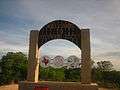 Welcome sign in Denver City
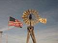 A windmill adjacent to the United States flag greets visitors to Denver City at State Highways 214 and 83.
 The Bennett Plaza, named for ranchers L.P. and Ruth Bennett, offers a respite to travelers.
 Bickley Library
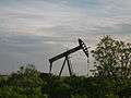 Oil wells pump throughout Denver City
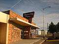 Denver City Press newspaper office
 Denver City downtown
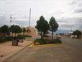 Another view of downtown Denver City
See also
![]()
References
- "U.S. Census website". United States Census Bureau. Retrieved 2008-01-31.
- "US Board on Geographic Names". United States Geological Survey. 2007-10-25. Retrieved 2008-01-31.
- Texas Historical Commission marker, State Highway 114, 1981
- "Denver City Chamber of Commerce". denvercitychamber.com. Retrieved March 12, 2019.
- "Denver City Independent School District Bond Information". www.dcisd.org. Retrieved March 12, 2019.
- "Voters approve sales of alcohol in three elections". Lubbock Avalanche-Journal, May 12, 2013. Retrieved May 13, 2013.
- "US Gazetteer files: 2010, 2000, and 1990". United States Census Bureau. 2011-02-12. Retrieved 2011-04-23.
- "Denver City Demographics". United States Census Bureau. Retrieved March 12, 2019.
- "Population and Housing Unit Estimates". Retrieved October 1, 2019.
- "Census of Population and Housing". Census.gov. Retrieved June 4, 2015.
-
https://www.usclimatedata.com/climate/denver-city/texas/united-states/ustx1876. Retrieved March 12, 2019. Missing or empty
|title=(help) - "Paul Leon Gooch obituary". Lubbock Avalanche-Journal. Retrieved January 30, 2013.
- Lubbock Avalanche-Journal, September 8, 2008
- "Recreation in Denver City Texas". denvercitychamber.com. Retrieved March 12, 2019.
- "Kiddie Park Location". www.google.com. Retrieved March 12, 2019.
External links
Municipalities and communities of Gaines County, Texas, United States | ||
|---|---|---|
| Cities | 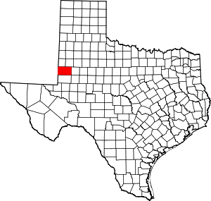 Gaines County map | |
| Town | ||
| CDP | ||
| Footnotes | ‡This populated place also has portions in an adjacent county or counties | |
Municipalities and communities of Yoakum County, Texas, United States | ||
|---|---|---|
| Towns | 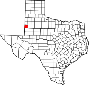 Yoakum County map | |
| Unincorporated community | ||
| Footnotes | ‡This populated place also has portions in an adjacent county or counties | |
| Authority control |
|
|---|