Daxing'anling Prefecture
Daxing'anling Prefecture (Chinese: 大兴安岭地区; pinyin: Dàxīng'ānlǐng Dìqū), also known as Da Hinggan Ling Prefecture, is the northernmost Chinese prefecture-level division, located in Heilongjiang Province. Its area is 46,755 square kilometres (18,052 sq mi) and has a population of 520,000, as of 2004. It is named after the Greater Khingan Range (Daxing'anling; ᠠᠮᠪᠠ᠋ ᡥᡳᠨ᠋ᡤᡤᠠᠨ ᠵᡠᡨ᠊ᡠᠨ; Amba Hinggan Dabagan) Mountains. In 2007 it had a GDP of RMB 6.1 billion and a growth rate of 11.1%. In 2015 Daxing'anling Prefecture had a GDP of RMB 13.49 billion, while a GDP of RMB 15.39 billion in the year 2014.[1]
Daxing'anling Prefecture 大兴安岭地区 | |
|---|---|
Prefecture | |
.jpg) Jiagedaqi the urban center of Daxing'anling | |
.png) Location of Daxing'anling (yellow) in Heilongjiang (light grey); | |
| Coordinates: 52°30′N 123°54′E | |
| Country | People's Republic of China |
| Province | Heilongjiang |
| County-level divisions | 4 administrative zones 1 county-level city 2 counties |
| Township-level divisions | 6 subdistricts 24 towns 11 townships 2 ethnic townships |
| Village-level divisions | 41 residential communities 80 villages |
| Area | |
| • Total | 46,755 km2 (18,052 sq mi) |
| Population (2004) | |
| • Total | 520,000 |
| • Density | 11/km2 (29/sq mi) |
| Time zone | UTC+8 (China Standard) |
| Postal code | 165000 |
| Area code(s) | 0457 |
| ISO 3166 code | CN-HL-27 |
| Daxing'anling Prefecture | |||||||
|---|---|---|---|---|---|---|---|
 "Daxing'anling", as written in Chinese calligraphy | |||||||
| Chinese name | |||||||
| Simplified Chinese | 大兴安岭地区 | ||||||
| Traditional Chinese | 大興安嶺地區 | ||||||
| |||||||
| Manchu name | |||||||
| Manchu script | ᠠᠮᠪᠠ ᡥᡳᠨ᠋ᡤᡤᠠᠨ ᠵᡠᡨ᠊ᡠᠨ ᡳ ᠪᠠ | ||||||
| Romanization | Abma'hingan'dabagan i'ba | ||||||
| Russian name | |||||||
| Russian | Округ Да-Хинган-Лин | ||||||
Administrative divisions
Daxing'anling Prefecture administrates 1 county-level city, 2 counties, and 4 administration zones. These counties and management districts contain 6 urban subdistricts, 24 towns, 11 townships, 2 ethnic townships, 41 residential communities, and 80 villages.
| Map | |||||||
|---|---|---|---|---|---|---|---|
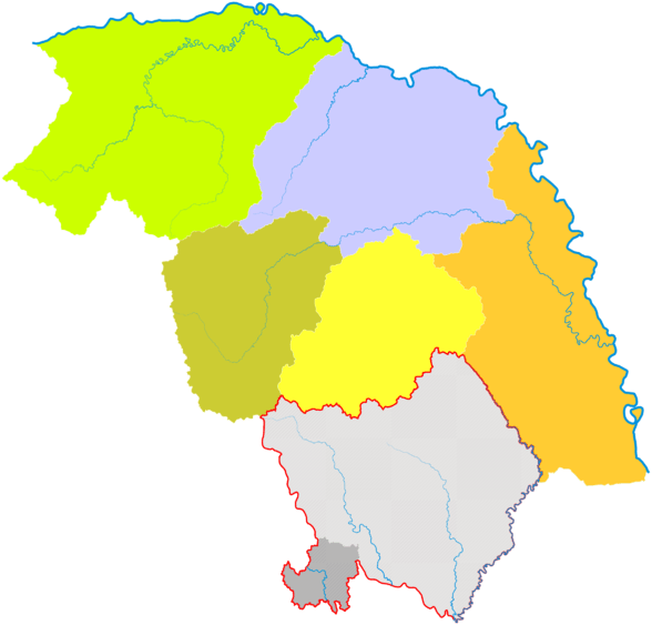 Mohe
(city) Note: Jiagedaqi & Songling
is subordinate to Daxing'anling Prefecture but part of Oroqen Banner in Inner Mongolia. | |||||||
| Name | Hanzi | Hanyu Pinyin | Population (2010 Census) | Area (km²) | Density (/km²) | ||
| City | |||||||
| Mohe city | 漠河市 | Mòhé Shì | 83,414 | 18,367 | 4.5 | ||
| Counties | |||||||
| Tahe County | 塔河县 | Tǎhé Xiàn | 92,473 | 14,103 | 6.6 | ||
| Huma County | 呼玛县 | Hūmǎ Xiàn | 51,861 | 14,300 | 3.6 | ||
| Administrative Zones | |||||||
| Huzhong Administrative Zone* | 呼中行政区 | Hūzhōng Xíngzhèngqū | 45,039 | 9,400 | 4.8 | ||
| Xinlin Administrative Zone* | 新林行政区 | Xīnlín Xíngzhèngqū | 50,859 | 8,700 | 5.8 | ||
| Songling Administrative Zone* | 松岭行政区 | Sōnglǐng Xíngzhèngqū | 33,555 | 16,800 | 2.0 | ||
| Jiagedaqi Administrative Zone* | 加格达奇行政区 | Jiāgédáqí Xíngzhèngqū | 154,363 | 1,587 | 97 | ||
| *All administrative zones are management areas; not administrative divisions registered under the Ministry of Civil Affairs. | |||||||
Forestry divisions
Administrate by the State Forestry Administration's Heilongjiang Daxing'anling Forestry Group Corporation (Chinese: 黑龙江省大兴安岭林业集团公司) with 10 Forestry Bureaux and 61 Woodlands.
| Name | Hanzi | Residence | Woodlands |
|---|---|---|---|
| Songlin Forestry Bureau | 松岭林业局 | Xiaoyangqi Town, Songling | 5 |
| Xinlin Forestry Bureau | 新林林业局 | Xinlin Town, Xinlin | 8 |
| Tahe Forestry Bureau | 塔河林业局 | Tahe Town, Tahe | 6 |
| Huzhong Forestry Bureau | 呼中林业局 | Huzhong Town, Huzhong | 6 |
| Amur Forestry Bureau | 阿木尔林业局 | Jitao Town, Mohe | 6 |
| Tuqiang Forestry Bureau | 图强林业局 | Tuqiang Town, Mohe | 7 |
| Xilinji Forestry Bureau | 西林吉林业局 | Xilinji Town, Mohe | 5 |
| Shibazhan Forestry Bureau | 十八站林业局 | Shibazhan Township, Tahe | 6 |
| Hanjiayuan Forestry Bureau | 韩家园林业局 | Hanjiayuan Town, Huma | 1 |
| Jiagedaqi Forestry Bureau | 加格达奇林业局 | Jiagedaqi District | 10 |
Administrate by Daxing'anling Prefecture Administrative Operation Forestry Bureau (Chinese: 大兴安岭地区行政公署营林局) with 3 County-level Forestry Bureaux and 6 Woodlands.
| Name | Hanzi | Residence | Woodlands |
|---|---|---|---|
| Huma Forestry Bureau | 呼玛县林业局 | Huma Town, Huma | 4 |
| Tahe Forestry Bureau | 塔河县林业局 | Tahe Town, Tahe | 1 |
| Mohe Forestry Bureau | 漠河市林业局 | Xilinji Town, Mohe | 1 |
References
- 2015年黑龙江各市GDP和人均GDP排名 (in Chinese).