Dawn, Missouri
Dawn is an unincorporated community and census-designated place (CDP) in Livingston County, Missouri, United States.[3] As of the 2010 census it had a population of 128.[4]
Dawn, Missouri | |
|---|---|
 Dawn  Dawn | |
| Coordinates: 39°40′6″N 93°38′7″W[1] | |
| Country | United States |
| State | Missouri |
| County | Livingston |
| Area | |
| • Total | 1.31 sq mi (3.39 km2) |
| • Land | 1.31 sq mi (3.39 km2) |
| Elevation | 728 ft (222 m) |
| Population | |
| • Total | 128 |
| • Density | 98/sq mi (37.8/km2) |
| Time zone | UTC-6 (Central (CST)) |
| • Summer (DST) | UTC-5 (CDT) |
| ZIP code | 64638 |
| Area code(s) | 660 |
| FIPS code | 29-18496 |
| GNIS feature ID | 716744[1] |
Dawn was platted in 1853.[5] A post office called Dawn has been in operation since 1852.[6]
Geography
Dawn is located in southwestern Livingston County on Missouri Supplemental Route C, approximately 13 miles (21 km) southwest of Chillicothe, the county seat.
According to the U.S. Census Bureau, the Dawn CDP has an area of 1.3 square miles (3.4 km2), all of it recorded as land.[2] The community is on high ground on the east bank of Shoal Creek, a northeast-flowing tributary of the Grand River and part of the Missouri River watershed.
References
- U.S. Geological Survey Geographic Names Information System: Dawn, Missouri
- "U.S. Gazetteer Files: 2019: Places: Missouri". U.S. Census Bureau Geography Division. Retrieved April 13, 2020.
- U.S. Geological Survey Geographic Names Information System: Dawn, Missouri
- "Total Population: 2010 Census DEC Summary File 1 (P1), Dawn CDP, Missouri". data.census.gov. U.S. Census Bureau. Retrieved April 13, 2020.
- "Livingston County Place Names, 1928–1945". The State Historical Society of Missouri. Archived from the original on June 24, 2016. Retrieved October 30, 2016.
- "Post Offices". Jim Forte Postal History. Retrieved 30 October 2016.
Municipalities and communities of Livingston County, Missouri, United States | ||
|---|---|---|
| Cities | 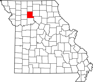 Map of Missouri highlighting Livingston County | |
| Villages | ||
| Townships |
| |
| CDP | ||
| Unincorporated communities | ||
| Ghost towns | ||
This article is issued from Wikipedia. The text is licensed under Creative Commons - Attribution - Sharealike. Additional terms may apply for the media files.