Dasuya
Dasuya (Dasua) is a town and a municipal council in Hoshiarpur district in the state of Punjab, India. It is one of the major subdivisions with 398 villages under its jurisdiction.
Dasuya Dasua | |
|---|---|
Town | |
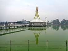
 Dasuya Location in Punjab, India | |
| Coordinates: 31.82°N 75.66°E | |
| Country | |
| State | Punjab |
| District | Hoshiarpur |
| Area | |
| • Total | 420 km2 (160 sq mi) |
| Elevation | 239 m (784 ft) |
| Population (2012) | |
| • Total | 360,505 |
| • Density | 860/km2 (2,200/sq mi) |
| Languages | |
| • Official | Punjabi |
| Time zone | UTC+5:30 (IST) |
| PIN | 144205 |
| Telephone code | 01883 |
| Vehicle registration | PB21 |
| Sex ratio | 1000: 976 ♂/♀ |
| Website | www |
History
According to a report by The Tribune newspaper in 1977, the town is referred to in the ancient Indian epic, the Mahabharata, as being the seat of king Virata. In recognition of this, Dasuya is still referred to as Virat Ki Nagri today.[1]
In the closing decade of the fourteenth century, Dasuya at least twice witnessed the passage of an army during the struggle against the Muslim conquerors, Abu Bakar and Amir Taimur.[2] Later, in December 1557, the army of the incumbent Sultan Akbar, led by his governor of Lahore, Khizr Khan, camped at the town while dealing successfully with a threat posed by Sikandar Sur.[3]
More recently, Dasuya featured in debates related to the emergence of Himachal Pradesh. Verma has noted that "Perhaps no other State of India has suffered as many territorial and political changes in recent times as the Punjab".[4] Within the process of the linguistic reorganization of states, the claim that Dasuya should be incorporated into Himachal Pradesh on the grounds that it was the home of Dogras was rejected because that point was irrelevant to the linguistic issue. Dasuya remained in Punjab when the negotiations culminated in the Punjab Reorganisation Act of 1966.[5]
Demographics
The provisional statistics for 2011 census of India show that Dasuya urban had a population of 56,204 and the Dasuya subdivision is 360,505. The gender ratio is 976:1000::Females: Males (981 for urban and 942 for rural areas). The gender ratio improved from 958 in 2001 to 976 in 2011. The average literacy rate was 76%, which was higher than the national average of 59.5%. Male literacy was 79% and female literacy was 73%. Of the total population, 11% was under 6 years of age.[6]|align=middle}}
| Historical population | ||
|---|---|---|
| Year | Pop. | ±% p.a. |
| 1951 | 295,071 | — |
| 1961 | 343,778 | +1.54% |
| 1971 | 373,345 | +0.83% |
| 1981 | 447,703 | +1.83% |
| 1991 | 260,160 | −5.28% |
| 2001 | 340,494 | +2.73% |
| 2011 | 360,505 | +0.57% |
| source:[7] | ||
Geography
Dasuya is located in Hoshiarpur district of Punjab state in India. at 31.82°N 75.66°E. It has an average elevation of 239 metres (784 ft) from sea level.[8]
Of the major neighbouring population centres, Hoshiarpur lies at a distance of 48 kilometres (30 mi) for Dasuya; Mukerian is 14 kilometres (8.7 mi) away; Jalandhar is 56 kilometres (35 mi); Gurdaspur, 40 kilometres (25 mi); Amritsar, 90 kilometres (56 mi); and Pathankot is 56 kilometres (35 mi) distant.
Transport
The town has a railway station[9] and various road links. It is located on National Highway 1A, which connects Jammu and Kashmir to the rest of India, and state highways connect it with the city of Hoshiarpur as well as Talwara and Hajipur. Other connecting roads link Dasuya with Amritsar, Daulatpur, and Kapurthala.
Tourism
The town is attempting to capitalize on its history in order to attract tourists. To this end, a grant of Rs 10.6 million was given by the Government of India in order to renovate the sarovar and a temple, and it was reported in 2009 that many people attend a historic Sarovar and gurdwara situated at nearby Garna Sahib.[9]
See also
References
- Sharma, Baldev Raj, ed. (1979). "Punjab Gazetteer: Hoshiarpur". Archived from the original on 4 February 2012. Retrieved 21 February 2012.
- Nijjar, Bakhshish Singh (1968). Punjab under the Sultans, 1000-1526 A.D. Delhi. pp. 59, 71.
- Nijjar, Bakhshish Singh (1968). Punjab Under the Great Mughals 1526-1707 A.D. Bombay. pp. 28–37.
- Verma, V. (1995). The emergence of Himachal Pradesh: a survey of constitutional developments. Indus Publishing. p. 243. ISBN 978-81-7387-035-4. Retrieved 21 February 2012.
- Verma, V. (1995). The emergence of Himachal Pradesh: a survey of constitutional developments. Indus Publishing. p. 250. ISBN 978-81-7387-035-4. Retrieved 21 February 2012.
- "Census of India 2001: Data from the 2001 Census, including cities, villages and towns (Provisional)". Census Commission of India. Archived from the original on 16 June 2004. Retrieved 1 November 2008.
- Decadal Variation In Population Since 1901
- Falling Rain Genomics, Inc - Dasua
- "Residents demand train halt at Dasuya". The Tribune. Chandigarh. 16 December 2009. Retrieved 21 February 2012.