Cuyler, New York
Cuyler is a town in Cortland County, New York, United States. The population was 980 at the 2010 census.[3]
Cuyler, New York | |
|---|---|
Town | |
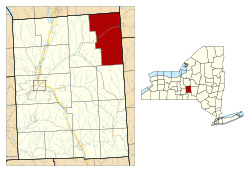 Location within Cortland County and New York | |
 Cuyler Location in the United States  Cuyler Cuyler (New York) | |
| Coordinates: 42°43′29″N 75°56′19″W | |
| Country | United States |
| State | New York |
| County | Cortland |
| Government | |
| • Type | Town Council |
| • Town Supervisor | Louanne Randall (D, R) |
| • Town Council | Members' List
|
| Area | |
| • Total | 43.51 sq mi (112.69 km2) |
| • Land | 43.48 sq mi (112.61 km2) |
| • Water | 0.03 sq mi (0.08 km2) |
| Elevation | 1,670 ft (509 m) |
| Population (2010) | |
| • Total | 980 |
| • Estimate (2016)[2] | 935 |
| • Density | 21.51/sq mi (8.30/km2) |
| Time zone | UTC-5 (Eastern (EST)) |
| • Summer (DST) | UTC-4 (EDT) |
| ZIP code | 13158 |
| Area code(s) | 607 |
| FIPS code | 36-023-19499 |
| GNIS feature ID | 0978881 |
The town is in the northeast corner of Cortland County and is northeast of the city of Cortland.
History
Cuyler was in the former Central New York Military Tract. The area was first settled around 1794. The town was formed from part of the town of Truxton in 1858. In 1865, the population of the town was 1,447.
Geography
According to the United States Census Bureau, the town has a total area of 43.5 square miles (112.7 km2), of which 0.031 square miles (0.08 km2), or 0.07%, is water.[3]
The north town line is the border of Onondaga County, and the east town line is the border of Madison and Chenango counties.
The East Branch of the Tioughnioga River flows southwest through the town. The entire town is within the watershed of the Susquehanna River.
New York State Route 13 is a northeast-southwest highway in Cuyler.
Demographics
| Historical population | |||
|---|---|---|---|
| Census | Pop. | %± | |
| 1860 | 1,658 | — | |
| 1870 | 1,357 | −18.2% | |
| 1880 | 1,382 | 1.8% | |
| 1890 | 1,096 | −20.7% | |
| 1900 | 991 | −9.6% | |
| 1910 | 881 | −11.1% | |
| 1920 | 813 | −7.7% | |
| 1930 | 748 | −8.0% | |
| 1940 | 708 | −5.3% | |
| 1950 | 704 | −0.6% | |
| 1960 | 753 | 7.0% | |
| 1970 | 836 | 11.0% | |
| 1980 | 846 | 1.2% | |
| 1990 | 850 | 0.5% | |
| 2000 | 1,036 | 21.9% | |
| 2010 | 980 | −5.4% | |
| Est. 2016 | 935 | [2] | −4.6% |
| U.S. Decennial Census[4] | |||
As of the census[5] of 2000, there were 1,036 people, 359 households, and 269 families residing in the town. The population density was 23.8 people per square mile (9.2/km2). There were 406 housing units at an average density of 9.3 per square mile (3.6/km2). The racial makeup of the town was 97.49% White, 0.58% Native American, 0.19% Asian, 0.10% from other races, and 1.64% from two or more races. Hispanic or Latino of any race were 0.87% of the population.
There were 359 households, out of which 38.2% had children under the age of 18 living with them, 57.9% were married couples living together, 9.2% had a female householder with no husband present, and 24.8% were non-families. 18.9% of all households were made up of individuals, and 6.4% had someone living alone who was 65 years of age or older. The average household size was 2.89 and the average family size was 3.25.
In the town, the population was spread out, with 30.9% under the age of 18, 7.8% from 18 to 24, 28.8% from 25 to 44, 23.4% from 45 to 64, and 9.2% who were 65 years of age or older. The median age was 34 years. For every 100 females, there were 100.8 males. For every 100 females age 18 and over, there were 105.2 males.
The median income for a household in the town was $36,023, and the median income for a family was $39,896. Males had a median income of $27,614 versus $21,316 for females. The per capita income for the town was $13,111. About 10.3% of families and 16.8% of the population were below the poverty line, including 19.3% of those under age 18 and 18.0% of those age 65 or over.
Communities and locations in Cuyler
- Cowles Settlement – A hamlet in the northeast part of the town by the town line.
- Cuyler – The hamlet of Cuyler on Route 13.
- Cuyler Hill – A hamlet southeast of Cuyler village.
- Keeney – A hamlet near the north town line, north of Tripoli. The community was once known as "Keeney Settlement."
- New Boston – A hamlet in the south part of the town.
- Tripoli – A hamlet northwest of Cuyler village.
References
- "2016 U.S. Gazetteer Files". United States Census Bureau. Retrieved Jul 4, 2017.
- "Population and Housing Unit Estimates". Retrieved June 9, 2017.
- "Geographic Identifiers: 2010 Demographic Profile Data (G001): Cuyler town, Cortland County, New York". U.S. Census Bureau, American Factfinder. Archived from the original on February 12, 2020. Retrieved December 15, 2014.
- "Census of Population and Housing". Census.gov. Retrieved June 4, 2015.
- "U.S. Census website". United States Census Bureau. Retrieved 2008-01-31.
External links
Municipalities and communities of Cortland County, New York, United States | ||
|---|---|---|
| City | 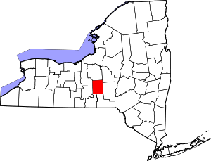 Map of New York highlighting Cortland County | |
| Towns | ||
| Villages | ||
| CDPs | ||
| Hamlets | ||