Crosby, Minnesota
Crosby is a city in Crow Wing County, Minnesota, United States. The population was 2,386 at the 2010 census.[6] It is part of the Brainerd Micropolitan Statistical Area. Crosby is adjacent to its twin city of Ironton, in the Cuyuna iron range.
Crosby | |
|---|---|
| Motto(s): Founded by George H. Crosby | |
 Location of Crosby within Crow Wing County, Minnesota | |
| Coordinates: 46°28′55″N 93°57′29″W | |
| Country | United States |
| State | Minnesota |
| County | Crow Wing |
| Area | |
| • Total | 3.73 sq mi (9.66 km2) |
| • Land | 2.96 sq mi (7.65 km2) |
| • Water | 0.77 sq mi (2.01 km2) |
| Elevation | 1,260 ft (384 m) |
| Population | |
| • Total | 2,386 |
| • Estimate (2018)[3] | 2,341 |
| • Density | 793.23/sq mi (306.22/km2) |
| Time zone | UTC-6 (Central (CST)) |
| • Summer (DST) | UTC-5 (CDT) |
| ZIP code | 56441 |
| Area code(s) | 218 |
| FIPS code | 27-13924[4] |
| GNIS feature ID | 0642478[5] |
| Website | www.crosbymn.govoffice3.com |

History
Crosby was built for the sole purpose of mining. It was named for George H. Crosby, a businessman in the mining industry.[7]
Crosby was the location of Minnesota's worst mining disaster, the Milford Mine disaster.[8] On February 5, 1924, a new tunnel was blasted too close to nearby Foley Lake, and water rushed in, killing 41 miners.
In the 1932 local elections, Karl Emil Nygard was elected president of Crosby's Village Council, making it the first city in the United States to have a Communist mayor.
In August 1957, David G. Simons, a 35-year-old Air Force major, climbed to nearly 102,000 feet (31,000 m) above the earth as part of Project Manhigh. The flight, which was launched from Crosby's 400-foot-deep (120 m) Portsmouth Mine Pit Lake, helped the United States take its fledgling steps into space exploration. Simons returned to Crosby in 2007 to mark the anniversary of the project.[9]
Geography
According to the United States Census Bureau, the city has a total area of 3.73 square miles (9.66 km2), of which 3.07 square miles (7.95 km2) is land and 0.66 square miles (1.71 km2) is water.[10]
Infrastructure
Demographics
| Historical population | |||
|---|---|---|---|
| Census | Pop. | %± | |
| 1920 | 3,500 | — | |
| 1930 | 3,451 | −1.4% | |
| 1940 | 2,954 | −14.4% | |
| 1950 | 2,777 | −6.0% | |
| 1960 | 2,629 | −5.3% | |
| 1970 | 2,241 | −14.8% | |
| 1980 | 2,218 | −1.0% | |
| 1990 | 2,073 | −6.5% | |
| 2000 | 2,299 | 10.9% | |
| 2010 | 2,386 | 3.8% | |
| Est. 2018 | 2,341 | [3] | −1.9% |
| U.S. Decennial Census | |||
2010 census
As of the census[2] of 2010, there were 2,386 people, 1,065 households, and 552 families living in the city. The population density was 777.2 inhabitants per square mile (300.1/km2). There were 1,241 housing units at an average density of 404.2 per square mile (156.1/km2). The racial makeup of the city was 96.3% White, 0.4% African American, 1.1% Native American, 0.6% Asian, 0.1% from other races, and 1.5% from two or more races. Hispanic or Latino of any race were 1.3% of the population.
There were 1,065 households, of which 27.5% had children under the age of 18 living with them, 32.3% were married couples living together, 13.8% had a female householder with no husband present, 5.7% had a male householder with no wife present, and 48.2% were non-families. 42.3% of all households were made up of individuals, and 22.8% had someone living alone who was 65 years of age or older. The average household size was 2.13 and the average family size was 2.88.
The median age in the city was 43.2 years. 23.3% of residents were under the age of 18; 7.7% were between the ages of 18 and 24; 20.5% were from 25 to 44; 24.3% were from 45 to 64; and 24.2% were 65 years of age or older. The gender makeup of the city was 46.7% male and 53.3% female.
2000 census
As of the census[4] of 2000, there were 2,299 people, 989 households, and 554 families living in the city. The population density was 755.0 people per square mile (292.0/km2). There were 1,081 housing units at an average density of 355.0 per square mile (137.3/km2). The racial makeup of the city was 97.69% White, 0.04% African American, 0.91% Native American, 0.22% Asian, 0.09% Pacific Islander, 0.35% from other races, and 0.70% from two or more races. Hispanic or Latino of any race were 1.00% of the population. 23.9% were of German, 14.1% Norwegian, 11.7% Swedish, 9.6% American and 7.0% English ancestry according to Census 2000.
There were 989 households, out of which 27.6% had children under the age of 18 living with them, 40.3% were married couples living together, 11.8% had a female householder with no husband present, and 43.9% were non-families. 39.4% of all households were made up of individuals, and 21.2% had someone living alone who was 65 years of age or older. The average household size was 2.18 and the average family size was 2.93.
In the city, the population was spread out, with 24.4% under the age of 18, 8.1% from 18 to 24, 21.9% from 25 to 44, 20.0% from 45 to 64, and 25.6% who were 65 years of age or older. The median age was 42 years. For every 100 females, there were 85.3 males. For every 100 females age 18 and over, there were 79.5 males.
The median income for a household in the city was $24,053, and the median income for a family was $31,629. Males had a median income of $28,879 versus $20,842 for females. The per capita income for the city was $15,465. About 15.6% of families and 16.9% of the population were below the poverty line, including 17.8% of those under age 18 and 12.9% of those age 65 or over.
Notable people
- Robert A. Good, physician
- Robert M. Polich, Sr., World War II Pilot, Prisoner of War, Distinguished Flying Cross Recipient
- Anthony "The Bullet" Bonsante, Professional Boxer
- Nick Anderson (baseball), MLB pitcher for the Miami Marlins
- Thomas W. Simons Jr., U.S. Ambassador to Poland and Pakistan
References
- "2017 U.S. Gazetteer Files". United States Census Bureau. Retrieved Jan 3, 2019.
- "U.S. Census website". United States Census Bureau. Retrieved 2012-11-13.
- "Population and Housing Unit Estimates". Retrieved December 15, 2019.
- "U.S. Census website". United States Census Bureau. Retrieved 2008-01-31.
- "US Board on Geographic Names". United States Geological Survey. 2007-10-25. Retrieved 2008-01-31.
- "2010 Census Redistricting Data (Public Law 94-171) Summary File". American FactFinder. U.S. Census Bureau, 2010 Census. Retrieved 23 April 2011.
- Warren Upham (1920). Minnesota Geographic Names: Their Origin and Historic Significance. Minnesota Historical Society. p. 156.
- "Brainerd-Crosby Lakes Area Trail System | Cuyuna Country | Crosby - Ironton | Attractions". Archived from the original on 2008-09-07. Retrieved 2008-01-24.
- "Archived copy". Archived from the original on 2010-04-25. Retrieved 2010-04-22.CS1 maint: archived copy as title (link)
- "US Gazetteer files 2010". United States Census Bureau. Archived from the original on January 12, 2012. Retrieved 2012-11-13.
External links
Municipalities and communities of Crow Wing County, Minnesota, United States | ||
|---|---|---|
| Cities | 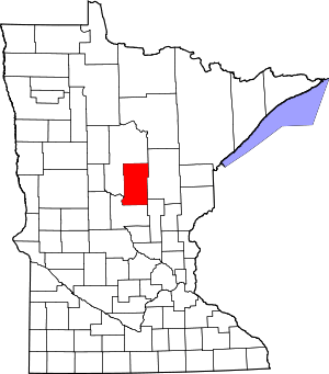 Map of Minnesota highlighting Crow Wing County | |
| Townships | ||
| Unorganized territories | ||
| CDP | ||
| Unincorporated communities | ||
| Indian reservation | ||
| Ghost towns | ||
| Footnotes | ‡This populated place also has portions in an adjacent county or counties | |
Cities in the Brainerd Lakes area, Minnesota | |||||
|---|---|---|---|---|---|
| Core City | 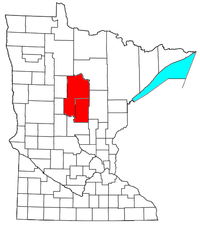 | ||||
| Surrounding communities |
| ||||
| Counties | |||||
† indicates a county seat. ‡ indicates that it is partially in the micropolitan area. § indicates a CDP. | |||||
| Authority control |
|
|---|