Croesyceiliog
Croesyceiliog (Welsh: [ˌkrɔɨs ə ˈkɛiljɔɡ], Cockerel's Cross) is a suburb of Cwmbran, Wales.
| Croesyceiliog | |
|---|---|
 Croesyceiliog Comprehensive School | |
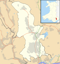 Croesyceiliog Location within Torfaen | |
| Area | 2.18 km2 (0.84 sq mi) [1] |
| Population | 5,246 (2011)[2] |
| • Density | 2,406/km2 (6,230/sq mi) |
| GSS code | W04000761 |
| OS grid reference | ST 305 965 |
| Community |
|
| Principal area | |
| Ceremonial county | |
| Country | Wales |
| Sovereign state | United Kingdom |
| Post town | CWMBRAN |
| Postcode district | NP44 |
| Dialling code | 01633 |
| Police | Gwent |
| Fire | South Wales |
| Ambulance | Welsh |
| UK Parliament | |
| Senedd Cymru – Welsh Parliament |
|
Housing
Croesyceiliog is primarily a residential district and contains a wide variety of housing from Victorian terraces and even older Welsh cottages to property built between 1930 and 1970 and newer developments within the area. Most of the housing was built in the 1950s and 1960s as part of the development of Cwmbran New Town.
Facilities
The main shopping precinct is Edlogan Square and contains, among others, a newsagent, a pharmacy, a grocer and a Fish & Chip Shop/Chinese Take-away. The 'Six in Hand', one of the area's two pubs, is also here: the other, 'The Upper Cock', is on The Highway. There is a smaller shopping precinct on North Road that includes a Co-operative Convenience store, hair salon and a doctor's surgery. There is an old/unused Texaco Petrol Station on The Highway and a corner shop & hair salon opposite 'The Upper Cock'. Adjacent to 'The Upper Cock' is Croesyceiliog Cricket and Rugby Club. Croesyceiliog Cricket Club currently play in the Glamorgan and Monmouthshire League, while Croesyceiliog Rugby Club play in the Welsh Division Three East League. Croesyceiliog also has lawn bowls team which play at Woodland Road Sports Grounds.
The area is served by Croesyceiliog Comprehensive School, and a primary school on North Road (Croesyceiliog Primary School). There is a Baptist chapel on Chapel Lane, Pontrhydyrun Baptist Church and an Anglican church named St Mary's Church on Bryn Eglwys (literally 'Church Hill'). Woodland Road Park is a recreation area which contains a bowling green, rugby pitch, tennis courts, outdoor paddling pool and adventure playground.
The former Gwent County Hall was located here.[3] Until 2012 it provided the main administrative base for Monmouthshire County Council (even though it was outside that administrative area) and Gwent Police, and also some offices for Torfaen County Borough Council. The demolition of the premises was required as a result of concrete cancer, and took place in 2013.[4]
Developments
The community, like many in Torfaen, is expanding. New housing estates have been built: Woodland View (2002) and Stonebridge Park (2006/7).
Census data
At the 2011 Census the following information was captured:
Electoral wards
For elections, Croesyceiliog is split into two electoral wards: Croesyceiliog North and Croesyceiliog South.
- For elections to the UK parliament, both wards are part of the constituency of Monmouth.
- For elections to the Senedd, both wards are part of the constituency of Monmouth.
- For elections to Torfaen County Borough Council, Croesyceiliog North returns 2 councillors, and Croesyceiliog South returns 1 councillor.
- For elections to Croesyceiliog and Llanyrafon Community Council, Croesyceiliog North returns 6 councillors, and Croesyceiliog South returns 2 councillors.
People from Croesyceiliog
See also
Communities near Croesyceiliog | ||||||||||
|---|---|---|---|---|---|---|---|---|---|---|
| ||||||||||
References
- "2011 Census:Quick Statistics:Population Density for Croesyceiliog". Office for National Statistics. Retrieved 29 November 2013.
- "2011 Census:Key Statistics:Key Figures for Croesyceiliog". Office for National Statistics. Retrieved 25 November 2013.
- Photo of Gwent County Hall
- South Wales Argus, Demolition of Cwmbran's County Hall continues, 5 April 2013. Retrieved 16 July 2013
- "2011 Census, Age Structure for Croesyceiliog". Office for National Statistics. Retrieved 26 November 2013.
External links
- Croesyceiliog Community Council website
- Croesyceiliog Cricket Club
- Croesyceiliog Canoe Club
- Pontrhydyrun Baptist Church
- St Mary's Church, Croesyceiliog
| Principal settlements |  | |
|---|---|---|
| Electoral wards | ||
| Communities | ||
| Places of interest | ||
| Rivers and canals |
| |
| Topics | ||