Cornagunleog
Cornagunleog (from Irish: Cor na gCoinnleóg, meaning "The Round Hill of the Crop Stubbles") is a townland in the civil parish of Templeport, County Cavan, Ireland. It lies in the Roman Catholic parish of Templeport and barony of Tullyhaw.
Geography
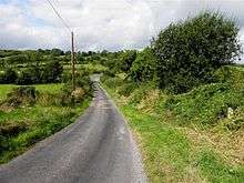
Cornagunleog is bounded on the north by Stranadarragh townland, on the west by Ballymagirril and Greagh townlands, on the south by Knocks and Glebe townlands in County Leitrim and on the east by Boley townland. Its chief geographical features are a stream, a wood and dug wells. Cornagunleog is traversed by the L1037 road, minor roads and rural lanes. The townland covers 183 statute acres.[1]
History
Until the late 18th century Cornagunleog formed part of the modern townland of Stranadarragh so its history is the same until then.
The 1790 Cavan Carvaghs list spells the townland name as Curnegunlieg.[2]
Lowther Kirkwood of Mullinagrave, parish of Templeport, Co. Cavan, gentleman made the following will:
2 July 1804. To his grandnephew Lowther Brien, city of Dublin, attorney, and his heirs his lands of Awengallis, Ballylenan, Ballymagirill, Stranadarragh, Carnagimlie, Cullagh, Drumleden, Leitry [Leitra], Corlagh, Lananleragh [Lannanerriagh], Gowlanlea and Drumlogher, Co. Cavan, held under lease from the Beresford family. He had begun a suit in Chancery, Ireland, against John Brien, late of Salvon, Co. Fermanagh, deceased, for setting aside a fradulent deed obtained by said John Brien, which suit against the representatives is to be continued by said Lowther Brien, his sole exor. Witnesses: John Johnston and Andrew Rutledge, both of Ballymagiril, and Thos. Stephenson, Drumleaden, Co. Cavan, gent. Memorial witnessed by: said Andrew Rutledge, and John Balfour, city of Dublin, attorney.[3]
The Tithe Applotment Books for 1827 list sixteen tithepayers in the townland.[4][5]
In 1833 one person in Cornagunleog was registered as a keeper of weapons- John Dolan.[6]
The Cornagunleog Valuation Office Field books are available for October 1839.[7]
In 1841 the population of the townland was 97, being 49 males and 48 females. There were sixteen houses in the townland, one of which was uninhabited.[8]
In 1851 the population of the townland was 56, being 31 males and 25 females, the reduction being due to the Great Famine (Ireland). There were eleven houses in the townland, one of which was uninhabited.[9]
Griffith's Valuation of 1857 lists twelve landholders in the townland.[10]
On 6 July 1857 the Incumbered Estates Commission published the following notice[11]-
In the Matter of the Estate of James Brien, Geo. Brien, Edward Brien and Francis Brien, Owners. Exparte by Isabella Crummer, Petitioner. The commissioners having ordered a Sale of the Lands of Shanadaragh and Curnagunlogh, Cullegh, Drumlohgher, Drumledin, Sananaragh, and Drumledin, and Corlough, situate in the Barony of Tullyhaw, and County of Cavan, held under lease dated 10 April 1718, from the Bishop Raphoe, for lives renewable for ever, and which Lands are included in the denominations of Ballymagord, Owngally, Gortneglough, Drumedin or Ballylennin, in said lease mentioned:
In 1861 the population of the townland was 58, being 29 males and 29 females. There were ten houses in the townland and all were inhabited.[12]
In 1871 the population of the townland was 55, being 32 males and 23 females. There were ten houses in the townland, all were inhabited.[13]
In 1881 the population of the townland was 66, being 32 males and 34 females. There were eleven houses in the townland, all were inhabited.[14]
In 1891 the population of the townland was 57, being 28 males and 29 females. There were eleven houses in the townland, all were inhabited.[15]
In the 1901 census of Ireland, there are twelve families listed in the townland, [16] and in the 1911 census of Ireland, there are only eleven families listed in the townland.[17]
Antiquities
The chief structures of historical interest in the townland are
References
- "IreAtlas". Retrieved 29 February 2012.
- Registry of Deeds (Ireland); Eustace, P.B.; Ellis, E.; Irish Manuscripts Commission (1984). Abstracts of Wills: 1785-1832. Stationery Office. Retrieved 16 April 2016.
- "The Tithe Applotment Books, 1823-37". titheapplotmentbooks.nationalarchives.ie. Retrieved 16 April 2016.
- "The Tithe Applotment Books, 1823-37". titheapplotmentbooks.nationalarchives.ie. Retrieved 16 April 2016.
- "Griffith's Valuation". askaboutireland.ie. Retrieved 16 April 2016.
- "National Archives: Census of Ireland 1901". census.nationalarchives.ie. Retrieved 16 April 2016.
- "National Archives: Census of Ireland 1911". census.nationalarchives.ie. Retrieved 16 April 2016.
- Site numbers 421 in “Archaeological Inventory of County Cavan”, Patrick O’Donovan, 1995, where it is described as- Raised circular area (int. diam. c. 37m WNW-ESE; c. 35m NNE-SSW) enclosed by a substantial earthen bank and a wide, deep fosse. An earlier report (OPW 1969) noted a break in the bank at SE with accompanying causeway which presumably represents the original entrance. From SE-S-W the site is skirted by a stream which forms part of the border between counties Cavan and Leitrim. Densely overgrown with vegetation.
- Site numbers 422 in "Archaeological Inventory of County Cavan", Patrick O’Donovan, 1995, where it is described as- Raised circular area (int. diam. 30.8m) enclosed by vague traces of a fosse, identifiable only from S-W-NW. An earlier report recorded a low earthen bank at the upper edge of the scarp from WNW-NW and suggested that the original entrance may have been at SE.
External links
Places in County Cavan | ||
|---|---|---|
| Towns |  | |
| Villages |
| |
| Townlands | ||
| ||