Cooroy, Queensland
Cooroy is a town and a locality in the Shire of Noosa, Queensland, Australia,[2][3] but between 2008 and 2013 it was in Sunshine Coast Region.
| Cooroy Sunshine Coast, Queensland | |||||||||||||||
|---|---|---|---|---|---|---|---|---|---|---|---|---|---|---|---|
 Myall Street, Cooroy | |||||||||||||||
 Cooroy | |||||||||||||||
| Coordinates | 26.4166°S 152.9119°E | ||||||||||||||
| Population | 3,791 (2016 census)[1] | ||||||||||||||
| • Density | 123.08/km2 (318.8/sq mi) | ||||||||||||||
| Established | 1885 | ||||||||||||||
| Postcode(s) | 4563 | ||||||||||||||
| Area | 30.8 km2 (11.9 sq mi) | ||||||||||||||
| Location | 22 km (14 mi) W of Noosa Heads | ||||||||||||||
| LGA(s) | Shire of Noosa | ||||||||||||||
| State electorate(s) | |||||||||||||||
| Federal Division(s) | Wide Bay | ||||||||||||||
| |||||||||||||||
Geography
Cooroy is in the hinterland of the northern Sunshine Coast hinterland about 22 kilometres (14 mi) west of Noosa Heads. The Bruce Highway runs through the locality from south-east to north-west, bypassing the town. The Cooroy Noosa Road (State Route 6) runs north through the town from the Bruce Highway, then turns east.[4]
History
Cooroy's name came from Mount Cooroy, which was originally called Coorooey, from an Aboriginal word for possum, kurui.[5]
The area was explored by timber-cutters as early as 1863. Cooroy's main industry developed from timber, having two operating sawmills, into dairying and fruit growing. In 1915, a butter factory opened.[6]
Cooroy railway station was opened in 1891 and in the same year a post office opened.[6] A town survey was conducted in 1907.
Cooroy State School opened in 1909. Cooroy West State School opened in 1911 but closed in 1962.[7]
On 23 January 1961 a secondary department was added to Cooroy State School until the Cooroy State High School was opened as a separate school on 23 January 1963. In 1967 it became Noosa District State High School. In 2007, it was Cooroora Secondary College at Pomona which was merged into Noosa District State High School, with the Pomona campus being used for the younger students and Cooroy campus being used for the older students.[7]
Noosa Christian College opened on 28 January 2003 as a primary school with 37 students. In 2007 it expanded to offer secondary classes.[7][8]
The town was bisected by the Bruce Highway until a bypass was built in 1994.[9]
The Cooroy Library opened in 2010.[10]
Heritage listings
Cooroy has a number of heritage-listed sites, including:
- Lower Mill Road: Cooroy Lower Mill Site Kiln[11]
- 33 Maple Street: Cooroy Post Office[12]
- 14 Myall Street: Cooroy railway station[13]
Amenities
Cooroy has one hotel, a library, a police station, a golf club, a bowls club, the RSL club and sub branch, a selection of cafes and restaurants, unique retail outlets and a range of accommodation options. Noosa Botanical Gardens is situated on Lake MacDonald just outside the town and several of the Noosa Trails are accessible in Cooroy. An RV parking area has opened adjacent to the town sewerage works.
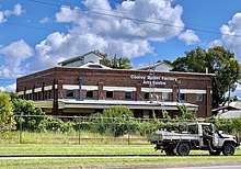
The Shire of Noosa operates a library at 9 Maple Street.[14] In 1991 Noosa Shire Council purchased former Butter Factory buildings for use as a community centre.
Community service groups
- Cooroy Memorial Hall Association Inc. (based in Cooroy)
- Cooroy Area Residents Association Inc.
- Cooroy Chamber of Commerce
- Cooroy-Pomona RSL Sub-Branch, (based in Cooroy)
- Cooroy-Pomona Lions Club (Mountain Lions), (Based in Pomona)
- Rotary Club of Cooroy
- New Training Ship Sheean, Australian Navy Cadets, (Established in Cooroy in 2002 and now Based in Tewantin since 2006)
- 128th Army Cadet Unit, Australian Army Cadets, (Based in Yandina)
- No. 207 Squadron, Australian Air Force Cadets, (Based in Nambour)
- Cooroy Scout Group
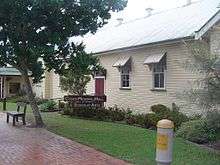
The Cooroy branch of the Queensland Country Women's Association meets at the Cooroy Memorial Hall & School of Arts at 23 Maple Street.[15]
Schools
Cooroy State School is a primary (P-6) school for boys and girls operated by the Queensland Government at 59 Elm Street. In 2016, the school had an enrolment of 545 students with 40 teachers (34 full-time equivalent) and 24 non-teaching staff (15 full-time equivalent).[16]
Noosa District State High School is a secondary (7-12) school for boys and girls operated by the Queendland Government over two campuses, one at 120 Summit Road, Pomona, for Years 7-8 and the other at Tulip Street in Cooroy for Years 9-12. In 2016, the school had a total enrolment of 1335 students with 111 teachers (106 full-time equivalent) and 48 non-teaching staff (40 full-time equivalent).[17]
Noosa Christian College is a primary and secondary school (P-12) for boys and girls operated by Adventist Schools Australia at 20 Cooroy Belli Creek Road. In 2016, the school had an enrolment of 243 students with 21 teachers (19.1 full-time equivalent) and 14 non-teaching staff.[18]
Cooroy Community Kindergarten (CCK) is at 13-15 Maple Street.[19]
Notable residents
- Major General John Cantwell, AO, DSC (Retd.) - former Deputy Chief of Army
- Marayke Jonkers - Bronze and Silver medal Paralympic swimmer
Transport
Cooroy railway station is serviced by two daily Queensland Rail City network services in each direction.[20]
See also
References
- Australian Bureau of Statistics (27 June 2017). "Cooroy (SSC)". 2016 Census QuickStats. Retrieved 17 October 2017.

- "Cooroy - town in Shire of Noosa (entry 8317)". Queensland Place Names. Queensland Government. Retrieved 17 October 2017.
- "Cooroy - locality in Shire of Noosa (entry 48584)". Queensland Place Names. Queensland Government. Retrieved 17 October 2017.
- Google (13 August 2019). "Cooroy, Queensland" (Map). Google Maps. Google. Retrieved 13 August 2019.
- South East Queensland - Place Names Archived 22 June 2005 at the Wayback Machine 16 December 2006
- Environmental Protection Agency (Queensland) (2000). Heritage Trails of the Great South East. State of Queensland. p. 143. ISBN 0-7345-1008-X.
- Queensland Family History Society (2010), Queensland schools past and present (Version 1.01 ed.), Queensland Family History Society, ISBN 978-1-921171-26-0
- "Facts & Figures". Noosa Christian College. Archived from the original on 17 October 2017. Retrieved 17 October 2017.
- Queensland Transport Annual Report 1993-1994
- "Public Libraries Statistical Bulletin 2016-17" (PDF). Public Libraries Connect. State Library of Queensland. November 2017. p. 15. Archived (PDF) from the original on 30 January 2018. Retrieved 30 January 2018.
- "Cooroy Lower Mill Site Kiln (entry 602688)". Queensland Heritage Register. Queensland Heritage Council. Retrieved 14 July 2013.
- "Cooroy Post Office (Place ID 106202)". Australian Heritage Database. Department of the Environment. Retrieved 1 October 2018.
- "Cooroy Railway Station (entry 602381)". Queensland Heritage Register. Queensland Heritage Council. Retrieved 14 July 2013.
- "Noosa Libraries". Noosa Council. Retrieved 19 January 2018.
- "Find Your Closest Branch". Queensland Country Women's Association. Retrieved 22 June 2020.
- "Annual Report 2016" (PDF). Cooroy State School. Archived (PDF) from the original on 17 October 2017. Retrieved 17 October 2017.
- "Annual Report 2016" (PDF). Noosa District State High School. Archived (PDF) from the original on 17 October 2017. Retrieved 17 October 2017.
- "2016 Annual Report". Noosa Christian College. Archived from the original on 17 October 2017. Retrieved 17 October 2017.
- "Cooroy Community Kindergarten". Lady Gowrie. Retrieved 17 October 2017.
- "Sunshine Coast Line timetable". TransLink. 2 March 2020.
External links
- Cooroy Website
- Cooroy Area Residents Association Inc
- Cooroy Rotary Club
- The Cooroy Mobile App
- Christmas in Cooroy
- Cooroy Fusion Festival
- University of Queensland: Queensland Places: Cooroy
- "Walk Cooroy" (PDF) (brochure). Sunshine Coast Regional Council. Archived (PDF) from the original on 17 October 2017.
- Town map of Cooroy, 1978