Colorado State Highway 72
State Highway 72 (SH 72) is a 51-mile-long (82 km) state highway passing through the foothills and the eastern edge of the Front Range. Its southern terminus is at Interstate 70 (I-70) in Wheat Ridge, and its northern terminus is at SH 7 east of Allenspark.
| ||||
|---|---|---|---|---|
 Map of north central Colorado with SH 72 highlighted in red | ||||
| Route information | ||||
| Maintained by CDOT | ||||
| Length | 51.01 mi[1] (82.09 km) | |||
| Major junctions | ||||
| South end | ||||
| ||||
| North end | ||||
| Location | ||||
| Counties | Jefferson, Boulder, Gilpin | |||
| Highway system | ||||
Colorado State Highways
| ||||

Route description
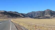
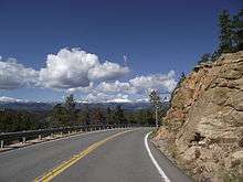
The route is a mainly rural, scenic, mountainous highway; not having many junctions. It begins at I-70 (Exit 266) in Wheat Ridge as Ward Road. It continues north through the western parts of Arvada where it becomes Coal Creek Canyon Rd. The highway continues west-north-west through Coal Creek Canyon and aptly named Wondervu, across the Union Pacific Railroad tracks at Pinecliffe, eventually joining the Peak to Peak Scenic Byway northbound. For three miles along the Byway it coincides with SH 119. The two routes diverge at Nederland. From Nederland, SH 72 continues north along the Byway past Ward to its terminus with SH 7 east of Allenspark.
History
The route was established in the 1920s, when it began at 46th Avenue in Denver and headed northwest to Nederland. The section of the present-day SH 72 north of Nederland was designated as SH 160. By 1936, the southeastern terminus had been moved to SH 58, itself since relocated. The section from SH 93 east was paved by 1946, and the route was paved entirely by 1958. In 1968, SH 160 was deleted and SH 72 took the route from Nederland to Raymond.[2]
Major intersections
| County | Location | mi | km | Destinations | Notes | |||
|---|---|---|---|---|---|---|---|---|
| Jefferson | Wheat Ridge | 0.00 | 0.00 | Southern terminus; I-70 exit 266; interchange | ||||
| Arvada | 10.65 | 17.14 | ||||||
| Boulder |
No major junctions | |||||||
| Gilpin |
No major junctions | |||||||
| Boulder | Nederland | 29.37 | 47.27 | South end of SH 119 overlap | ||||
| 32.37 | 52.09 | North end of SH 119 overlap | ||||||
| | 54.06 | 87.00 | Northern terminus | |||||
1.000 mi = 1.609 km; 1.000 km = 0.621 mi
| ||||||||
References
- "Segment list for SH 71". Retrieved 2007-05-12.
- Salek, Matthew E. "Colorado Routes 60-79". Retrieved 2010-05-29.