Colorado State Highway 65
State Highway 65 (SH 65) is a state highway in Colorado that crosses the Grand Mesa. The highway along with a road to Lands End Overlook were designated as the Grand Mesa Scenic and Historic Byway in 1996.[2] SH 65's southern terminus is at SH 92 east of Delta, and its northern terminus is at Interstate 70 (I-70) and U.S. Route 6 (US 6) northeast of Palisade.
| ||||
|---|---|---|---|---|

SH 65 highlighted in red | ||||
| Route information | ||||
| Maintained by CDOT | ||||
| Length | 61.377 mi[1] (98.777 km) | |||
| Major junctions | ||||
| South end | ||||
| North end | ||||
| Location | ||||
| Counties | Delta, Mesa | |||
| Highway system | ||||
Colorado State Highways
| ||||


Route description
SH 65 runs 61.4 miles (98.8 km), starting at a junction with SH 92 east of Delta. The highway heads north, crossing the Gunnison River, through Orchard City and Cedaredge. The highway then enters Grand Mesa National Forest climbing to the top of Grand Mesa. It then drops down the north side of Grand Mesa, ending at a junction with I-70 northeast of Palisade.
Grand Mesa Scenic and Historic Byway
The byway runs north from Cedaredge along Highway 65, to the top of the Grand Mesa at more than 10,000 feet (3,000 m). It also includes Land's End Road to the Land's End Observatory from Highway 65. The byway continues past Island Lake, one of more than 300 trout-filled lakes in Grand Mesa National Forest. On the north side of the Mesa are the towns of Mesa, Collbran, and Powderhorn Ski Resort.[3][4] The byway continues along De Beque Canyon, with its colorful sandstone bluffs, and eventually meets Interstate 70 in the town of De Beque.
Historic and scenic byway designations:
- National Scenic Byway received in 1996.
- Colorado Scenic and Historic Byway by the Colorado Department of Transportation received in 1991.
- Forest Service Byway received in 1992.[3]
Scenic Overlooks include:[4]
- Cedaredge overlook - an easy access overlook
- Land O Lakes overlook - a 1/4 mile moderate walk by foot
- Island Lake - an easy access overlook with restrooms and accessible boat ramp
- Grand Mesa Visitor Center - easy to moderate access with restrooms
- Mesa Lakes Lodge area - an easy to moderate access with restrooms
- Jumbo Lakes area - an easy access overlook with restrooms
- Skyway Point - an easy access
- Powderhorn - an easy access overlook with restrooms
- I-70 pullout and interpretation information

Major intersections
| County | Location | mi | km | Destinations | Notes |
|---|---|---|---|---|---|
| Delta | Saunders | 0.000 | 0.000 | Southern terminus | |
| Cedaredge | 10.856 | 17.471 | Grand Mesa Scenic and Historic Byway begins | ||
| Mesa | | 51.203 | 82.403 | Western terminus of SH 330 | |
| | 61.377 | 98.777 | Northern terminus | ||
| 1.000 mi = 1.609 km; 1.000 km = 0.621 mi | |||||
Gallery
 Cliff edge on Grand Mesa
 Observatory located on the western edge of the Grand Mesa
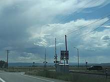
 Near mile marker 58, or about 3.5 miles from Interstate-70.
See also
References
- "Segment list for SH 65". Retrieved January 21, 2011.
- "Grand Mesa Scenic and Historic Byway". America's Byways. Retrieved January 21, 2011.
- Grand Mesa Scenic Byway Grand Mesa Scenic and Historic Byway Association. 2010-2011.
- Grand Mesa Scenic Byway Map Archived September 15, 2013, at the Wayback Machine Grand Mesa Scenic and Historic Byway Association. 2010-2011.
External links
| Wikimedia Commons has media related to Colorado State Highway 65. |