Coleman, Michigan
Coleman is a city in Midland County of the U.S. state of Michigan. The population was 1,243 at the 2010 census.
Coleman, Michigan | |
|---|---|
| City of Coleman | |
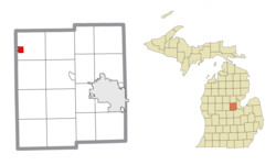 Location within Midland County | |
 Coleman Location within the state of Michigan | |
| Coordinates: 43°45′24″N 84°35′09″W | |
| Country | United States |
| State | Michigan |
| County | Midland |
| Settled | 1868 |
| Incorporated | 1887 (village) 1905 (city) |
| Government | |
| • Type | Mayor–council |
| • Mayor | Steve Miller |
| • Mayor pro tem | Frank Kroll |
| Area | |
| • Total | 1.26 sq mi (3.26 km2) |
| • Land | 1.25 sq mi (3.23 km2) |
| • Water | 0.01 sq mi (0.03 km2) |
| Elevation | 758 ft (231 m) |
| Population | |
| • Total | 1,243 |
| • Estimate (2018)[3] | 1,194 |
| • Density | 961.51/sq mi (371.19/km2) |
| Time zone | UTC-5 (Eastern (EST)) |
| • Summer (DST) | UTC-4 (EDT) |
| ZIP code(s) | 48618 |
| Area code(s) | 989 |
| FIPS code | 26-17100[4] |
| GNIS feature ID | 0623595[5] |
| Website | Official website |
History
Coleman began with the building of a sawmill here in 1870. The following year a station of the Pere Marquette Railroad was opened. It was incorporated as a village in 1887 and as a city in 1905.[6]
Geography
According to the United States Census Bureau, the city has a total area of 1.27 square miles (3.29 km2), of which 1.26 square miles (3.26 km2) is land and 0.01 square miles (0.03 km2) is water.[7]
Demographics
| Historical population | |||
|---|---|---|---|
| Census | Pop. | %± | |
| 1880 | 111 | — | |
| 1890 | 540 | 386.5% | |
| 1900 | 1,014 | 87.8% | |
| 1910 | 909 | −10.4% | |
| 1920 | 769 | −15.4% | |
| 1930 | 667 | −13.3% | |
| 1940 | 722 | 8.2% | |
| 1950 | 1,024 | 41.8% | |
| 1960 | 1,264 | 23.4% | |
| 1970 | 1,295 | 2.5% | |
| 1980 | 1,429 | 10.3% | |
| 1990 | 1,237 | −13.4% | |
| 2000 | 1,296 | 4.8% | |
| 2010 | 1,243 | −4.1% | |
| Est. 2018 | 1,194 | [3] | −3.9% |
| U.S. Decennial Census[8] | |||
2010 census
As of the census[2] of 2010, there were 1,243 people, 533 households, and 327 families residing in the city. The population density was 986.5 inhabitants per square mile (380.9/km2). There were 640 housing units at an average density of 507.9 per square mile (196.1/km2). The racial makeup of the city was 96.1% White, 0.7% African American, 0.3% Native American, 0.2% Asian, 0.1% Pacific Islander, 0.2% from other races, and 2.5% from two or more races. Hispanic or Latino of any race were 3.1% of the population.
There were 533 households, of which 31.0% had children under the age of 18 living with them, 41.7% were married couples living together, 14.1% had a female householder with no husband present, 5.6% had a male householder with no wife present, and 38.6% were non-families. 33.8% of all households were made up of individuals, and 13.9% had someone living alone who was 65 years of age or older. The average household size was 2.33 and the average family size was 2.99.
The median age in the city was 36.4 years. 26.5% of residents were under the age of 18; 8.8% were between the ages of 18 and 24; 24% were from 25 to 44; 23.3% were from 45 to 64; and 17.3% were 65 years of age or older. The gender makeup of the city was 47.9% male and 52.1% female.
2000 census
As of the census[4] of 2000, there were 1,296 people, 539 households, and 336 families residing in the city. The population density was 1,151.7 people per square mile (442.8/km2). There were 582 housing units at an average density of 517.2 per square mile (198.9/km2). The racial makeup of the city was 96.91% White, 0.08% African American, 1.47% Native American, 0.69% from other races, and 0.85% from two or more races. Hispanic or Latino of any race were 1.23% of the population.
There were 539 households, out of which 31.7% had children under the age of 18 living with them, 43.0% were married couples living together, 15.2% had a female householder with no husband present, and 37.5% were non-families. 31.7% of all households were made up of individuals, and 14.7% had someone living alone who was 65 years of age or older. The average household size was 2.40 and the average family size was 3.00.
In the city, the population was spread out, with 27.8% under the age of 18, 10.1% from 18 to 24, 29.6% from 25 to 44, 17.7% from 45 to 64, and 14.8% who were 65 years of age or older. The median age was 34 years. For every 100 females, there were 88.6 males. For every 100 females age 18 and over, there were 82.1 males.
The median income for a household in the city was $28,750, and the median income for a family was $36,544. Males had a median income of $29,943 versus $21,719 for females. The per capita income for the city was $15,921. About 13.1% of families and 17.0% of the population were below the poverty line, including 24.8% of those under age 18 and 7.5% of those age 65 or over.
Notable people
- Virginia Harriett Kline (1910–1959), geologist, stratigrapher, and librarian, was born in Coleman
- Vern Ruhle (1951-2007), Major League Baseball pitcher, was born in Coleman
References
Notes
- "2017 U.S. Gazetteer Files". United States Census Bureau. Retrieved Jan 3, 2019.
- "U.S. Census website". United States Census Bureau. Retrieved 2012-11-25.
- "Population and Housing Unit Estimates". Retrieved February 8, 2020.
- "U.S. Census website". United States Census Bureau. Retrieved 2008-01-31.
- U.S. Geological Survey Geographic Names Information System: Coleman, Michigan
- Romig 1986, p. 125.
- "US Gazetteer files 2010". United States Census Bureau. Archived from the original on 2012-07-02. Retrieved 2012-11-25.
- "Census of Population and Housing". Census.gov. Retrieved June 4, 2015.
Sources
- Romig, Walter (October 1, 1986) [1973]. Michigan Place Names: The History of the Founding and the Naming of More Than Five Thousand Past and Present Michigan Communities. Great Lakes Books Series (Paperback). Detroit, Michigan: Wayne State University Press. ISBN 0-8143-1838-X. ISBN 978-0814318386.CS1 maint: ref=harv (link)
Municipalities and communities of Midland County, Michigan, United States | ||
|---|---|---|
| Cities | 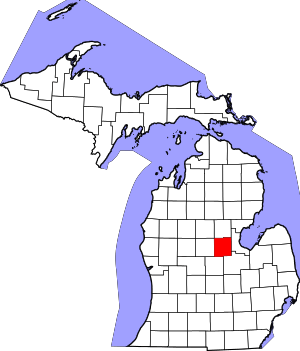 Map of Michigan highlighting Midland County.svg | |
| Village | ||
| Charter townships | ||
| Civil townships | ||
| Unincorporated communities | ||
| Footnotes | ‡This populated place also has portions in an adjacent county or counties | |