Colby, Norfolk
Colby is a village and a civil parish in the English county of Norfolk.[1] The village is 8.6 miles (13.8 km) south of Cromer, 16.8 miles (27.0 km) north-north-west of Norwich, 5.2 miles (8.4 km) west-north-west of North Walsham and 131 miles (211 km) north-east of London. The nearest railway station is at North Walsham Railway station where the Bittern Line from Cromer to Norwich can be accessed and the national rail network beyond. The nearest airport is Norwich International Airport. The village lies a small distance east from the A140 Cromer to Norwich road.[2] The parish of Colby in the 2001 census, has a population of 524, including Banningham but reducing to 494 at the 2011 Census.[3] For the purposes of local government, the parish falls within the district of North Norfolk.
| Colby | |
|---|---|
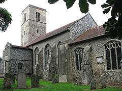 Parish Church of Saint Giles, Colby, Norfolk | |
 Colby Location within Norfolk | |
| Area | 8.34 km2 (3.22 sq mi) |
| Population | 494 (2011 census) |
| • Density | 59/km2 (150/sq mi) |
| OS grid reference | TG222316 |
| • London | 131 miles (211 km) |
| Civil parish |
|
| District | |
| Shire county | |
| Region | |
| Country | England |
| Sovereign state | United Kingdom |
| Post town | NORWICH |
| Postcode district | NR11 |
| Dialling code | 01263 |
| Police | Norfolk |
| Fire | Norfolk |
| Ambulance | East of England |
Description
The parish is in the north-east of the county and is a short distance north-east from the town of Aylsham and south of the estates of Gunton Park. The name of the village derives from the translated from Old Norse as farmstead or village of a man called Koli.[4]
References
- Ordnance Survey, Explorer Sheet 252, Norfolk Coast East, ISBN 978-0-319-46726-8
- County A to Z Atlas, Street & Road maps Norfolk, Page 128, ISBN 978-1-84348-614-5
- "Civil Parish 2011". Retrieved 31 August 2015.
- Rye, James (2000). A Popular Guide to Norfolk Place-names. Dereham: Larks Press. ISBN 0-948400-15-3.