Clio, California
Clio (formerly, Wash) is a census-designated place in Plumas County, California, United States. Clio is located 23 miles (37.0 km) southeast of Quincy.[2] The population was 66 at the 2010 census, down from 90 at the 2000 census.
Clio | |
|---|---|
 Location in Plumas County and the state of California | |
 Clio Location in the United States | |
| Coordinates: 39°44′42″N 120°34′17″W | |
| Country | |
| State | |
| County | Plumas |
| Area | |
| • Total | 0.576 sq mi (1.491 km2) |
| • Land | 0.576 sq mi (1.491 km2) |
| • Water | 0 sq mi (0 km2) 0% |
| Elevation | 4,416 ft (1,346 m) |
| Population (2010) | |
| • Total | 66 |
| • Density | 110/sq mi (44/km2) |
| Time zone | UTC-8 (Pacific (PST)) |
| • Summer (DST) | UTC-7 (PDT) |
| ZIP code | 96106 |
| Area code(s) | 530 |
| FIPS code | 06-14106 |
| GNIS feature ID | 1655907; 2407637 |
History
The Wash post office opened in 1875, changed its name to Wash and moved to the railroad depot in 1904.[2]
Geography
Clio is located at 39°44′42″N 120°34′17″W (39.745044, -120.571412).[3]
According to the United States Census Bureau, the CDP has a total area of 0.6 square miles (1.6 km2), all of it land.
Demographics
| Historical population | |||
|---|---|---|---|
| Census | Pop. | %± | |
| U.S. Decennial Census[4] | |||
2010
At the 2010 census Clio had a population of 66. The population density was 114.7 people per square mile (44.3/km²). The racial makeup of Clio was 64 (97.0%) White, 0 (0.0%) African American, 0 (0.0%) Native American, 0 (0.0%) Asian, 1 (1.5%) Pacific Islander, 1 (1.5%) from other races, and 0 (0.0%) from two or more races. Hispanic or Latino of any race were 1 people (1.5%).[5]
The whole population lived in households, no one lived in non-institutionalized group quarters and no one was institutionalized.
There were 39 households, 4 (10.3%) had children under the age of 18 living in them, 14 (35.9%) were opposite-sex married couples living together, 2 (5.1%) had a female householder with no husband present, 0 (0%) had a male householder with no wife present. There were 0 (0%) unmarried opposite-sex partnerships, and 1 (2.6%) same-sex married couples or partnerships. 21 households (53.8%) were one person and 10 (25.6%) had someone living alone who was 65 or older. The average household size was 1.69. There were 16 families (41.0% of households); the average family size was 2.56.
The age distribution was 7 people (10.6%) under the age of 18, 3 people (4.5%) aged 18 to 24, 7 people (10.6%) aged 25 to 44, 31 people (47.0%) aged 45 to 64, and 18 people (27.3%) who were 65 or older. The median age was 56.0 years. For every 100 females, there were 94.1 males. For every 100 females age 18 and over, there were 90.3 males.
There were 60 housing units at an average density of 104.2 per square mile, of the occupied units 33 (84.6%) were owner-occupied and 6 (15.4%) were rented.The homeowner vacancy rate was 8.3%; the rental vacancy rate was 0%. 60 people (90.9% of the population) lived in owner-occupied housing units and 6 people (9.1%) lived in rental housing units.
2000
At the 2000 census there were 90 people, 39 households, and 26 families in the CDP. The population density was 151.5 people per square mile (58.9/km²). There were 60 housing units at an average density of 101.0 per square mile (39.3/km²). The racial makeup of the CDP was 98.89% White, and 1.11% from two or more races. 3.33% of the population were Hispanic or Latino of any race.[6] Of the 39 households 30.8% had children under the age of 18 living with them, 56.4% were married couples living together, 7.7% had a female householder with no husband present, and 33.3% were non-families. 28.2% of households were one person and 15.4% were one person aged 65 or older. The average household size was 2.31 and the average family size was 2.81.
The age distribution was 23.3% under the age of 18, 3.3% from 18 to 24, 18.9% from 25 to 44, 27.8% from 45 to 64, and 26.7% 65 or older. The median age was 47 years. For every 100 females, there were 100 males. For every 100 females age 18 and over, there were 91.7 males.
The median household income was $23,036 and the median family income was $42,917. Males had a median income of $11,250 versus $0 for females. The per capita income for the CDP was $14,560. None of the population and none of the families were below the poverty line.
Politics
In the state legislature, Clio is in the 1st Senate District, represented by Republican Brian Dahle,[7] and the 1st Assembly District, represented by Republican Megan Dahle.[8]
Federally, Clio is in California's 1st congressional district, represented by Republican Doug LaMalfa.[9]
See also
- Clio trestle
References
- "U.S. Census". Archived from the original on 2013-10-14. Retrieved 2017-12-05.
- Durham, David L. (1998). California's Geographic Names: A Gazetteer of Historic and Modern Names of the State. Clovis, Calif.: Word Dancer Press. p. 365. ISBN 1-884995-14-4.
- "US Gazetteer files: 2010, 2000, and 1990". United States Census Bureau. 2011-02-12. Retrieved 2011-04-23.
- "Census of Population and Housing". Census.gov. Retrieved June 4, 2016.
- "2010 Census Interactive Population Search: CA - Clio CDP". U.S. Census Bureau. Archived from the original on July 15, 2014. Retrieved July 12, 2014.
- "U.S. Census website". United States Census Bureau. Retrieved 2008-01-31.
- "Senators". State of California. Retrieved March 10, 2013.
- "Members Assembly". State of California. Retrieved March 2, 2013.
- "California's 1st Congressional District - Representatives & District Map". Civic Impulse, LLC. Retrieved March 3, 2013.
Municipalities and communities of Plumas County, California, United States | ||
|---|---|---|
| City | 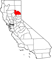 Plumas County map | |
| CDPs |
| |
| Unincorporated communities | ||
| Ghost towns | ||