Beckwourth, California
Beckwourth (formerly, Beckwith[4] and Beekwith[5]) is a census-designated place (CDP) in Plumas County, California, United States.[6] Beckwourth is located on the Middle Fork Feather River 5 miles (8.0 km) east of Portola.[2][4] The population was 432 at the 2010 census, up from 342 at the 2000 census.
Beckwourth | |
|---|---|
 Location in Plumas County and the state of California | |
 Beckwourth Location in the United States | |
| Coordinates: 39°49′39″N 120°24′13″W | |
| Country | |
| State | |
| County | Plumas |
| Area | |
| • Total | 11.69 sq mi (30.27 km2) |
| • Land | 11.68 sq mi (30.26 km2) |
| • Water | 0.01 sq mi (0.01 km2) 0.04% |
| Elevation | 4,911 ft (1,497 m) |
| Population (2010) | |
| • Total | 36,877 |
| • Estimate (2016)[3] | N/A |
| Time zone | UTC-8 (Pacific (PST)) |
| • Summer (DST) | UTC-7 (PDT) |
| ZIP code | 96129 |
| Area code(s) | 530 |
| FIPS code | 06-04772 |
| GNIS feature IDs | 1658022; 2407819 |
| U.S. Geological Survey Geographic Names Information System: Beckwourth, California; U.S. Geological Survey Geographic Names Information System: Beckwourth, California | |
Name
The community was named for James P. Beckwourth, an explorer who discovered Beckwourth Pass in 1851.[7]
History
The Beckwith post office opened in 1870 and changed its name to Beckwourth in 1932.[4]
Geography
Beckwourth is located at 39°49′39″N 120°24′13″W (39.827528, -120.403710).[8]
According to the United States Census Bureau, the CDP has a total area of 11.7 square miles (30 km2), 99.96% of it land and 0.04% of it water.
Nervino Airport (FAA identifier: O02 or oscar-zero-two) is plotted three quarters of a mile east of Beckwourth along State Route 70 on the Reconnaissance Peak, California 7.5 minute quadrangle. It has a 4,600-foot (1,400 m) runway and is located at 39°49′05″N 120°21′20″W.[9] The US Geological Survey says variant names for the airport are Beckwourth Airport and Plumas County Airport.[10]
State facilities in the town include a State of California, Department of Water Resources maintenance yard and a Caltrans Maintenance Station. These appear to be colocated (at the same site).
Climate
This region experiences warm (but not hot) and dry summers, with no average monthly temperatures above 71.6 °F. According to the Köppen Climate Classification system, Beckwourth has a warm-summer Mediterranean climate, abbreviated "Csb" on climate maps.[11]
Demographics
| Historical population | |||
|---|---|---|---|
| Census | Pop. | %± | |
| U.S. Decennial Census[12] | |||
2010
At the 2010 census Beckwourth had a population of 432. The population density was 37.0 people per square mile (14.3/km²). The racial makeup of Beckwourth was 402 (93.1%) White, 0 (0.0%) African American, 11 (2.5%) Native American, 2 (0.5%) Asian, 1 (0.2%) Pacific Islander, 7 (1.6%) from other races, and 9 (2.1%) from two or more races. Hispanic or Latino of any race were 29 people (6.7%).[13]
The whole population lived in households, no one lived in non-institutionalized group quarters and no one was institutionalized.
There were 196 households, 41 (20.9%) had children under the age of 18 living in them, 111 (56.6%) were opposite-sex married couples living together, 9 (4.6%) had a female householder with no husband present, 11 (5.6%) had a male householder with no wife present. There were 8 (4.1%) unmarried opposite-sex partnerships, and 0 (0%) same-sex married couples or partnerships. 53 households (27.0%) were one person and 15 (7.7%) had someone living alone who was 65 or older. The average household size was 2.20. There were 131 families (66.8% of households); the average family size was 2.64.
The age distribution was 71 people (16.4%) under the age of 18, 14 people (3.2%) aged 18 to 24, 72 people (16.7%) aged 25 to 44, 177 people (41.0%) aged 45 to 64, and 98 people (22.7%) who were 65 or older. The median age was 53.9 years. For every 100 females, there were 118.2 males. For every 100 females age 18 and over, there were 121.5 males.
There were 342 housing units at an average density of 29.3 per square mile, of the occupied units 169 (86.2%) were owner-occupied and 27 (13.8%) were rented.The homeowner vacancy rate was 8.6%; the rental vacancy rate was 0%. 363 people (84.0% of the population) lived in owner-occupied housing units and 69 people (16.0%) lived in rental housing units.
2000
At the 2000 census there were 342 people, 147 households, and 108 families in the CDP. The population density was 29.3 people per square mile (11.3/km2). There were 225 housing units at an average density of 19.3 per square mile (7.4/km2). The racial makeup of the CDP was 93.86% White, 2.05% Native American, 0.88% Pacific Islander, 1.46% from other races, and 1.75% from two or more races. 2.92% of the population were Hispanic or Latino of any race.[14] Of the 147 households 23.8% had children under the age of 18 living with them, 66.0% were married couples living together, 5.4% had a female householder with no husband present, and 25.9% were non-families. 19.7% of households were one person and 10.9% were one person aged 65 or older. The average household size was 2.33 and the average family size was 2.67.
The age distribution was 19.0% under the age of 18, 3.5% from 18 to 24, 21.3% from 25 to 44, 33.6% from 45 to 64, and 22.5% 65 or older. The median age was 48 years. For every 100 females, there were 94.3 males. For every 100 females age 18 and over, there were 100.7 males.
The median household income was $47,813 and the median family income was $52,031. Males had a median income of $49,219 versus $31,250 for females. The per capita income for the CDP was $16,928. None of the families and 2.8% of the population were living below the poverty line, including no under eighteens and 4.8% of those over 64.
Politics
In the state legislature Beckwourth is located in the 1st Senate District, represented by Republican Brian Dahle,[15] and the 1st Assembly District, represented by Republican Megan Dahle.[16]
Federally, Beckwourth is in California's 1st congressional district, represented by Republican Doug LaMalfa.[17]
See also
Notable people
- Jim Beckwourth, mountain man, fur trader, and explorer
- Alice Marble, a World Number One American tennis player who won 18 Grand Slam championships
References
- "2016 U.S. Gazetteer Files". United States Census Bureau. Retrieved Jul 19, 2017.
- U.S. Geological Survey Geographic Names Information System: Beckwourth, California
- "Population and Housing Unit Estimates". Retrieved June 9, 2017.
- Durham, David L. (1998). California's Geographic Names: A Gazetteer of Historic and Modern Names of the State. Clovis, Calif.: Word Dancer Press. p. 355. ISBN 1-884995-14-4.
- The Great Register of Plumas County, California - 1894 (Collection no. 4-2A, CSL Film Roll 34 ed.). Sacramento, CA: California State Library, California History Section. 1898.
- U.S. Geological Survey Geographic Names Information System: Beckwourth, California
- Brown, Thomas P. (May 30, 1940). "Over the Sierra". Indian Valley Record. p. 3. Retrieved 7 May 2015.
- "US Gazetteer files: 2010, 2000, and 1990". United States Census Bureau. 2011-02-12. Retrieved 2011-04-23.
- US Geological Survey, Reconnaissance Peak, California, 7.5 minute quadrangle, 1994.
- US Geological Survey, National Geographic Names Database.
- Climate Summary for Beckwourth, California
- "Census of Population and Housing". Census.gov. Retrieved June 4, 2016.
- "2010 Census Interactive Population Search: CA - Beckwourth CDP". U.S. Census Bureau. Archived from the original on July 15, 2014. Retrieved July 12, 2014.
- "U.S. Census website". United States Census Bureau. Retrieved 2008-01-31.
- "Senators". State of California. Retrieved March 10, 2013.
- "Members Assembly". State of California. Retrieved March 2, 2013.
- "California's 1st Congressional District - Representatives & District Map". Civic Impulse, LLC. Retrieved March 3, 2013.
External links
Municipalities and communities of Plumas County, California, United States | ||
|---|---|---|
| City | 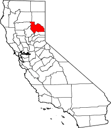 Plumas County map | |
| CDPs |
| |
| Unincorporated communities | ||
| Ghost towns | ||