Clay Township, Bartholomew County, Indiana
Clay Township is one of twelve townships in Bartholomew County, Indiana, United States. As of the 2010 census, its population was 3,271 and it contained 1,320 housing units.[1]
Clay Township | |
|---|---|
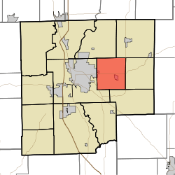 Location in Bartholomew County | |
| Coordinates: 39°13′26″N 85°49′02″W | |
| Country | United States |
| State | Indiana |
| County | Bartholomew |
| Government | |
| • Type | Indiana township |
| Area | |
| • Total | 23.16 sq mi (60.0 km2) |
| • Land | 23.15 sq mi (60.0 km2) |
| • Water | 0.01 sq mi (0.03 km2) 0.04% |
| Elevation | 640 ft (195 m) |
| Population (2010) | |
| • Total | 3,271 |
| • Density | 141.3/sq mi (54.6/km2) |
| ZIP codes | 47201, 47203, 47246 |
| GNIS feature ID | 0453204 |
Geography
According to the 2010 census, the township has a total area of 23.16 square miles (60.0 km2), of which 23.15 square miles (60.0 km2) (or 99.96%) is land and 0.01 square miles (0.026 km2) (or 0.04%) is water.[1]
Cities, towns, villages
- Columbus (east edge)
Unincorporated towns
(This list is based on USGS data and may include former settlements.)
Adjacent townships
- Haw Creek Township (northeast)
- Clifty Township (east)
- Rock Creek Township (southeast)
- Columbus Township (west)
- Flat Rock Township (northwest)
Cemeteries
The township contains these two cemeteries: Sand Hill and Sharon.
Major highways


Landmarks
- Otter Creek County Golf Course
School districts
- Bartholomew Consolidated School Corporation
Political districts
- Indiana's 6th congressional district
- State House District 57
- State Senate District 41
References
- United States Census Bureau 2007 TIGER/Line Shapefiles
- United States Board on Geographic Names (GNIS)
- United States National Atlas
- "Population, Housing Units, Area, and Density: 2010 - County -- County Subdivision and Place -- 2010 Census Summary File 1". United States Census. Archived from the original on 2020-02-12. Retrieved 2013-05-10.
External links
Municipalities and communities of Bartholomew County, Indiana, United States | ||
|---|---|---|
| City | Map of Indiana highlighting Bartholomew County | |
| Towns | ||
| Townships | ||
| CDP | ||
| Other unincorporated communities |
| |
| Ghost town | ||
| Footnotes | ‡This populated place also has portions in an adjacent county or counties | |
This article is issued from Wikipedia. The text is licensed under Creative Commons - Attribution - Sharealike. Additional terms may apply for the media files.