Chyornye Zemli Nature Reserve
Chornye Zemli Nature Reserve (Russian: заповедник Чёрные земли) (also) is a Russian 'zapovednik' (strict nature reserve). The name in Russian means "Black Lands". The main part of the reserve is located in the Caspian Depression, northwest of the Caspian Sea. It was originally created in 1990 to protect the saiga antelope (Saiga tatarica). In the meantime the economy of Kalmykia collapsed and the numbers of saiga have crashed due to poaching for meat and horns (Chinese medicine) and desertification caused by overgrazing by domestic animals. The reserve also has colonies of egrets, cormorants, and rare pelicans. The reserve is situated in the Chernozemelsky District of Republic of Kalmykia. It was created in 1990, and covers 1,219 km² in two locations, with a 900 km² buffer zone.[1][2]
| Chornye Zemli Nature Reserve | |
|---|---|
| Russian: заповедник Чёрные земли | |
IUCN category Ia (strict nature reserve) | |
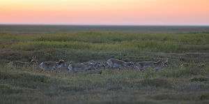
 Saiga in Chornye Zemli Nature Reserve | |
 Location of Reserve | |
| Location | Republic of Kalmykia |
| Nearest city | Astrakhan |
| Coordinates | 46°2′N 46°8′E |
| Area | 121,901 acres (493.32 km2) |
| Established | 1990 |
| Governing body | Ministry of Natural Resources and Environment (Russia) |
| Website | http://zapovednik-chernyezemli.ru/ |
Since 1993, Cherny Zemli Nature Reserve has been designated as one of UNESCO biosphere reserves.
Ecoregion and climate
Chornye Zemli is located in the middle of the Caspian lowland desert ecoregion, a regio that covers the north and southeast coasts of the Caspian Sea, including the deltas of the Volga River and Ural River in the northern region. Although precipitation is relatively low (less than 200 mm/year), wildlife is supported by the river systems and sea itself.[3]
The climate of Chornye Zemli is cool semi-arid (Köppen climate classification BSk). This climate is characterized by high variation in temperature, both daily and seasonally; with low precipitation.[4][5]
See also
References
- "Chyornye Zemli Zapovednik (Official Site)" (in Russian). Ministry of Natural Resources and Environment (Russia). Retrieved January 21, 2016.
- "Chyornye Zemli Zapovednik" (in Russian). Ministry of Natural Resources and Environment (Russia). Retrieved January 21, 2016.
- "Map of Ecoregions 2017". Resolve, using WWF data. Retrieved September 14, 2019.
- Kottek, M., J. Grieser, C. Beck, B. Rudolf, and F. Rubel, 2006. "World Map of Koppen-Geiger Climate Classification Updated" (PDF). Gebrüder Borntraeger 2006. Retrieved September 14, 2019.CS1 maint: multiple names: authors list (link)
- "Dataset - Koppen climate classifications". World Bank. Retrieved September 14, 2019.