Chop, Zakarpattia Oblast
Chop (Ukrainian: Чоп, Hungarian: Csap, Slovak: Čop, Rusyn: Чоп, Yiddish: טשאָפּ) is a city located in Zakarpattia Oblast (province) of western Ukraine, near the borders of Slovakia and Hungary. It is separated from the Hungarian town of Záhony by the river Tisza by being situated on its right bank. Located inside Uzhhorod Raion, since 2003 it is designated as a city of oblast significance - not included in any raion (district) of the oblast. Population: 8,937 (2016 est.)[2].
Chop Чоп Csap (in Hungarian) Čop (in Slovak) | |
|---|---|
 Railway station in Chop | |
 Flag  Coat of arms | |
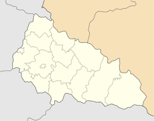 Chop Location of Chop 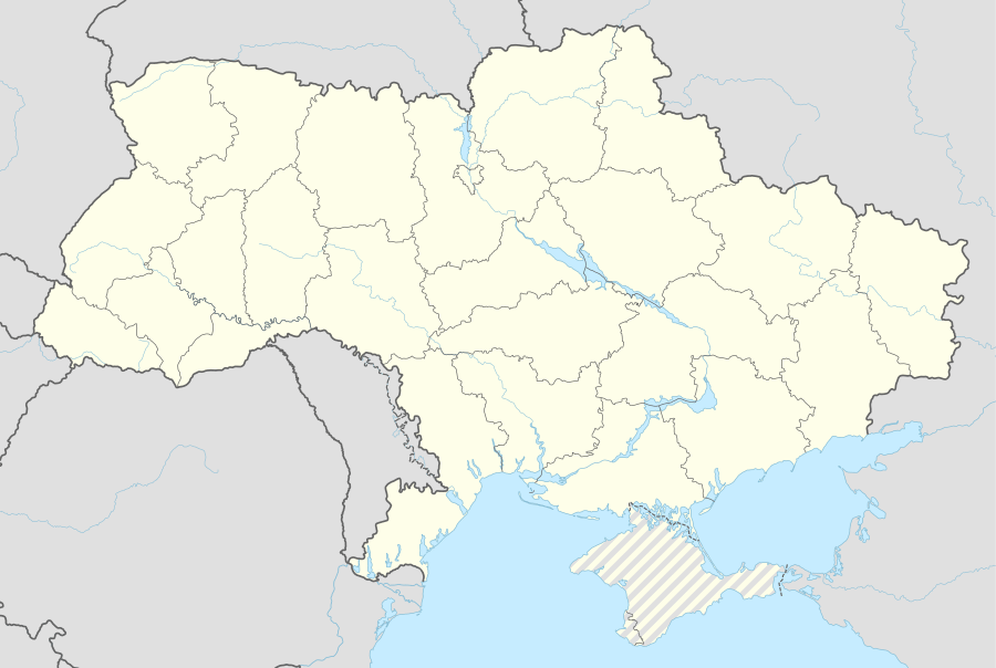 Chop Chop (Ukraine) | |
| Coordinates: 48°25′50″N 22°12′00″E | |
| Country | |
| Oblast | |
| Council | Chop city council |
| Government | |
| • Mayor | Galina Car |
| Elevation | 103 m (338 ft) |
| Population (2016) | |
| • Total | 8,937 |
| Time zone | UTC+1 (CET) |
| • Summer (DST) | UTC+2 (CEST) |
| Postal code | 89500 — 89509 |
| Area code(s) | +380 22 |
| Climate | Cfb |
| Sister cities | Milove (Ukraine) Sokołów Małopolski, (Poland) Záhony (Hungary) |
| Website | http://chop-rada.gov.ua/ |
Names
There are several alternative names used for this city: Hungarian: Csap, Slovak: Čop, German: Tschop, Romanian: Ciop, Polish: Czop, Russian: Чоп, Yiddish: טשאָפּ.
History

Like the rest of Transcarpathia, Csap (as it was then known) was part of Hungary until 1920, when, as a result of the post-World War I Treaty of Trianon, it was included in the newly created Czechoslovakia, where it belonged to Slovakia, not to Subcarpathian Rus. During World War II, under the First Vienna Award, it briefly became Hungarian again. But, after the war, as part of the Czechoslovakia–Soviet Union relations, it became part of the expanded Ukrainian Soviet Socialist Republic (now Ukraine), adopting the Ukrainian version of its name, 'Чоп' (usually transliterated as 'Chop' or 'Tchop' in English).
Demography
According to the Ukrainian national census, Chop had a population in 2001 of 8,919, of whom 40% were Ukrainians, 39.2% ethnic Hungarians and 20.8% Roma, Russians, Slovaks, Belarusians, and Jews.
Features


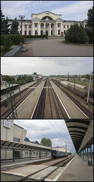
_02.jpg)
Chop is an important railway junction in Ukraine where the Lviv-Stryi-Budapest railway line meets the Lviv-Uzhgorod-Košice line. There is also a line running eastwards to Romania via Korolevo and Halmeu although there are currently no regular passenger services.
Near Chop, there are also international railway and highway border crossings to Hungary and Slovakia and also to the westernmost point of Ukraine. The first town across the border in Slovakia is Čierna nad Tisou while in Hungary, the first city is Záhony.
Notable residents
- J. Peters, political activist
See also
- Chop railway station
- Chop - Tysa
References
- "Chop (Zakarpattia Oblast, Uzhhorod Raion)". weather.in.ua (in Ukrainian). Retrieved 25 December 2018.
- "Чисельність наявного населення України (Actual population of Ukraine)" (PDF) (in Ukrainian). State Statistics Service of Ukraine. Retrieved 19 July 2016.
External links
| Raions | |||||
|---|---|---|---|---|---|
| Hromadas | |||||
| Cities |
| ||||
| |||||
| Wikimedia Commons has media related to Chop, Ukraine. |