Chikmagalur
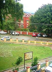
Chikmagalur (known officially as Chikkamagaluru in its anglicised form), is a city and the headquarters of Chikmagalur district in the Indian state of Karnataka. Located on the foothills of the Mullayanagiri peak of the Western Ghats, the city attracts tourists from around the state for its pleasant and favourable hill station climate, tropical rainforest and coffee estates.
Chikmagalur | |
|---|---|
City | |
 Chikmagalur Location in Karnataka, India | |
| Coordinates: 13.313°N 75.737°E | |
| Country | India |
| State | Karnataka |
| Founded by | King Rukmangada |
| Named for | Mullayanagiri range |
| Government | |
| • Body | City Municipality |
| Area | |
| • Total | 30 km2 (10 sq mi) |
| Elevation | 1,090 m (3,580 ft) |
| Population (2011)[1] | |
| • Total | 118,401 |
| • Density | 3,900/km2 (10,000/sq mi) |
| Languages | |
| • Official | Kannada |
| Time zone | UTC+5:30 (IST) |
| PIN | 577101 - 577102, 577133,577146 |
| Vehicle registration | KA-18 |
| Website | www |
Etymology
Chikmagalur takes its name from the Kannada Chikkamagaḷa ūru that translates to "younger daughter's town". It is said to have been given as a dowry to the youngest daughter of Rukmangada, the legendary chief of Sakharayapattana.

Demographics
As of 2011 Indian Census, Chikmagalur city had a total population of 118,401, of which 58,702 were males and 59,699 were females. Population within the age group of 0 to 6 years was 11,633. The total number of literates in Chikmagalur was 96,359, which constituted 81.4% of the population with male literacy of 83.7% and female literacy of 79.1%. The effective literacy rate of 7+ population of Chikmagalur was 90.3%, of which male literacy rate was 93.1% and female literacy rate was 87.5%. The Scheduled Castes and Scheduled Tribes population was 16,423 and 1,734 respectively. Chikmagalur had 28545 households in 2011.[1]
Transport
Chikmagalur is connected to other parts of the state through roads. National Highway 173 (India) passes through the town connecting it with the state capital Bangalore, located 250 kilometres (160 mi) away, and with port city Mangalore, located 150 kilometres (93 mi) away. State Highway 57 (Karnataka) connects between Shimoga and Hassan. A railway line connects Chikmagalur to Kadur. The nearest international airport is at Mangalore.
Geography and Climate
Chikmagalur is situated in the Malenadu region of Karnataka in the Deccan plateau in the foothills of the Western Ghats. It is situated at an elevation of 1,090 metres (3,580 ft) above mean sea level. The Yagachi River has its source near the town and flows in the south-easterly direction before uniting with the Kaveri river. Chikmagalur generally has a moderate to cool climate. The temperature of the city varies from 11-20 °C during winter to 25-32 °C during summer.
| Climate data for Chikmagalur (1981–2010, extremes 1974–2012) | |||||||||||||
|---|---|---|---|---|---|---|---|---|---|---|---|---|---|
| Month | Jan | Feb | Mar | Apr | May | Jun | Jul | Aug | Sep | Oct | Nov | Dec | Year |
| Record high °C (°F) | 32.5 (90.5) |
35.0 (95.0) |
36.7 (98.1) |
37.0 (98.6) |
37.0 (98.6) |
35.5 (95.9) |
31.0 (87.8) |
30.5 (86.9) |
32.0 (89.6) |
32.0 (89.6) |
32.5 (90.5) |
32.5 (90.5) |
37.0 (98.6) |
| Average high °C (°F) | 27.9 (82.2) |
30.5 (86.9) |
32.7 (90.9) |
33.2 (91.8) |
31.8 (89.2) |
26.9 (80.4) |
25.3 (77.5) |
25.3 (77.5) |
26.9 (80.4) |
27.3 (81.1) |
26.8 (80.2) |
26.7 (80.1) |
28.5 (83.3) |
| Average low °C (°F) | 15.0 (59.0) |
16.4 (61.5) |
18.1 (64.6) |
19.5 (67.1) |
19.7 (67.5) |
19.1 (66.4) |
18.8 (65.8) |
18.6 (65.5) |
18.3 (64.9) |
17.9 (64.2) |
16.6 (61.9) |
14.9 (58.8) |
17.7 (63.9) |
| Record low °C (°F) | 10.0 (50.0) |
11.1 (52.0) |
14.0 (57.2) |
15.0 (59.0) |
15.0 (59.0) |
15.0 (59.0) |
15.7 (60.3) |
16.0 (60.8) |
14.6 (58.3) |
12.0 (53.6) |
11.1 (52.0) |
10.9 (51.6) |
10.0 (50.0) |
| Average rainfall mm (inches) | 3.3 (0.13) |
1.2 (0.05) |
29.4 (1.16) |
59.6 (2.35) |
104.3 (4.11) |
122.8 (4.83) |
134.1 (5.28) |
126.3 (4.97) |
109.4 (4.31) |
168.1 (6.62) |
68.2 (2.69) |
13.0 (0.51) |
939.7 (37.00) |
| Average rainy days | 0.3 | 0.3 | 1.2 | 4.2 | 6.1 | 9.1 | 11.0 | 10.0 | 6.7 | 8.3 | 3.5 | 0.8 | 61.6 |
| Average relative humidity (%) (at 17:30 IST) | 46 | 42 | 43 | 51 | 60 | 76 | 79 | 79 | 74 | 70 | 62 | 53 | 62 |
| Source: India Meteorological Department[2][3] | |||||||||||||
References
- "Census of India: Chikmagalur". www.censusindia.gov.in. Retrieved 27 November 2019.
- "Station: Chickmagalur Climatological Table 1981–2010" (PDF). Climatological Normals 1981–2010. India Meteorological Department. January 2015. pp. 191–192. Archived from the original (PDF) on 5 February 2020. Retrieved 18 April 2020.
- "Extremes of Temperature & Rainfall for Indian Stations (Up to 2012)" (PDF). India Meteorological Department. December 2016. p. M92. Archived from the original (PDF) on 5 February 2020. Retrieved 18 April 2020.
External links
| Wikimedia Commons has media related to Chikmagalur. |

- Chickmagalur City Municipal Council Website